
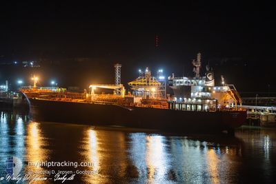
STI WEMBLEY
Tanker
Current Trip
| Time Travelled | 4 days |
|---|---|
| Remaining Time | 1 day |
| Distance Travelled | 466.36 nm |
| Remaining Distance | 462.84 nm |
| AVG Speed | 8.2 Knots |
| MAX Speed | 14 Knots |
| AVG Wind | 16.5 knots |
| MAX Wind | 23.9 knots |
| MIN Temp | 11.6°C / 52.88°F |
| MAX Temp | 14.7°C / 58.46°F |
| Draught | 7.1 m |
| Position Received | 2 d ago |
Current Position
| Longitude | -5.24500° |
|---|---|
| Latitude | 49.52966° |
| Status | Under way using engine |
| Speed | 1.2 Knots |
| Course | 172° |
| Area | English Channel |
| Station | T-AIS |
| Position Received | 2 d ago |
Info
Information
The current position of STI WEMBLEY is in English Channel with coordinates 49.52966° / -5.24500° as reported on 2024-05-29 02:18 by AIS to our vessel tracker app. The vessel's current speed is 1.2 Knots and is heading at the port of AMSTERDAM. The estimated time of arrival as calculated by vessel tracking app is 2024-06-02 08:39 LT
The vessel STI WEMBLEY (IMO: 9691735, MMSI: 538005404) is a Tanker It's sailing under the flag of [MH] Marshall Is.
In this page you can find informations about the vessels current position, last detected port calls, and current voyage information. If the vessels is not in coverage by AIS you will find the latest position.
The current position of STI WEMBLEY is detected by our AIS receivers and we are not responsible for the reliability of the data. The last position was recorded while the vessel was in Coverage by the Ais receivers of our vessel tracking app.
The current draught of STI WEMBLEY as reported by AIS is 7.1 meters
Weather
| Temperature | 13.5°C / 56.3°F |
|---|---|
| Wind Speed | 18 knots |
| Direction | 11° N |
| Pressure | 1023.8 hPa |
| Humidity | 78.4 % |
| Cloud Coverage | 69 % |
Featured Company
Last Port Calls
| Port | Arrival | Departure | Time In Port |
|---|---|---|---|
| 2024-05-21 09:03 | 2024-05-27 09:56 | 6 d | |
| 2024-05-15 13:55 | 2024-05-18 17:41 | 3 d | |
| 2024-05-09 13:37 | 2024-05-11 12:17 | 1 d | |
| 2024-04-29 23:45 | 2024-05-01 06:31 | 1 d | |
| 2024-04-26 04:12 | 2024-04-27 03:56 | 23 h | |
| 2024-04-24 09:43 | 2024-04-25 04:29 | 18 h | |
| 2024-04-19 01:18 | 2024-04-20 09:22 | 1 d | |
| 2024-04-12 02:06 | 2024-04-17 02:43 | 5 d | |
| 2024-03-30 16:56 | 2024-04-01 16:32 | 1 d | |
| 2024-03-24 21:17 | 2024-03-27 16:37 | 2 d |
Most Visited Ports (Last year)
| Port | Arrivals | |
|---|---|---|
| 5 | ||
| 4 | ||
| 4 | ||
| 2 | ||
| 2 | ||
| 2 |
Last Trips
| Origin | Departure | Destination | Arrival | Distance | |
|---|---|---|---|---|---|
| 2024-05-18 19:41 | 2024-05-21 10:03 | 638.80 nm | |||
| 2024-05-11 15:17 | 2024-05-15 15:55 | 1238.97 nm | |||
| 2024-05-01 07:31 | 2024-05-09 16:37 | 2471.58 nm | |||
| 2024-04-27 05:56 | 2024-04-30 00:45 | 802.12 nm | |||
| 2024-04-25 06:29 | 2024-04-26 06:12 | 268.30 nm | |||
| 2024-04-20 11:22 | 2024-04-24 11:43 | 571.65 nm | |||
| 2024-04-17 04:43 | 2024-04-19 03:18 | 642.39 nm | |||
| 2024-04-01 18:32 | 2024-04-12 04:06 | 747.87 nm | |||
| 2024-03-27 17:37 | 2024-03-30 17:56 | 676.47 nm | |||
| 2024-03-21 16:08 | 2024-03-24 22:17 | 154.33 nm |
Events
| Time | Event | Details | Position / Dest | Info |
|---|---|---|---|---|
| 2024-05-29 02:32 | Status Changed | Default Under way using engine |
49.52659 / -5.24182
AMSTERDAM FOR ORDERS
|
Speed: 1.2 kn Course: 172° |
| 2024-05-29 02:18 | OUT of Coverage |
49.52966 / -5.24500
English Channel
AMSTERDAM FOR ORDERS
|
Speed: 1.2 kn Course: 157.7° |
|
| 2024-05-29 01:40 | Status Changed | Under way using engine Default |
49.53730 / -5.25506
AMSTERDAM FOR ORDERS
|
Speed: 1.2 kn Course: 163° |
| 2024-05-29 01:36 | Status Changed | Default Under way using engine |
49.53811 / -5.25640
AMSTERDAM FOR ORDERS
|
Speed: 0.9 kn Course: 160° |
| 2024-05-28 23:44 | Change Sea Area | United Kingdom part of the English Channel United Kingdom part of the Celtic Sea |
49.56014 / -5.30490
English Channel
AMSTERDAM FOR ORDERS
|
Speed: 1.3 kn Course: 121.3° |
| 2024-05-28 22:34 | Status Changed | Under way using engine Default |
49.57134 / -5.35195
AMSTERDAM FOR ORDERS
|
Speed: 2.4 kn Course: 153° |
| 2024-05-28 22:31 | Status Changed | Default Under way using engine |
49.57178 / -5.35382
AMSTERDAM FOR ORDERS
|
Speed: 1.8 kn Course: 157° |
| 2024-05-28 22:22 | Status Changed | Under way using engine Default |
49.57314 / -5.36116
AMSTERDAM FOR ORDERS
|
Speed: 1.8 kn Course: 161° |
| 2024-05-28 22:12 | Status Changed | Default Under way using engine |
49.57485 / -5.36913
AMSTERDAM FOR ORDERS
|
Speed: 1.8 kn Course: 156° |
| 2024-05-28 21:57 | Status Changed | Under way using engine Default |
49.57693 / -5.38097
AMSTERDAM FOR ORDERS
|
Speed: 2.4 kn Course: 153° |