
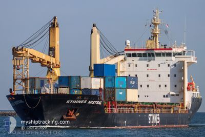
STINNES MISTRAL
General Cargo
Current Trip
| Time Travelled | 2 days |
|---|---|
| Remaining Time | --- |
| Distance Travelled | 856.11 nm |
| Remaining Distance | --- |
| AVG Speed | 13.6 Knots |
| MAX Speed | 16.3 Knots |
| AVG Wind | 12.8 knots |
| MAX Wind | 25 knots |
| MIN Temp | 18.9°C / 66.02°F |
| MAX Temp | 26.3°C / 79.34°F |
| Draught | 6.7 m |
| Position Received | 2 d ago |
Current Position
| Longitude | -70.94010° |
|---|---|
| Latitude | 39.70473° |
| Status | Under way using engine |
| Speed | 13.5 Knots |
| Course | 166.5° |
| Area | North Atlantic Ocean |
| Station | T-AIS |
| Position Received | 2 d ago |
Info
Information
The current position of STINNES MISTRAL is in North Atlantic Ocean with coordinates 39.70473° / -70.94010° as reported on 2024-06-18 11:43 by AIS to our vessel tracker app. The vessel's current speed is 13.5 Knots and is heading at the port of HOUSTON. The estimated time of arrival as calculated by vessel tracking app is 2024-06-25 17:00 LT
The vessel STINNES MISTRAL (IMO: 9452218, MMSI: 305955000) is a General Cargo that was built in 2010 ( 14 years old ). It's sailing under the flag of [AG] Antigua Barbuda.
In this page you can find informations about the vessels current position, last detected port calls, and current voyage information. If the vessels is not in coverage by AIS you will find the latest position.
The current position of STINNES MISTRAL is detected by our AIS receivers and we are not responsible for the reliability of the data. The last position was recorded while the vessel was in Coverage by the Ais receivers of our vessel tracking app.
The current draught of STINNES MISTRAL as reported by AIS is 6.7 meters
Weather
| Temperature | 26.3°C / 79.34°F |
|---|---|
| Wind Speed | 20 knots |
| Direction | 97° E |
| Pressure | 1018.9 hPa |
| Humidity | 86.5 % |
| Cloud Coverage | 100 % |
Featured Company
Last Port Calls
| Port | Arrival | Departure | Time In Port |
|---|---|---|---|
| 2024-06-16 05:58 | 2024-06-17 23:49 | 1 d | |
| 2024-06-13 08:07 | 2024-06-14 16:27 | 1 d | |
| 2024-05-27 20:26 | 2024-05-30 14:45 | 2 d | |
| 2024-05-24 03:39 | 2024-05-26 16:32 | 2 d | |
| 2024-05-20 15:23 | 2024-05-22 14:36 | 1 d | |
| 2024-05-05 17:06 | 2024-05-08 23:10 | 3 d | |
| 2024-04-30 11:12 | 2024-05-01 23:23 | 1 d | |
| 2024-04-26 05:06 | 2024-04-27 13:32 | 1 d | |
| 2024-04-20 14:53 | 2024-04-24 01:18 | 3 d | |
| 2024-04-17 11:32 | 2024-04-19 19:21 | 2 d |
Most Visited Ports (Last year)
| Port | Arrivals | |
|---|---|---|
| 6 | ||
| 5 | ||
| 5 | ||
| 4 | ||
| 3 | ||
| 2 |
Last Trips
| Origin | Departure | Destination | Arrival | Distance | |
|---|---|---|---|---|---|
| 2024-06-14 12:27 | 2024-06-16 01:58 | 396.46 nm | |||
| 2024-05-30 16:45 | 2024-06-13 04:07 | 3909.14 nm | |||
| 2024-05-26 18:32 | 2024-05-27 22:26 | 353.96 nm | |||
| 2024-05-22 15:36 | 2024-05-24 05:39 | 266.09 nm | |||
| 2024-05-08 19:10 | 2024-05-20 16:23 | 3647.72 nm | |||
| 2024-05-01 19:23 | 2024-05-05 13:06 | 1172.87 nm | |||
| 2024-04-27 08:32 | 2024-04-30 07:12 | 888.62 nm | |||
| 2024-04-23 20:18 | 2024-04-26 00:06 | 678.70 nm | |||
| 2024-04-19 14:21 | 2024-04-20 09:53 | 238.32 nm | |||
| 2024-03-27 11:57 | 2024-04-17 06:32 | 6158.39 nm |
Events
| Time | Event | Details | Position / Dest | Info |
|---|---|---|---|---|
| 2024-06-18 11:49 | Status Changed | Default Under way using engine |
39.68258 / -70.93338
USHOU
|
Speed: 13.5 kn Course: 166.5° |
| 2024-06-18 11:43 | OUT of Coverage |
39.70473 / -70.94010
North Atlantic Ocean
USHOU
|
Speed: 13.5 kn Course: 166.5° |
|
| 2024-06-18 11:33 | Status Changed | Under way using engine Default |
39.74098 / -70.94996
USHOU
|
Speed: 13.4 kn Course: 168° |
| 2024-06-18 11:18 | Status Changed | Default Under way using engine |
39.79680 / -70.96500
USHOU
|
Speed: 13.4 kn Course: 167.6° |
| 2024-06-18 11:06 | Status Changed | Under way using engine Default |
39.84217 / -70.97773
USHOU
|
Speed: 13.3 kn Course: 169° |
| 2024-06-18 11:03 | Status Changed | Default Under way using engine |
39.85186 / -70.98033
USHOU
|
Speed: 13.4 kn Course: 169.2° |
| 2024-06-18 10:17 | Status Changed | Under way using engine Default |
40.02321 / -71.03092
USHOU
|
Speed: 13.6 kn Course: 165° |
| 2024-06-18 10:15 | Status Changed | Default Under way using engine |
40.02750 / -71.03242
USHOU
|
Speed: 13.7 kn Course: 164° |
| 2024-06-18 10:00 | Status Changed | Under way using engine Default |
40.08479 / -71.05204
USHOU
|
Speed: 14.1 kn Course: 166° |
| 2024-06-18 09:59 | Status Changed | Default Under way using engine |
40.08638 / -71.05257
USHOU
|
Speed: 14.2 kn Course: 166.2° |