
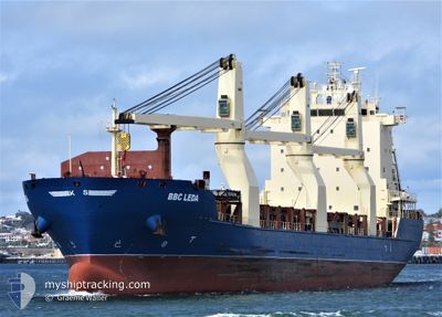
STINNES PASSAT
Cargo
Current Trip
| Time Travelled | 8 days |
|---|---|
| Remaining Time | 6 days |
| Distance Travelled | 2948.07 nm |
| Remaining Distance | 2113.67 nm |
| AVG Speed | 13.7 Knots |
| MAX Speed | 17 Knots |
| AVG Wind | 7.3 knots |
| MAX Wind | 21 knots |
| MIN Temp | 17.2°C / 62.96°F |
| MAX Temp | 28.3°C / 82.94°F |
| Draught | 9 m |
| Position Received | 10 h, 27 m ago |
Current Position
| Longitude | -44.34230° |
|---|---|
| Latitude | 37.41644° |
| Status | Under way using engine |
| Speed | 12.8 Knots |
| Course | 66.6° |
| Area | North Atlantic Ocean |
| Station | T-AIS |
| Position Received | 10 h, 27 m ago |
Info
Information
The current position of STINNES PASSAT is in North Atlantic Ocean with coordinates 37.41644° / -44.34230° as reported on 2024-05-31 16:40 by AIS to our vessel tracker app. The vessel's current speed is 12.8 Knots and is heading at the port of ANTWERP. The estimated time of arrival as calculated by vessel tracking app is 2024-06-07 17:50 LT
The vessel STINNES PASSAT (IMO: 9473248, MMSI: 304330000) is a Cargo It's sailing under the flag of [AG] Antigua Barbuda.
In this page you can find informations about the vessels current position, last detected port calls, and current voyage information. If the vessels is not in coverage by AIS you will find the latest position.
The current position of STINNES PASSAT is detected by our AIS receivers and we are not responsible for the reliability of the data. The last position was recorded while the vessel was in Coverage by the Ais receivers of our vessel tracking app.
The current draught of STINNES PASSAT as reported by AIS is 9 meters
Weather
| Temperature | 17.9°C / 64.22°F |
|---|---|
| Wind Speed | 10 knots |
| Direction | 341° NNW |
| Pressure | 1018.5 hPa |
| Humidity | 72.9 % |
| Cloud Coverage | 100 % |
Featured Company
Last Port Calls
| Port | Arrival | Departure | Time In Port |
|---|---|---|---|
| 2024-05-17 01:22 | 2024-05-23 08:47 | 6 d | |
| 2024-05-13 02:50 | 2024-05-14 22:21 | 1 d | |
| 2024-05-09 15:17 | 2024-05-12 10:17 | 2 d | |
| 2024-05-03 17:53 | 2024-05-05 02:44 | 1 d | |
| 2024-04-21 07:03 | 2024-04-22 15:01 | 1 d | |
| 2024-04-16 08:28 | 2024-04-19 13:13 | 3 d | |
| 2024-04-11 17:30 | 2024-04-13 01:37 | 1 d | |
| 2024-04-05 18:18 | 2024-04-10 16:29 | 4 d |
Last Trips
| Origin | Departure | Destination | Arrival | Distance | |
|---|---|---|---|---|---|
| 2024-05-14 17:21 | 2024-05-16 20:22 | 691.72 nm | |||
| 2024-05-12 05:17 | 2024-05-12 21:50 | 241.09 nm | |||
| 2024-05-04 22:44 | 2024-05-09 10:17 | 1458.48 nm | |||
| 2024-04-22 16:01 | 2024-05-03 13:53 | 3516.85 nm | |||
| 2024-04-19 15:13 | 2024-04-21 08:03 | 478.48 nm | |||
| 2024-04-13 03:37 | 2024-04-16 10:28 | 1047.31 nm | |||
| 2024-04-10 18:29 | 2024-04-11 19:30 | 352.60 nm | |||
| 2024-03-12 18:23 | 2024-04-05 20:18 | 6722.50 nm |
Events
| Time | Event | Details | Position / Dest | Info |
|---|---|---|---|---|
| 2024-05-31 16:44 | Status Changed | Default Under way using engine |
37.42211 / -44.32555
BE ANR
|
Speed: 12.8 kn Course: 66.6° |
| 2024-05-31 16:40 | OUT of Coverage |
37.41644 / -44.34230
North Atlantic Ocean
BE ANR
|
Speed: 12.8 kn Course: 66.6° |
|
| 2024-05-31 16:20 | Status Changed | Under way using engine Default |
37.38701 / -44.42757
BE ANR
|
Speed: 12 kn Course: 65° |
| 2024-05-31 16:03 | IN Coverage |
37.38701 / -44.42757
North Atlantic Ocean
BE ANR
|
Speed: 13.3 kn Course: 66.6° |
|
| 2024-05-31 13:58 | Status Changed | Default Under way using engine |
37.17939 / -45.02309
BE ANR
|
Speed: 13.6 kn Course: 69.1° |
| 2024-05-31 13:53 | OUT of Coverage |
37.17196 / -45.04720
North Atlantic Ocean
BE ANR
|
Speed: 13.6 kn Course: 69.1° |
|
| 2024-05-31 13:41 | Status Changed | Under way using engine Default |
37.15571 / -45.09895
BE ANR
|
Speed: 13 kn Course: 67° |
| 2024-05-31 13:23 | Status Changed | Default Under way using engine |
37.13092 / -45.17654
BE ANR
|
Speed: 13.7 kn Course: 68.2° |
| 2024-05-31 12:57 | Status Changed | Under way using engine Default |
37.08838 / -45.30719
BE ANR
|
Speed: 13 kn Course: 67° |
| 2024-05-31 12:51 | IN Coverage |
37.08838 / -45.30719
North Atlantic Ocean
BE ANR
|
Speed: 13.5 kn Course: 67.9° |