
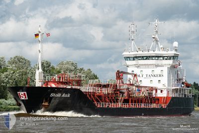
STOLT AUK
Chemical Tanker
Current Trip
| Time Travelled | 2 days |
|---|---|
| Remaining Time | --- |
| Distance Travelled | 739.11 nm |
| Remaining Distance | --- |
| AVG Speed | 12.2 Knots |
| MAX Speed | 16.1 Knots |
| AVG Wind | 13.3 knots |
| MAX Wind | 21.9 knots |
| MIN Temp | 12.2°C / 53.96°F |
| MAX Temp | 14.8°C / 58.64°F |
| Draught | 6.3 m |
| Position Received | 17 h, 41 m ago |
Current Position
| Longitude | -10.37196° |
|---|---|
| Latitude | 51.55511° |
| Status | Under way using engine |
| Speed | 12.1 Knots |
| Course | 312.6° |
| Area | North Atlantic Ocean |
| Station | T-AIS |
| Position Received | 17 h, 41 m ago |
Info
Information
The current position of STOLT AUK is in North Atlantic Ocean with coordinates 51.55511° / -10.37196° as reported on 2024-05-27 16:01 by AIS to our vessel tracker app. The vessel's current speed is 12.1 Knots
The vessel STOLT AUK (IMO: 9164108, MMSI: 235104739) is a Chemical Tanker that was built in 2001 ( 23 years old ). It's sailing under the flag of [GB] United Kingdom.
In this page you can find informations about the vessels current position, last detected port calls, and current voyage information. If the vessels is not in coverage by AIS you will find the latest position.
The current position of STOLT AUK is detected by our AIS receivers and we are not responsible for the reliability of the data. The last position was recorded while the vessel was in Coverage by the Ais receivers of our vessel tracking app.
The current draught of STOLT AUK as reported by AIS is 6.3 meters
Weather
| Temperature | 13.4°C / 56.12°F |
|---|---|
| Wind Speed | 9 knots |
| Direction | 238° WSW |
| Pressure | 1006.2 hPa |
| Humidity | 94.2 % |
| Cloud Coverage | 100 % |
Featured Company
Last Port Calls
| Port | Arrival | Departure | Time In Port |
|---|---|---|---|
| 2024-05-24 08:04 | 2024-05-25 12:17 | 1 d | |
| 2024-05-21 07:38 | 2024-05-21 19:10 | 11 h | |
| 2024-05-20 20:26 | 2024-05-20 21:02 | 35 m | |
| 2024-05-19 23:45 | 2024-05-20 20:03 | 20 h | |
| 2024-05-19 22:34 | 2024-05-19 23:26 | 51 m | |
| 2024-05-16 05:29 | 2024-05-18 06:56 | 2 d | |
| 2024-05-15 18:14 | 2024-05-16 02:38 | 8 h | |
| 2024-05-11 18:44 | 2024-05-13 10:39 | 1 d | |
| 2024-05-08 19:18 | 2024-05-09 08:26 | 13 h | |
| 2024-05-07 15:59 | 2024-05-08 10:01 | 18 h |
Last Trips
| Origin | Departure | Destination | Arrival | Distance | |
|---|---|---|---|---|---|
| 2024-05-21 20:10 | 2024-05-24 10:04 | 703.76 nm | |||
| 2024-05-20 22:02 | 2024-05-21 08:38 | 81.27 nm | |||
| 2024-05-20 21:03 | 2024-05-20 21:26 | 1.96 nm | |||
| 2024-05-20 00:26 | 2024-05-20 00:45 | 1.82 nm | |||
| 2024-05-18 07:56 | 2024-05-19 23:34 | 295.78 nm | |||
| 2024-05-13 12:39 | 2024-05-16 06:29 | 713.80 nm | |||
| 2024-05-13 12:39 | 2024-05-15 19:14 | 686.87 nm | |||
| 2024-05-09 09:26 | 2024-05-11 20:44 | 351.65 nm | |||
| 2024-05-08 11:01 | 2024-05-08 20:18 | 117.26 nm | |||
| 2024-05-06 02:04 | 2024-05-07 16:59 | 219.23 nm |
Events
| Time | Event | Details | Position / Dest | Info |
|---|---|---|---|---|
| 2024-05-27 16:19 | Status Changed | Default Under way using engine |
51.59297 / -10.45167
NLRTM>IEFOV
|
Speed: 12.1 kn Course: 312.6° |
| 2024-05-27 16:01 | OUT of Coverage |
51.55511 / -10.37196
North Atlantic Ocean
NLRTM>IEFOV
|
Speed: 12.1 kn Course: 312.6° |
|
| 2024-05-27 14:49 | Change Sea Area | Irish part of the North Atlantic Ocean Irish part of the Celtic Sea |
51.40295 / -10.06838
North Atlantic Ocean
NLRTM>IEFOV
|
Speed: 11.9 kn Course: 310.8° |
| 2024-05-27 13:11 | IN Coverage |
51.19646 / -9.66077
Celtic Sea
NLRTM>IEFOV
|
Speed: 12.3 kn Course: 310.4° |
|
| 2024-05-27 11:58 | OUT of Coverage |
51.04147 / -9.34128
Celtic Sea
NLRTM>IEFOV
|
Speed: 12.2 kn Course: 305.3° |
|
| 2024-05-27 11:20 | IN Coverage |
50.96170 / -9.18130
Celtic Sea
NLRTM>IEFOV
|
Speed: 12.2 kn Course: 308.6° |
|
| 2024-05-27 07:53 | OUT of Coverage |
50.54036 / -8.33494
Celtic Sea
NLRTM>IEFOV
|
Speed: 11.8 kn Course: 309.1° |
|
| 2024-05-27 07:41 | Detected in Sea | Irish part of the Celtic Sea |
50.51515 / -8.28488
Celtic Sea
NLRTM>IEFOV
|
Speed: 11.6 kn Course: 306.4° |
| 2024-05-27 06:48 | IN Coverage |
50.41160 / -8.07782
Celtic Sea
NLRTM>IEFOV
|
Speed: 10.9 kn Course: 308.7° |
|
| 2024-05-27 04:07 | OUT of Coverage |
50.09020 / -7.44211
Celtic Sea
NLRTM>IEFOV
|
Speed: 11.5 kn Course: 309.6° |