
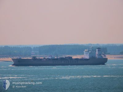
STOLT BRELAND
Oil/Chemical Tanker
Current Trip
| Time Travelled | 12 days |
|---|---|
| Remaining Time | 5 days |
| Distance Travelled | 2976.94 nm |
| Remaining Distance | 1513.78 nm |
| AVG Speed | 10.8 Knots |
| MAX Speed | 10.8 Knots |
| AVG Wind | 14 knots |
| MAX Wind | 25.9 knots |
| MIN Temp | 26.2°C / 79.16°F |
| MAX Temp | 32.1°C / 89.78°F |
| Draught | 10.5 m |
| Position Received | 9 d ago |
Current Position
| Longitude | 57.01581° |
|---|---|
| Latitude | 24.67926° |
| Status | Under way using engine |
| Speed | 12 Knots |
| Course | 139.4° |
| Area | Gulf of Oman |
| Station | T-AIS |
| Position Received | 9 d ago |
Info
Information
The current position of STOLT BRELAND is in Gulf of Oman with coordinates 24.67926° / 57.01581° as reported on 2024-05-21 23:31 by AIS to our vessel tracker app. The vessel's current speed is 12 Knots and is heading at the port of DURBAN. The estimated time of arrival as calculated by vessel tracking app is 2024-06-05 06:19 LT
The vessel STOLT BRELAND (IMO: 9414084, MMSI: 319017500) is a Oil/Chemical Tanker that was built in 2010 ( 14 years old ). It's sailing under the flag of [KY] Cayman Is.
In this page you can find informations about the vessels current position, last detected port calls, and current voyage information. If the vessels is not in coverage by AIS you will find the latest position.
The current position of STOLT BRELAND is detected by our AIS receivers and we are not responsible for the reliability of the data. The last position was recorded while the vessel was in Coverage by the Ais receivers of our vessel tracking app.
The current draught of STOLT BRELAND as reported by AIS is 10.5 meters
Weather
| Temperature | 26.9°C / 80.42°F |
|---|---|
| Wind Speed | 17 knots |
| Direction | 136° SE |
| Pressure | 1013.3 hPa |
| Humidity | 80.3 % |
| Cloud Coverage | 48 % |
Featured Company
Last Port Calls
| Port | Arrival | Departure | Time In Port |
|---|---|---|---|
| 2024-05-17 01:41 | 2024-05-19 00:07 | 1 d | |
| 2024-05-15 06:12 | 2024-05-16 01:15 | 19 h | |
| 2024-05-10 22:11 | 2024-05-11 19:11 | 21 h | |
| 2024-05-07 17:10 | 2024-05-10 02:44 | 2 d | |
| 2024-05-06 10:01 | 2024-05-07 05:19 | 19 h | |
| 2024-05-01 00:07 | 2024-05-02 10:37 | 1 d | |
| 2024-04-22 20:01 | 2024-04-24 09:33 | 1 d | |
| 2024-03-03 13:45 | 2024-03-05 14:18 | 2 d | |
| 2024-03-03 02:23 | 2024-03-03 13:26 | 11 h |
Most Visited Ports (Last year)
| Port | Arrivals | |
|---|---|---|
| 5 | ||
| 4 | ||
| 3 | ||
| 2 | ||
| 2 | ||
| 2 |
Last Trips
| Origin | Departure | Destination | Arrival | Distance | |
|---|---|---|---|---|---|
| 2024-05-16 04:15 | 2024-05-17 04:41 | 19.45 nm | |||
| 2024-05-11 22:11 | 2024-05-15 09:12 | 30.17 nm | |||
| 2024-05-10 05:44 | 2024-05-11 01:11 | 143.45 nm | |||
| 2024-05-07 08:19 | 2024-05-07 20:10 | 98.99 nm | |||
| 2024-05-02 16:07 | 2024-05-06 13:01 | 1177.47 nm | |||
| 2024-04-24 15:03 | 2024-05-01 05:37 | 944.60 nm | |||
| 2024-03-05 15:18 | 2024-04-23 01:31 | 10391.08 nm | |||
| 2024-03-03 14:26 | 2024-03-03 14:45 | 2.25 nm | |||
| 2024-02-28 14:40 | 2024-03-03 03:23 | 259.68 nm |
Events
| Time | Event | Details | Position / Dest | Info |
|---|---|---|---|---|
| 2024-05-21 23:31 | OUT of Coverage |
24.67926 / 57.01581
Gulf of Oman
ZA DUR
|
Speed: 12 kn Course: 139.4° |
|
| 2024-05-21 21:25 | Destination Changed | ZA DUR AE FJR |
25.00453 / 56.71580
ZA DUR
|
Speed: 11.3 kn Course: 133.1° |
| 2024-05-21 21:25 | ETA Changed | 2024/06/04 13:00 2024/06/03 19:00 |
25.00453 / 56.71580
ZA DUR
|
Speed: 11.3 kn Course: 133.1° |
| 2024-05-21 21:14 | Change Sea Area | Omani part of the Gulf of Oman United Arab Emirates part of the Gulf of Oman |
25.02935 / 56.68856
Gulf of Oman
AE FJR
|
Speed: 11.3 kn Course: 137.8° |
| 2024-05-21 19:57 | START Moving | 10.16 nm, East of FUJAIRAH |
25.17231 / 56.54900
AE FJR
|
Speed: 3.2 kn Course: 114° |
| 2024-05-21 19:31 | Status Changed | Under way using engine At anchor |
25.17454 / 56.54012
AE FJR
|
Speed: Course: 171° |
| 2024-05-21 19:29 | ETA Changed | 2024/06/03 19:00 2024/05/20 19:00 |
25.17459 / 56.54012
AE FJR
|
Speed: Course: 173° |
| 2024-05-21 17:42 | Status Changed | At anchor Default |
25.17465 / 56.53983
AE FJR
|
Speed: Course: 160° |
| 2024-05-21 17:39 | Status Changed | Default At anchor |
25.17466 / 56.53985
AE FJR
|
Speed: Course: 159° |
| 2024-05-21 13:18 | Status Changed | At anchor Default |
25.17425 / 56.53881
AE FJR
|
Speed: Course: 125° |