
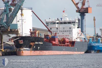
STOLT FULMAR
Oil/Chemical Tanker
Current Trip
| Time Travelled | 20 h, 31 mins |
|---|---|
| Remaining Time | 1 h, 40 mins |
| Distance Travelled | 239.68 nm |
| Remaining Distance | 23.33 nm |
| AVG Speed | 12.3 Knots |
| MAX Speed | 14.9 Knots |
| AVG Wind | 7 knots |
| MAX Wind | 10 knots |
| MIN Temp | 12.3°C / 54.14°F |
| MAX Temp | 18.2°C / 64.76°F |
| Draught | 5.4 m |
| Position Received | Now |
Current Position
| Longitude | -0.15824° |
|---|---|
| Latitude | 49.70070° |
| Status | Under way using engine |
| Speed | 12 Knots |
| Course | 184.4° |
| Area | English Channel |
| Station | T-AIS |
| Position Received | Now |
Info
Information
The current position of STOLT FULMAR is in English Channel with coordinates 49.70070° / -0.15824° as reported on 2024-05-17 07:22 by AIS to our vessel tracker app. The vessel's current speed is 12 Knots and is heading at the port of LE HAVRE. The estimated time of arrival as calculated by vessel tracking app is 2024-05-17 09:03 LT
The vessel STOLT FULMAR (IMO: 9148972, MMSI: 255806426) is a Oil/Chemical Tanker that was built in 2000 ( 24 years old ). It's sailing under the flag of [PT] Portugal.
In this page you can find informations about the vessels current position, last detected port calls, and current voyage information. If the vessels is not in coverage by AIS you will find the latest position.
The current position of STOLT FULMAR is detected by our AIS receivers and we are not responsible for the reliability of the data. The last position was recorded while the vessel was in Coverage by the Ais receivers of our vessel tracking app.
The current draught of STOLT FULMAR as reported by AIS is 5.4 meters
Weather
| Temperature | 12.3°C / 54.14°F |
|---|---|
| Wind Speed | 9 knots |
| Direction | 169° S |
| Pressure | 1009.1 hPa |
| Humidity | 83.9 % |
| Cloud Coverage | 100 % |
Featured Company
Last Port Calls
| Port | Arrival | Departure | Time In Port |
|---|---|---|---|
| 2024-05-13 12:48 | 2024-05-16 10:52 | 2 d | |
| 2024-05-10 18:52 | 2024-05-11 10:12 | 15 h | |
| 2024-04-21 05:12 | 2024-04-22 01:19 | 20 h | |
| 2024-04-18 01:08 | 2024-04-18 16:40 | 15 h | |
| 2024-04-01 14:46 | 2024-04-03 20:29 | 2 d | |
| 2024-03-25 12:05 | 2024-03-26 21:38 | 1 d | |
| 2024-03-23 04:18 | 2024-03-24 05:35 | 1 d | |
| 2024-03-20 05:34 | 2024-03-21 03:37 | 22 h | |
| 2024-03-17 15:57 | 2024-03-18 14:46 | 22 h | |
| 2024-03-15 21:12 | 2024-03-15 22:40 | 1 h |
Last Trips
| Origin | Departure | Destination | Arrival | Distance | |
|---|---|---|---|---|---|
| 2024-05-11 11:12 | 2024-05-13 14:48 | 637.97 nm | |||
| 2024-04-21 21:19 | 2024-05-10 19:52 | 4712.60 nm | |||
| 2024-04-18 12:40 | 2024-04-21 01:12 | 241.47 nm | |||
| 2024-04-03 21:29 | 2024-04-17 21:08 | 3936.11 nm | |||
| 2024-03-26 22:38 | 2024-04-01 15:46 | 1062.42 nm | |||
| 2024-03-24 06:35 | 2024-03-25 13:05 | 281.86 nm | |||
| 2024-03-21 04:37 | 2024-03-23 05:18 | 492.00 nm | |||
| 2024-03-18 14:46 | 2024-03-20 06:34 | 426.81 nm | |||
| 2024-03-15 23:40 | 2024-03-17 15:57 | 182.08 nm | |||
| 2024-03-15 21:41 | 2024-03-15 22:12 | 2.00 nm |
Events
| Time | Event | Details | Position / Dest | Info |
|---|---|---|---|---|
| 2024-05-17 04:35 | Change Sea Area | French part of the English Channel United Kingdom part of the English Channel |
50.22470 / -.14082
English Channel
FRLEH
|
Speed: 11.6 kn Course: 164° |
| 2024-05-16 22:22 | Detected in Sea | United Kingdom part of the English Channel |
50.87712 / 1.27338
English Channel
FRLEH
|
Speed: 11.8 kn Course: 216.1° |
| 2024-05-16 21:59 | Change Sea Area | French part of the English Channel United Kingdom part of the English Channel |
50.94032 / 1.34438
English Channel
FRLEH
|
Speed: 11.7 kn Course: 215.6° |
| 2024-05-16 21:08 | Detected in Sea | United Kingdom part of the English Channel |
51.05377 / 1.51113
English Channel
FRLEH
|
Speed: 10.1 kn Course: 225.5° |
| 2024-05-16 18:08 | Detected in Sea | United Kingdom part of the North Sea |
51.40237 / 2.06775
North Sea
FRLEH
|
Speed: 12.1 kn Course: 294.5° |
| 2024-05-16 17:10 | Detected in Sea | French part of the North Sea |
51.35236 / 2.34390
North Sea
FRLEH
|
Speed: 12 kn Course: 251.2° |
| 2024-05-16 14:04 | Change Sea Area | Belgian part of the North Sea Dutch part of the North Sea |
51.40220 / 3.32212
North Sea
FRLEH
|
Speed: 13.2 kn Course: 245.9° |
| 2024-05-16 11:03 | Status Changed | Under way using engine Moored |
51.39985 / 4.19133
FRLEH
|
Speed: 12.9 kn Course: 267.7° |
| 2024-05-16 10:52 | PORT DEPARTURE |
|
51.36869 / 4.22095
FRLEH
|
Speed: 13.8 kn Course: 344° |
| 2024-05-16 10:37 | START Moving |
51.34448 / 4.28148
[BE] ANTWERP
|
Speed: 4.5 kn Course: 275° |