
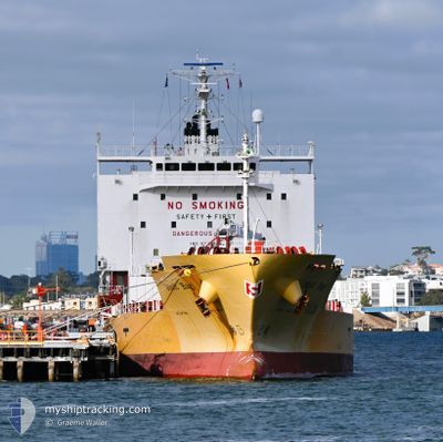
STOLT HAGI
Tanker B
Current Trip
TANJUNG BAKAU
| Time Travelled | 5 days |
|---|---|
| Remaining Time | --- |
| Distance Travelled | 1353.92 nm |
| Remaining Distance | --- |
| AVG Speed | 12.8 Knots |
| MAX Speed | 15.6 Knots |
| AVG Wind | 6.5 knots |
| MAX Wind | 15 knots |
| MIN Temp | 27.4°C / 81.32°F |
| MAX Temp | 30.2°C / 86.36°F |
| Draught | 6.3 m |
| Position Received | 3 d ago |
Current Position
| Longitude | 104.22989° |
|---|---|
| Latitude | 1.27032° |
| Status | Under way using engine |
| Speed | 15 Knots |
| Course | 83.4° |
| Area | Singapore Strait |
| Station | T-AIS |
| Position Received | 3 d ago |
Info
Information
The current position of STOLT HAGI is in Singapore Strait with coordinates 1.27032° / 104.22989° as reported on 2024-06-12 04:18 by AIS to our vessel tracker app. The vessel's current speed is 15 Knots
The vessel STOLT HAGI (IMO: 9750206, MMSI: 563206200) is a Tanker B It's sailing under the flag of [SG] Singapore.
In this page you can find informations about the vessels current position, last detected port calls, and current voyage information. If the vessels is not in coverage by AIS you will find the latest position.
The current position of STOLT HAGI is detected by our AIS receivers and we are not responsible for the reliability of the data. The last position was recorded while the vessel was in Coverage by the Ais receivers of our vessel tracking app.
The current draught of STOLT HAGI as reported by AIS is 6.3 meters
Weather
| Temperature | 27.7°C / 81.86°F |
|---|---|
| Wind Speed | 3 knots |
| Direction | 58° ENE |
| Pressure | 1010.3 hPa |
| Humidity | 72.2 % |
| Cloud Coverage | 100 % |
Featured Company
Last Port Calls
| Port | Arrival | Departure | Time In Port |
|---|---|---|---|
| 2024-06-10 05:51 | 2024-06-10 22:19 | 16 h | |
| 2024-05-25 22:47 | 2024-05-26 06:55 | 8 h | |
| 2024-05-25 01:08 | 2024-05-25 16:05 | 14 h | |
| 2024-05-24 19:56 | 2024-05-24 21:50 | 1 h | |
| 2024-05-24 15:44 | 2024-05-24 15:59 | 14 m | |
| 2024-05-23 04:38 | 2024-05-24 00:45 | 20 h | |
| 2024-05-10 17:50 | 2024-05-14 02:16 | 3 d | |
| 2024-05-03 15:53 | 2024-05-05 07:42 | 1 d | |
| 2024-04-19 13:57 | 2024-04-21 01:12 | 1 d | |
| 2024-04-16 12:34 | 2024-04-18 20:47 | 2 d |
Most Visited Ports (Last year)
| Port | Arrivals | |
|---|---|---|
| 8 | ||
| 5 | ||
| 4 | ||
| 3 | ||
| 3 | ||
| 3 |
Last Trips
| Origin | Departure | Destination | Arrival | Distance | |
|---|---|---|---|---|---|
| 2024-05-26 15:55 | 2024-06-10 13:51 | 3047.53 nm | |||
| 2024-05-26 01:05 | 2024-05-26 07:47 | 1.53 nm | |||
| 2024-05-25 06:50 | 2024-05-25 10:08 | 0.63 nm | |||
| 2024-05-25 00:59 | 2024-05-25 04:56 | 1.12 nm | |||
| 2024-05-24 09:45 | 2024-05-25 00:44 | 177.31 nm | |||
| 2024-05-14 10:16 | 2024-05-23 13:38 | 2590.58 nm | |||
| 2024-05-05 15:42 | 2024-05-11 01:50 | 658.31 nm | |||
| 2024-04-21 11:12 | 2024-05-03 23:53 | 3845.89 nm | |||
| 2024-04-19 06:47 | 2024-04-19 23:57 | 146.09 nm | |||
| 2024-04-13 08:30 | 2024-04-16 22:34 | 1116.89 nm |
Events
| Time | Event | Details | Position / Dest | Info |
|---|---|---|---|---|
| 2024-06-12 04:25 | Status Changed | Default Under way using engine |
1.27366 / 104.25907
TANJUNG BAKAU
|
Speed: 15 kn Course: 83.4° |
| 2024-06-12 04:18 | OUT of Coverage |
1.27032 / 104.22989
Singapore Strait
TANJUNG BAKAU
|
Speed: 15 kn Course: 83.4° |
|
| 2024-06-12 03:59 | Change Sea Area | Malaysian part of the Singapore Strait Indonesian part of the Singapore Strait |
1.25980 / 104.14913
Singapore Strait
TANJUNG BAKAU
|
Speed: 15 kn Course: 82° |
| 2024-06-12 03:48 | Status Changed | Under way using engine Default |
1.25366 / 104.10713
TANJUNG BAKAU
|
Speed: 14.7 kn Course: 79° |
| 2024-06-12 03:45 | Status Changed | Default Under way using engine |
1.25108 / 104.09472
TANJUNG BAKAU
|
Speed: 14.8 kn Course: 80.9° |
| 2024-06-12 03:15 | ETA Changed | 2024/06/16 15:00 2024/06/16 14:00 |
1.23221 / 103.97463
TANJUNG BAKAU
|
Speed: 13.9 kn Course: 72.2° |
| 2024-06-12 02:10 | ETA Changed | 2024/06/16 14:00 2024/06/16 15:00 |
1.13487 / 103.76860
TANJUNG BAKAU
|
Speed: 13.7 kn Course: 46.9° |
| 2024-06-12 01:42 | ETA Changed | 2024/06/16 15:00 2024/06/16 10:00 |
1.07002 / 103.70061
TANJUNG BAKAU
|
Speed: 9.8 kn Course: 55.1° |
| 2024-06-12 01:36 | Status Changed | Under way using engine Default |
1.06522 / 103.68716
TANJUNG BAKAU
|
Speed: 11.7 kn Course: 77° |
| 2024-06-12 01:33 | Status Changed | Default Under way using engine |
1.06249 / 103.67716
TANJUNG BAKAU
|
Speed: 12.4 kn Course: 81.5° |