
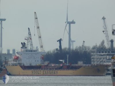
STOLT OCELOT
Oil/Chemical Tanker
Current Trip
| Time Travelled | 7 days |
|---|---|
| Remaining Time | 6 days |
| Distance Travelled | 2563.18 nm |
| Remaining Distance | 2167.73 nm |
| AVG Speed | 13.2 Knots |
| MAX Speed | 15.7 Knots |
| AVG Wind | 12.5 knots |
| MAX Wind | 18 knots |
| MIN Temp | 23.9°C / 75.02°F |
| MAX Temp | 28.4°C / 83.12°F |
| Draught | 9.7 m |
| Position Received | 6 h, 56 m ago |
Current Position
| Longitude | -55.36531° |
|---|---|
| Latitude | 13.29722° |
| Status | Under way using engine |
| Speed | 13.2 Knots |
| Course | 126.8° |
| Area | North Atlantic Ocean |
| Station | T-AIS |
| Position Received | 6 h, 56 m ago |
Info
Information
The current position of STOLT OCELOT is in North Atlantic Ocean with coordinates 13.29722° / -55.36531° as reported on 2024-05-13 16:54 by AIS to our vessel tracker app. The vessel's current speed is 13.2 Knots and is heading at the port of ARATU. The estimated time of arrival as calculated by vessel tracking app is 2024-05-20 20:58 LT
The vessel STOLT OCELOT (IMO: 9459539, MMSI: 636015005) is a Oil/Chemical Tanker that was built in 2008 ( 16 years old ). It's sailing under the flag of [LR] Liberia.
In this page you can find informations about the vessels current position, last detected port calls, and current voyage information. If the vessels is not in coverage by AIS you will find the latest position.
The current position of STOLT OCELOT is detected by our AIS receivers and we are not responsible for the reliability of the data. The last position was recorded while the vessel was in Coverage by the Ais receivers of our vessel tracking app.
The current draught of STOLT OCELOT as reported by AIS is 9.7 meters
Weather
| Temperature | 28.1°C / 82.58°F |
|---|---|
| Wind Speed | 13 knots |
| Direction | 68° ENE |
| Pressure | 1014.2 hPa |
| Humidity | 75.5 % |
| Cloud Coverage | 7 % |
Featured Company
Last Port Calls
| Port | Arrival | Departure | Time In Port |
|---|---|---|---|
| 2024-05-04 18:58 | 2024-05-06 01:27 | 1 d | |
| 2024-04-25 22:55 | 2024-05-03 07:08 | 7 d | |
| 2024-04-19 22:18 | 2024-04-23 02:51 | 3 d | |
| 2024-04-14 15:26 | 2024-04-15 08:19 | 16 h | |
| 2024-04-09 19:29 | 2024-04-11 08:55 | 1 d | |
| 2024-04-09 18:17 | 2024-04-09 18:43 | 26 m | |
| 2024-03-22 07:38 | 2024-03-28 11:05 | 6 d | |
| 2024-03-14 14:09 | 2024-03-19 02:22 | 4 d | |
| 2024-03-11 10:00 | 2024-03-14 13:49 | 3 d | |
| 2024-03-10 12:54 | 2024-03-11 09:22 | 20 h |
Most Visited Ports (Last year)
| Port | Arrivals | |
|---|---|---|
| 3 | ||
| 2 | ||
| 2 | ||
| 2 | ||
| 2 | ||
| 1 |
Last Trips
| Origin | Departure | Destination | Arrival | Distance | |
|---|---|---|---|---|---|
| 2024-05-03 02:08 | 2024-05-04 13:58 | 183.29 nm | |||
| 2024-04-22 21:51 | 2024-04-25 17:55 | 439.02 nm | |||
| 2024-04-15 04:19 | 2024-04-19 17:18 | 1358.79 nm | |||
| 2024-04-11 04:55 | 2024-04-14 11:26 | 572.35 nm | |||
| 2024-04-09 14:43 | 2024-04-09 15:29 | 2.99 nm | |||
| 2024-03-28 12:05 | 2024-04-09 14:17 | 3523.19 nm | |||
| 2024-03-19 03:22 | 2024-03-22 08:38 | 691.00 nm | |||
| 2024-03-14 14:49 | 2024-03-14 15:09 | 1.81 nm | |||
| 2024-03-11 10:22 | 2024-03-11 11:00 | 2.35 nm | |||
| 2024-03-08 14:27 | 2024-03-10 13:54 | 278.13 nm |
Events
| Time | Event | Details | Position / Dest | Info |
|---|---|---|---|---|
| 2024-05-13 17:02 | Status Changed | Default Under way using engine |
13.27952 / -55.34121
ARATU
|
Speed: 13.2 kn Course: 126.8° |
| 2024-05-13 16:54 | OUT of Coverage |
13.29722 / -55.36531
North Atlantic Ocean
ARATU
|
Speed: 13.2 kn Course: 126.8° |
|
| 2024-05-13 15:47 | Status Changed | Under way using engine Default |
13.45322 / -55.56927
ARATU
|
Speed: 13 kn Course: 127° |
| 2024-05-13 15:32 | Status Changed | Default Under way using engine |
13.48667 / -55.61333
ARATU
|
Speed: 13.8 kn Course: 127.7° |
| 2024-05-13 15:22 | Change Sea Area | High seas of the North Atlantic Ocean Anguilla part of the Caribbean Sea |
13.51232 / -55.64718
North Atlantic Ocean
ARATU
|
Speed: 13.9 kn Course: 128.2° |
| 2024-05-13 15:22 | Status Changed | Under way using engine Default |
13.51232 / -55.64718
ARATU
|
Speed: 13 kn Course: 128° |
| 2024-05-13 15:22 | IN Coverage |
13.51232 / -55.64718
North Atlantic Ocean
ARATU
|
Speed: 13.9 kn Course: 128.2° |
|
| 2024-05-12 02:50 | Status Changed | Default Under way using engine |
18.50197 / -62.65884
ARATU
|
Speed: 14.1 kn Course: 115.7° |
| 2024-05-12 02:45 | OUT of Coverage |
18.51030 / -62.67741
Caribbean Sea
ARATU
|
Speed: 14.1 kn Course: 115.7° |
|
| 2024-05-12 02:39 | Status Changed | Under way using engine Default |
18.51917 / -62.69710
ARATU
|
Speed: 14 kn Course: 115° |