
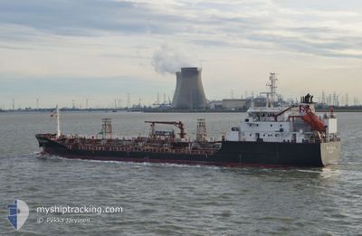
STOLT OSPREY
Oil/Chemical Tanker
Current Trip
| Trip Time | 1 day |
|---|---|
| Trip Distance | 206.00 nm |
| AVG Speed | 10.4 Knots |
| MAX Speed | 16 Knots |
| Draught | 5.7 m |
| AVG Wind | 11.4 knots |
| MAX Wind | 17 knots |
| MIN Temp | 12.4°C / 54.32°F |
| MAX Temp | 21°C / 69.8°F |
| Position Received | Now |
Current Position
| Longitude | 3.84319° |
|---|---|
| Latitude | 51.27629° |
| Status | Under way using engine |
| Speed | |
| Course | 332° |
| Area | North Sea |
| Station | T-AIS |
| Position Received | Now |
Info
Information
The current position of STOLT OSPREY is in North Sea with coordinates 51.27629° / 3.84319° as reported on 2024-05-20 21:16 by AIS to our vessel tracker app. The vessel's current speed is 0 Knots and is currently inside the port of SLUISKIL.
The vessel STOLT OSPREY (IMO: 9147461, MMSI: 235112065) is a Oil/Chemical Tanker that was built in 1998 ( 26 years old ). It's sailing under the flag of [GB] United Kingdom.
In this page you can find informations about the vessels current position, last detected port calls, and current voyage information. If the vessels is not in coverage by AIS you will find the latest position.
The current position of STOLT OSPREY is detected by our AIS receivers and we are not responsible for the reliability of the data. The last position was recorded while the vessel was in Coverage by the Ais receivers of our vessel tracking app.
The current draught of STOLT OSPREY as reported by AIS is 5.7 meters
Weather
| Temperature | 12°C / 53.6°F |
|---|---|
| Wind Speed | 4 knots |
| Direction | 344° NNW |
| Pressure | 1009.4 hPa |
| Humidity | 96.7 % |
| Cloud Coverage | 4 % |
Featured Company
Last Port Calls
| Port | Arrival | Departure | Time In Port |
|---|---|---|---|
| 2024-05-20 19:49 | |||
| 2024-05-18 14:50 | 2024-05-19 09:56 | 19 h | |
| 2024-05-14 14:37 | 2024-05-14 15:07 | 30 m | |
| 2024-05-14 13:59 | 2024-05-14 14:15 | 15 m | |
| 2024-05-13 15:30 | 2024-05-13 15:59 | 29 m | |
| 2024-05-13 14:42 | 2024-05-13 15:11 | 28 m | |
| 2024-05-11 07:35 | 2024-05-12 19:20 | 1 d | |
| 2024-05-05 15:35 | 2024-05-09 10:09 | 3 d | |
| 2024-05-02 12:02 | 2024-05-03 12:35 | 1 d | |
| 2024-05-02 10:32 | 2024-05-02 10:46 | 14 m |
Last Trips
| Origin | Departure | Destination | Arrival | Distance | |
|---|---|---|---|---|---|
| 2024-05-19 11:56 | 2024-05-20 21:49 | 206.00 nm | |||
| 2024-05-14 16:07 | 2024-05-18 16:50 | 772.87 nm | |||
| 2024-05-14 15:15 | 2024-05-14 15:37 | 1.93 nm | |||
| 2024-05-13 16:59 | 2024-05-14 14:59 | 0.94 nm | |||
| 2024-05-13 16:11 | 2024-05-13 16:30 | 1.47 nm | |||
| 2024-05-12 20:20 | 2024-05-13 15:42 | 275.94 nm | |||
| 2024-05-09 12:09 | 2024-05-11 08:35 | 578.22 nm | |||
| 2024-05-03 14:35 | 2024-05-05 17:35 | 219.07 nm | |||
| 2024-05-02 12:46 | 2024-05-02 14:02 | 8.29 nm | |||
| 2024-05-01 04:23 | 2024-05-02 12:32 | 345.79 nm |
Events
| Time | Event | Details | Position / Dest | Info |
|---|---|---|---|---|
| 2024-05-20 19:49 | STOP Moving |
51.27745 / 3.84184
[NL] SLUISKIL
|
Speed: 0.3 kn Course: 266° |
|
| 2024-05-20 19:49 | PORT ARRIVAL |
|
51.27750 / 3.84182
[NL] SLUISKIL
|
Speed: 0.6 kn Course: 238° |
| 2024-05-20 19:22 | START Moving | 0.46 nm, North West of TERNEUZEN |
51.32632 / 3.81879
NL RTM
|
Speed: 4.9 kn Course: 154° |
| 2024-05-20 18:17 | STOP Moving | 0.58 nm, North West of TERNEUZEN |
51.32811 / 3.81727
NL RTM
|
Speed: 0.3 kn Course: 155° |
| 2024-05-20 14:41 | START Moving | 16.12 nm, North West of NEELTJE JANS |
51.76195 / 3.32986
NL RTM
|
Speed: 5.3 kn Course: 180.6° |
| 2024-05-19 23:40 | STOP Moving | 16.22 nm, North West of NEELTJE JANS |
51.76348 / 3.32823
NL RTM
|
Speed: 0.3 kn Course: 263° |
| 2024-05-19 21:20 | Change Sea Area | Dutch part of the North Sea United Kingdom part of the North Sea |
51.94212 / 2.61098
North Sea
|
Speed: 15 kn Course: 158.9° |
| 2024-05-19 17:29 | Change Sea Area | United Kingdom part of the North Sea Dutch part of the North Sea |
52.35284 / 2.99102
North Sea
|
Speed: 14.5 kn Course: 290.5° |
| 2024-05-19 12:58 | START Moving | 0.41 nm, East of SPIJKENISSE |
51.85395 / 4.34709
NL RTM
|
Speed: 5.4 kn Course: 326.3° |
| 2024-05-19 11:45 | STOP Moving | 0.49 nm, East of SPIJKENISSE |
51.85236 / 4.34879
NL RTM
|
Speed: 0.3 kn Course: 319° |