
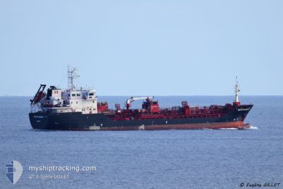
STOLT SANDPIPER
Oil/Chemical Tanker
Current Trip
| Time Travelled | 8 h, 46 mins |
|---|---|
| Remaining Time | --- |
| Distance Travelled | 28.44 nm |
| Remaining Distance | --- |
| AVG Speed | 10 Knots |
| MAX Speed | 14.6 Knots |
| AVG Wind | 16.9 knots |
| MAX Wind | 22.5 knots |
| MIN Temp | 12.4°C / 54.32°F |
| MAX Temp | 13.9°C / 57.02°F |
| Draught | 5.4 m |
| Position Received | 2 m ago |
Current Position
| Longitude | -0.13868° |
|---|---|
| Latitude | 49.48268° |
| Status | At anchor |
| Speed | 0.1 Knots |
| Course | 46° |
| Area | English Channel |
| Station | T-AIS |
| Position Received | 2 m ago |
Info
Information
The current position of STOLT SANDPIPER is in English Channel with coordinates 49.48268° / -0.13868° as reported on 2024-06-10 16:15 by AIS to our vessel tracker app. The vessel's current speed is 0.1 Knots
The vessel STOLT SANDPIPER (IMO: 9566758, MMSI: 235089284) is a Oil/Chemical Tanker that was built in 2011 ( 13 years old ). It's sailing under the flag of [GB] United Kingdom.
In this page you can find informations about the vessels current position, last detected port calls, and current voyage information. If the vessels is not in coverage by AIS you will find the latest position.
The current position of STOLT SANDPIPER is detected by our AIS receivers and we are not responsible for the reliability of the data. The last position was recorded while the vessel was in Coverage by the Ais receivers of our vessel tracking app.
The current draught of STOLT SANDPIPER as reported by AIS is 5.4 meters
Weather
| Temperature | 13.6°C / 56.48°F |
|---|---|
| Wind Speed | 13 knots |
| Direction | 334° NNW |
| Pressure | 1013.4 hPa |
| Humidity | 67.3 % |
| Cloud Coverage | 48 % |
Featured Company
Last Port Calls
| Port | Arrival | Departure | Time In Port |
|---|---|---|---|
| 2024-06-10 07:30 | 2024-06-10 07:32 | 2 m | |
| 2024-06-09 15:20 | 2024-06-10 04:12 | 12 h | |
| 2024-06-07 16:50 | 2024-06-08 12:01 | 19 h | |
| 2024-06-05 18:53 | 2024-06-06 03:07 | 8 h | |
| 2024-06-04 09:08 | 2024-06-05 18:17 | 1 d | |
| 2024-06-03 20:29 | 2024-06-04 08:54 | 12 h | |
| 2024-05-30 20:39 | 2024-05-31 21:20 | 1 d | |
| 2024-05-29 14:21 | 2024-05-30 07:31 | 17 h | |
| 2024-05-27 20:06 | 2024-05-28 16:37 | 20 h | |
| 2024-05-24 17:22 | 2024-05-25 17:26 | 1 d |
Last Trips
| Origin | Departure | Destination | Arrival | Distance | |
|---|---|---|---|---|---|
| 2024-06-10 06:12 | 2024-06-10 09:30 | 44.39 nm | |||
| 2024-06-08 14:01 | 2024-06-09 17:20 | 330.42 nm | |||
| 2024-06-06 05:07 | 2024-06-07 18:50 | 226.55 nm | |||
| 2024-06-05 20:17 | 2024-06-05 20:53 | 3.99 nm | |||
| 2024-06-04 10:54 | 2024-06-04 11:08 | 0.60 nm | |||
| 2024-05-31 22:20 | 2024-06-03 22:29 | 302.82 nm | |||
| 2024-05-30 08:31 | 2024-05-30 21:39 | 78.97 nm | |||
| 2024-05-28 17:37 | 2024-05-29 15:21 | 123.58 nm | |||
| 2024-05-25 19:26 | 2024-05-27 21:06 | 340.80 nm | |||
| 2024-05-23 10:09 | 2024-05-24 19:22 | 115.01 nm |
Events
| Time | Event | Details | Position / Dest | Info |
|---|---|---|---|---|
| 2024-06-10 14:13 | Status Changed | At anchor Default |
49.48227 / -.13679
FRPJE
|
Speed: Course: -1° |
| 2024-06-10 14:11 | Status Changed | Default At anchor |
49.48167 / -.13667
FRPJE
|
Speed: 0.3 kn Course: 330° |
| 2024-06-10 12:52 | Status Changed | At anchor Default |
49.48272 / -.13590
FRPJE
|
Speed: Course: -1° |
| 2024-06-10 12:47 | Status Changed | Default At anchor |
49.48167 / -.13500
FRPJE
|
Speed: 0.1 kn Course: 311° |
| 2024-06-10 10:22 | STOP Moving | 10.09 nm, West of LE HAVRE |
49.48297 / -.13567
FRPJE
|
Speed: 0.3 kn Course: 301° |
| 2024-06-10 10:19 | Status Changed | At anchor Under way using engine |
49.48300 / -.13605
FRPJE
|
Speed: 1.5 kn Course: 266° |
| 2024-06-10 07:32 | PORT DEPARTURE |
|
49.48386 / .51734
FRPJE
|
Speed: 14.4 kn Course: 296° |
| 2024-06-10 07:30 | PORT ARRIVAL |
|
49.47733 / .52736
[FR] PORT JEROME
|
Speed: 13.2 kn Course: 325.4° |
| 2024-06-10 05:09 | ETA Changed | 2024/06/10 17:00 2024/06/10 08:00 |
49.47730 / .92737
FRPJE
|
Speed: 13.9 kn Course: 339.1° |
| 2024-06-10 04:12 | PORT DEPARTURE |
|
49.38276 / 1.00903
FRPJE
|
Speed: 9.7 kn Course: 191° |