
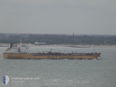
STOLT SISTO
Oil/Chemical Tanker
Current Trip
| Time Travelled | 4 days |
|---|---|
| Remaining Time | 5 days |
| Distance Travelled | 1378.77 nm |
| Remaining Distance | 1747.98 nm |
| AVG Speed | 11.2 Knots |
| MAX Speed | 12.7 Knots |
| AVG Wind | 14.8 knots |
| MAX Wind | 24.4 knots |
| MIN Temp | 17.2°C / 62.96°F |
| MAX Temp | 22.6°C / 72.68°F |
| Draught | 10.6 m |
| Position Received | 1 d ago |
Current Position
| Longitude | -26.07184° |
|---|---|
| Latitude | 39.98242° |
| Status | Under way using engine |
| Speed | 12.3 Knots |
| Course | 272.5° |
| Area | North Atlantic Ocean |
| Station | T-AIS |
| Position Received | 1 d ago |
Info
Information
The current position of STOLT SISTO is in North Atlantic Ocean with coordinates 39.98242° / -26.07184° as reported on 2024-06-19 21:32 by AIS to our vessel tracker app. The vessel's current speed is 12.3 Knots and is heading at the port of NEW YORK. The estimated time of arrival as calculated by vessel tracking app is 2024-06-27 11:49 LT
The vessel STOLT SISTO (IMO: 9359375, MMSI: 319004100) is a Oil/Chemical Tanker that was built in 2010 ( 14 years old ). It's sailing under the flag of [KY] Cayman Is.
In this page you can find informations about the vessels current position, last detected port calls, and current voyage information. If the vessels is not in coverage by AIS you will find the latest position.
The current position of STOLT SISTO is detected by our AIS receivers and we are not responsible for the reliability of the data. The last position was recorded while the vessel was in Coverage by the Ais receivers of our vessel tracking app.
The current draught of STOLT SISTO as reported by AIS is 10.6 meters
Weather
| Temperature | 22.5°C / 72.5°F |
|---|---|
| Wind Speed | 15 knots |
| Direction | 199° SSW |
| Pressure | 1019.6 hPa |
| Humidity | 88.7 % |
| Cloud Coverage | 3 % |
Featured Company
Most Visited Ports (Last year)
| Port | Arrivals | |
|---|---|---|
| 3 | ||
| 3 | ||
| 2 | ||
| 2 | ||
| 2 | ||
| 2 |
Last Trips
| Origin | Departure | Destination | Arrival | Distance | |
|---|---|---|---|---|---|
| 2024-06-06 07:06 | 2024-06-14 15:22 | 892.08 nm | |||
| 2024-05-27 14:03 | 2024-06-04 09:48 | 663.02 nm | |||
| 2024-05-12 15:34 | 2024-05-25 12:00 | 3412.65 nm | |||
| 2024-04-07 11:20 | 2024-05-11 09:30 | 4173.81 nm | |||
| 2024-03-27 13:35 | 2024-04-03 20:37 | 1836.21 nm |
Events
| Time | Event | Details | Position / Dest | Info |
|---|---|---|---|---|
| 2024-06-19 21:49 | Status Changed | Default Under way using engine |
39.98610 / -26.14477
USNYC
|
Speed: 12.3 kn Course: 272.5° |
| 2024-06-19 21:32 | Status Changed | Under way using engine Default |
39.98242 / -26.07184
USNYC
|
Speed: 12.4 kn Course: 273° |
| 2024-06-19 21:32 | OUT of Coverage |
39.98242 / -26.07184
North Atlantic Ocean
USNYC
|
Speed: 12.3 kn Course: 272.5° |
|
| 2024-06-19 21:18 | Status Changed | Default Under way using engine |
39.97934 / -26.00848
USNYC
|
Speed: 12.4 kn Course: 272.8° |
| 2024-06-19 21:08 | Status Changed | Under way using engine Default |
39.97725 / -25.96460
USNYC
|
Speed: 12.2 kn Course: 273° |
| 2024-06-19 20:57 | Status Changed | Default Under way using engine |
39.97500 / -25.91696
USNYC
|
Speed: 12.2 kn Course: 272.5° |
| 2024-06-19 19:48 | Status Changed | Under way using engine Default |
39.96218 / -25.60868
USNYC
|
Speed: 12.5 kn Course: 274° |
| 2024-06-19 19:44 | Status Changed | Default Under way using engine |
39.96159 / -25.59046
USNYC
|
Speed: 12.5 kn Course: 274.2° |
| 2024-06-19 19:29 | Detected in Sea | Portuguese (Azores) part of the North Atlantic Ocean |
39.95875 / -25.52388
North Atlantic Ocean
USNYC
|
Speed: 12.5 kn Course: 274.2° |
| 2024-06-19 19:29 | Status Changed | Under way using engine Default |
39.95875 / -25.52388
USNYC
|
Speed: 12.4 kn Course: 271° |