
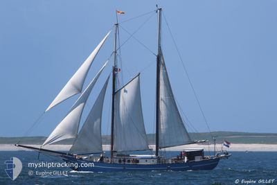
STORTEMELK
Passengers Ship
Current Trip
| Time Travelled | 3 h, 12 mins |
|---|---|
| Remaining Time | 2 h, 51 mins |
| Distance Travelled | 10.07 nm |
| Remaining Distance | 10.87 nm |
| AVG Speed | 3.7 Knots |
| MAX Speed | 4.5 Knots |
| AVG Wind | 7.8 knots |
| MAX Wind | 8 knots |
| MIN Temp | 12.9°C / 55.22°F |
| MAX Temp | 15.5°C / 59.9°F |
| Draught | 2.8 m |
| Position Received | 1 m ago |
Current Position
| Longitude | 10.17135° |
|---|---|
| Latitude | 54.50883° |
| Status | Under way sailing |
| Speed | 2.6 Knots |
| Course | --- |
| Area | Baltic Sea |
| Station | T-AIS |
| Position Received | 1 m ago |
Info
Information
The current position of STORTEMELK is in Baltic Sea with coordinates 54.50883° / 10.17135° as reported on 2024-05-10 11:22 by AIS to our vessel tracker app. The vessel's current speed is 2.6 Knots and is heading at the port of KIEL. The estimated time of arrival as calculated by vessel tracking app is 2024-05-10 14:15 LT
The vessel STORTEMELK (IMO: 5018612, MMSI: 244602000) is a Passengers Ship that was built in 1961 ( 63 years old ). It's sailing under the flag of [NL] Netherlands.
In this page you can find informations about the vessels current position, last detected port calls, and current voyage information. If the vessels is not in coverage by AIS you will find the latest position.
The current position of STORTEMELK is detected by our AIS receivers and we are not responsible for the reliability of the data. The last position was recorded while the vessel was in Coverage by the Ais receivers of our vessel tracking app.
The current draught of STORTEMELK as reported by AIS is 2.8 meters
Weather
| Temperature | 13.6°C / 56.48°F |
|---|---|
| Wind Speed | 8 knots |
| Direction | 309° NW |
| Pressure | 1024 hPa |
| Humidity | 85.4 % |
| Cloud Coverage | 81 % |
Featured Company
Last Port Calls
| Port | Arrival | Departure | Time In Port |
|---|---|---|---|
| 2024-05-10 08:10 | 2024-05-10 08:12 | 2 m | |
| 2024-05-09 16:55 | 2024-05-10 07:34 | 14 h | |
| 2024-05-06 16:19 | 2024-05-07 08:09 | 15 h | |
| 2024-05-02 15:46 | 2024-05-06 08:16 | 3 d | |
| 2024-05-01 14:26 | 2024-05-02 09:34 | 19 h | |
| 2024-04-30 14:51 | 2024-05-01 06:38 | 15 h | |
| 2024-04-29 19:41 | 2024-04-30 10:37 | 14 h | |
| 2024-04-27 15:36 | 2024-04-28 10:20 | 18 h | |
| 2024-04-22 17:09 | 2024-04-27 07:18 | 4 d | |
| 2024-04-22 11:00 | 2024-04-22 11:20 | 20 m |
Last Trips
| Origin | Departure | Destination | Arrival | Distance | |
|---|---|---|---|---|---|
| 2024-05-10 09:34 | 2024-05-10 10:10 | 2.36 nm | |||
| 2024-05-07 10:09 | 2024-05-09 18:55 | 79.45 nm | |||
| 2024-05-06 10:16 | 2024-05-06 18:19 | 33.51 nm | |||
| 2024-05-02 11:34 | 2024-05-02 17:46 | 45.30 nm | |||
| 2024-05-01 08:38 | 2024-05-01 16:26 | 44.43 nm | |||
| 2024-04-30 12:37 | 2024-04-30 16:51 | 20.27 nm | |||
| 2024-04-28 12:20 | 2024-04-29 21:41 | 204.31 nm | |||
| 2024-04-27 09:18 | 2024-04-27 17:36 | 48.53 nm | |||
| 2024-04-22 13:20 | 2024-04-22 19:09 | 38.28 nm | |||
| 2024-04-22 11:37 | 2024-04-22 13:00 | 10.55 nm |
Events
| Time | Event | Details | Position / Dest | Info |
|---|---|---|---|---|
| 2024-05-10 11:23 | Status Changed | Under way using engine Under way sailing |
54.50820 / 10.17212
KIEL
|
Speed: 2.6 kn Course: 511° |
| 2024-05-10 10:01 | Destination Changed | KIEL AEROSUND |
54.57217 / 10.10093
KIEL
|
Speed: 4.5 kn Course: 151.4° |
| 2024-05-10 10:01 | ETA Changed | 2024/05/10 15:00 2024/05/08 18:00 |
54.57217 / 10.10093
KIEL
|
Speed: 4.5 kn Course: 151.4° |
| 2024-05-10 08:12 | PORT DEPARTURE |
|
54.65973 / 10.04617
AEROSUND
|
Speed: 3.8 kn Course: 163.7° |
| 2024-05-10 08:10 | PORT ARRIVAL |
|
54.66248 / 10.04480
[DE] OLPENITZ
|
Speed: 3.8 kn Course: 160.6° |
| 2024-05-10 08:07 | START Moving | 0.43 nm, North East of OLPENITZ |
54.66553 / 10.04230
AEROSUND
|
Speed: 3.3 kn Course: 154° |
| 2024-05-10 08:05 | Status Changed | Under way sailing Under way using engine |
54.66683 / 10.04135
AEROSUND
|
Speed: 2.4 kn Course: 511° |
| 2024-05-10 08:01 | STOP Moving | 0.54 nm, North East of OLPENITZ |
54.66770 / 10.04178
AEROSUND
|
Speed: 0.3 kn Course: 511° |
| 2024-05-10 07:34 | PORT DEPARTURE |
|
54.67858 / 9.99217
AEROSUND
|
Speed: 4.2 kn Course: 163.5° |
| 2024-05-10 07:33 | Status Changed | Under way using engine Moored |
54.67995 / 9.99170
[DE] MAASHOLM
|
Speed: 3.7 kn Course: 163.5° |