
STRATEGIC ALLIANCE
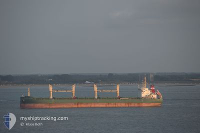
Bulk Carrier
Current Trip
| Time Travelled | 1 day |
|---|---|
| Remaining Time | --- |
| Distance Travelled | 557.28 nm |
| Remaining Distance | --- |
| AVG Speed | 11.6 Knots |
| MAX Speed | 13.9 Knots |
| AVG Wind | 6.7 knots |
| MAX Wind | 15.8 knots |
| MIN Temp | 7.2°C / 44.96°F |
| MAX Temp | 14.3°C / 57.74°F |
| Draught | 9.6 m |
| Position Received | 1 d ago |
Current Position
| Longitude | -125.47020° |
|---|---|
| Latitude | 48.21070° |
| Status | Under way using engine |
| Speed | 13.2 Knots |
| Course | 230.7° |
| Area | North Pacific Ocean |
| Station | T-AIS |
| Position Received | 1 d ago |
Info
Information
The current position of STRATEGIC ALLIANCE is in North Pacific Ocean with coordinates 48.21070° / -125.47020° as reported on 2024-05-31 11:03 by AIS to our vessel tracker app. The vessel's current speed is 13.2 Knots and is heading at the port of ACAJUTLA. The estimated time of arrival as calculated by vessel tracking app is 2024-06-10 14:00 LT
The vessel STRATEGIC ALLIANCE (IMO: 9648075, MMSI: 563642000) is a Bulk Carrier that was built in 2014 ( 10 years old ). It's sailing under the flag of [SG] Singapore.
In this page you can find informations about the vessels current position, last detected port calls, and current voyage information. If the vessels is not in coverage by AIS you will find the latest position.
The current position of STRATEGIC ALLIANCE is detected by our AIS receivers and we are not responsible for the reliability of the data. The last position was recorded while the vessel was in Coverage by the Ais receivers of our vessel tracking app.
The current draught of STRATEGIC ALLIANCE as reported by AIS is 9.6 meters
Weather
| Temperature | 12.8°C / 55.04°F |
|---|---|
| Wind Speed | 14 knots |
| Direction | 300° WNW |
| Pressure | 1018.3 hPa |
| Humidity | 78.3 % |
| Cloud Coverage | 100 % |
Featured Company
Last Port Calls
| Port | Arrival | Departure | Time In Port |
|---|---|---|---|
| 2024-05-28 13:40 | 2024-05-30 18:55 | 2 d | |
| 2024-05-06 00:25 | 2024-05-08 12:33 | 2 d | |
| 2024-04-22 19:56 | 2024-04-27 22:49 | 5 d | |
| 2024-04-08 22:13 | 2024-04-12 02:04 | 3 d |
Most Visited Ports (Last year)
| Port | Arrivals | |
|---|---|---|
| 1 | ||
| 1 | ||
| 1 | ||
| 1 | ||
| 1 | ||
| 1 |
Last Trips
| Origin | Departure | Destination | Arrival | Distance | |
|---|---|---|---|---|---|
| 2024-05-08 06:33 | 2024-05-28 06:40 | 4958.57 nm | |||
| 2024-04-27 16:49 | 2024-05-05 18:25 | 454.78 nm | |||
| 2024-04-11 20:04 | 2024-04-22 13:56 | 1622.28 nm | |||
| 2024-03-25 17:09 | 2024-04-08 16:13 | 1979.86 nm |
Events
| Time | Event | Details | Position / Dest | Info |
|---|---|---|---|---|
| 2024-05-31 11:07 | Status Changed | Default Under way using engine |
48.20114 / -125.48714
SV AQJ
|
Speed: 13.2 kn Course: 230.7° |
| 2024-05-31 11:03 | Status Changed | Under way using engine Default |
48.21070 / -125.47020
SV AQJ
|
Speed: 13 kn Course: 229° |
| 2024-05-31 11:03 | OUT of Coverage |
48.21070 / -125.47020
North Pacific Ocean
SV AQJ
|
Speed: 13.2 kn Course: 230.7° |
|
| 2024-05-31 10:18 | Status Changed | Default Under way using engine |
48.31323 / -125.28713
SV AQJ
|
Speed: 12.7 kn Course: 230.1° |
| 2024-05-31 10:14 | Status Changed | Under way using engine Default |
48.32297 / -125.26940
SV AQJ
|
Speed: 12 kn Course: 228° |
| 2024-05-31 10:05 | Status Changed | Default Under way using engine |
48.34167 / -125.23333
SV AQJ
|
Speed: 13 kn Course: 227.2° |
| 2024-05-31 09:59 | Status Changed | Under way using engine Default |
48.35801 / -125.21041
SV AQJ
|
Speed: 12.9 kn Course: 225° |
| 2024-05-31 09:26 | Status Changed | Default Under way using engine |
48.44333 / -125.10667
SV AQJ
|
Speed: 11.2 kn Course: 201.7° |
| 2024-05-31 09:23 | Status Changed | Under way using engine Default |
48.45159 / -125.10233
SV AQJ
|
Speed: 10.7 kn Course: 206° |
| 2024-05-31 09:23 | Change Sea Area | United States part of the North Pacific Ocean Canadian part of the North Pacific Ocean |
48.45159 / -125.10233
North Pacific Ocean
SV AQJ
|
Speed: 11.2 kn Course: 201.7° |