
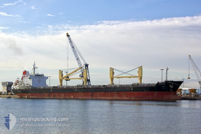
STRATEGIC ENDEAVOR
Bulk Carrier
Current Trip
MX VER
| Time Travelled | 5 days |
|---|---|
| Remaining Time | --- |
| Distance Travelled | 795.88 nm |
| Remaining Distance | --- |
| AVG Speed | 9.9 Knots |
| MAX Speed | 13.1 Knots |
| AVG Wind | 11.2 knots |
| MAX Wind | 18.1 knots |
| MIN Temp | 25°C / 77°F |
| MAX Temp | 33.9°C / 93.02°F |
| Draught | 10.5 m |
| Position Received | 2 d ago |
Current Position
| Longitude | -95.32179° |
|---|---|
| Latitude | 20.12591° |
| Status | Under way using engine |
| Speed | 9.5 Knots |
| Course | 217.4° |
| Area | Gulf of Mexico |
| Station | T-AIS |
| Position Received | 2 d ago |
Info
Information
The current position of STRATEGIC ENDEAVOR is in Gulf of Mexico with coordinates 20.12591° / -95.32179° as reported on 2024-05-12 00:03 by AIS to our vessel tracker app. The vessel's current speed is 9.5 Knots
The vessel STRATEGIC ENDEAVOR (IMO: 9475727, MMSI: 564180000) is a Bulk Carrier that was built in 2010 ( 14 years old ). It's sailing under the flag of [SG] Singapore.
In this page you can find informations about the vessels current position, last detected port calls, and current voyage information. If the vessels is not in coverage by AIS you will find the latest position.
The current position of STRATEGIC ENDEAVOR is detected by our AIS receivers and we are not responsible for the reliability of the data. The last position was recorded while the vessel was in Coverage by the Ais receivers of our vessel tracking app.
The current draught of STRATEGIC ENDEAVOR as reported by AIS is 10.5 meters
Weather
| Temperature | 29.2°C / 84.56°F |
|---|---|
| Wind Speed | 10 knots |
| Direction | 166° SSE |
| Pressure | 1004.5 hPa |
| Humidity | 63.7 % |
| Cloud Coverage | 29 % |
Featured Company
Last Port Calls
| Port | Arrival | Departure | Time In Port |
|---|---|---|---|
| 2024-05-05 19:06 | 2024-05-09 00:53 | 3 d | |
| 2024-04-30 18:22 | 2024-05-05 16:51 | 4 d | |
| 2024-04-28 23:20 | 2024-04-29 16:54 | 17 h | |
| 2024-04-10 19:30 | 2024-04-13 09:47 | 2 d | |
| 2024-03-13 20:48 | 2024-03-20 20:07 | 6 d | |
| 2024-03-02 08:51 |
Most Visited Ports (Last year)
| Port | Arrivals | |
|---|---|---|
| 3 | ||
| 3 | ||
| 1 | ||
| 1 | ||
| 1 | ||
| 1 |
Last Trips
| Origin | Departure | Destination | Arrival | Distance | |
|---|---|---|---|---|---|
| 2024-05-05 11:51 | 2024-05-05 14:06 | 29.98 nm | |||
| 2024-04-29 11:54 | 2024-04-30 13:22 | 31.07 nm | |||
| 2024-04-13 06:47 | 2024-04-28 18:20 | 3353.20 nm | |||
| 2024-03-20 17:07 | 2024-04-10 16:30 | 1178.22 nm | |||
| 2024-03-02 05:51 | 2024-03-13 17:48 | 2382.86 nm |
Events
| Time | Event | Details | Position / Dest | Info |
|---|---|---|---|---|
| 2024-05-12 10:25 | STOP Moving | 4.03 nm, East of BOCA DEL RIO |
19.10812 / -96.03332
MX VER
|
Speed: 0.2 kn Course: 110° |
| 2024-05-12 00:06 | Status Changed | Default Under way using engine |
20.12032 / -95.32636
MX VER
|
Speed: 9.5 kn Course: 217.4° |
| 2024-05-12 00:03 | OUT of Coverage |
20.12591 / -95.32179
Gulf of Mexico
|
Speed: 9.5 kn Course: 217.4° |
|
| 2024-05-11 23:42 | Status Changed | Under way using engine Default |
20.17037 / -95.28636
MX VER
|
Speed: 9.4 kn Course: 218° |
| 2024-05-11 23:37 | IN Coverage |
20.17037 / -95.28636
Gulf of Mexico
|
Speed: 9.4 kn Course: 214.2° |
|
| 2024-05-11 19:51 | Status Changed | Default Under way using engine |
20.63110 / -94.89970
MX VER
|
Speed: 9 kn Course: 217.6° |
| 2024-05-11 19:47 | Status Changed | Under way using engine Default |
20.63841 / -94.89363
MX VER
|
Speed: 8.9 kn Course: 217° |
| 2024-05-11 19:47 | IN Coverage |
20.63841 / -94.89363
Gulf of Mexico
|
Speed: 9 kn Course: 217.6° |
|
| 2024-05-11 19:47 | OUT of Coverage |
20.63841 / -94.89363
Gulf of Mexico
|
Speed: 9 kn Course: 217.6° |
|
| 2024-05-11 08:37 | OUT of Coverage |
22.11493 / -93.66267
Gulf of Mexico
|
Speed: 11.2 kn Course: 218.9° |