
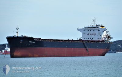
STRIGGLA
Bulk Carrier
Current Trip
| Time Travelled | 6 days |
|---|---|
| Remaining Time | --- |
| Distance Travelled | 1717.44 nm |
| Remaining Distance | --- |
| AVG Speed | 11.4 Knots |
| MAX Speed | 13.4 Knots |
| AVG Wind | 8.5 knots |
| MAX Wind | 19 knots |
| MIN Temp | 23.9°C / 75.02°F |
| MAX Temp | 29.4°C / 84.92°F |
| Draught | 7.2 m |
| Position Received | 3 d ago |
Current Position
| Longitude | 115.58419° |
|---|---|
| Latitude | -7.90774° |
| Status | Under way using engine |
| Speed | 11.9 Knots |
| Course | 319.9° |
| Area | Bali Sea |
| Station | T-AIS |
| Position Received | 3 d ago |
Info
Information
The current position of STRIGGLA is in Bali Sea with coordinates -7.90774° / 115.58419° as reported on 2024-05-30 13:03 by AIS to our vessel tracker app. The vessel's current speed is 11.9 Knots and is heading at the port of HON GAI. The estimated time of arrival as calculated by vessel tracking app is 2024-06-06 07:00 LT
The vessel STRIGGLA (IMO: 9465710, MMSI: 249620000) is a Bulk Carrier that was built in 2009 ( 15 years old ). It's sailing under the flag of [MT] Malta.
In this page you can find informations about the vessels current position, last detected port calls, and current voyage information. If the vessels is not in coverage by AIS you will find the latest position.
The current position of STRIGGLA is detected by our AIS receivers and we are not responsible for the reliability of the data. The last position was recorded while the vessel was in Coverage by the Ais receivers of our vessel tracking app.
The current draught of STRIGGLA as reported by AIS is 7.2 meters
Weather
| Temperature | 27.3°C / 81.14°F |
|---|---|
| Wind Speed | 6 knots |
| Direction | 210° SSW |
| Pressure | 1010.1 hPa |
| Humidity | 80.9 % |
| Cloud Coverage | 100 % |
Featured Company
Last Port Calls
| Port | Arrival | Departure | Time In Port |
|---|---|---|---|
| 2024-05-26 07:23 | 2024-05-27 17:54 | 1 d | |
| 2024-04-11 01:55 | 2024-04-11 18:51 | 16 h |
Last Trips
| Origin | Departure | Destination | Arrival | Distance | |
|---|---|---|---|---|---|
| 2024-04-12 04:51 | 2024-05-26 15:23 | 4136.20 nm | |||
| 2024-03-13 20:18 | 2024-04-11 11:55 | 4155.15 nm |
Events
| Time | Event | Details | Position / Dest | Info |
|---|---|---|---|---|
| 2024-05-30 13:06 | Status Changed | Default Under way using engine |
-7.89667 / 115.57500
VN HON
|
Speed: 11.9 kn Course: 319.9° |
| 2024-05-30 13:03 | Change Sea Area | Indonesian part of the Bali Sea Australian part of the Indian Ocean |
-7.90774 / 115.58419
Bali Sea
VN HON
|
Speed: 11.9 kn Course: 319.9° |
| 2024-05-30 13:03 | Status Changed | Under way using engine Default |
-7.90774 / 115.58419
VN HON
|
Speed: 12 kn Course: 320° |
| 2024-05-30 13:03 | OUT of Coverage |
-7.90774 / 115.58419
Bali Sea
VN HON
|
Speed: 11.9 kn Course: 319.9° |
|
| 2024-05-30 13:01 | IN Coverage |
-7.90774 / 115.58419
Bali Sea
VN HON
|
Speed: 11.9 kn Course: 319.9° |
|
| 2024-05-28 01:12 | Status Changed | Default Under way using engine |
-18.96883 / 118.20979
VN HON
|
Speed: 11.5 kn Course: 355.5° |
| 2024-05-28 01:07 | OUT of Coverage |
-18.98538 / 118.21161
Indian Ocean
VN HON
|
Speed: 11.5 kn Course: 355.5° |
|
| 2024-05-27 23:50 | Status Changed | Under way using engine Default |
-19.22470 / 118.26502
VN HON
|
Speed: 11.6 kn Course: 340° |
| 2024-05-27 23:44 | Status Changed | Default Under way using engine |
-19.24204 / 118.27181
VN HON
|
Speed: 11.7 kn Course: 341.3° |
| 2024-05-27 23:39 | Status Changed | Under way using engine Default |
-19.25952 / 118.27830
VN HON
|
Speed: 11.7 kn Course: 342° |