
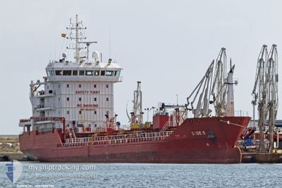
SUDE-S
Oil/Chemical Tanker
Current Trip
| Time Travelled | 14 h, 42 mins |
|---|---|
| Remaining Time | 6 h, 23 mins |
| Distance Travelled | 168.35 nm |
| Remaining Distance | 82.47 nm |
| AVG Speed | 12.5 Knots |
| MAX Speed | 14.8 Knots |
| AVG Wind | 6.2 knots |
| MAX Wind | 14.1 knots |
| MIN Temp | 10°C / 50°F |
| MAX Temp | 14.7°C / 58.46°F |
| Draught | 5.5 m |
| Position Received | 1 m ago |
Current Position
| Longitude | 0.54987° |
|---|---|
| Latitude | 50.56201° |
| Status | Under way using engine |
| Speed | 10 Knots |
| Course | 254° |
| Area | English Channel |
| Station | T-AIS |
| Position Received | 1 m ago |
Info
Information
The current position of SUDE-S is in English Channel with coordinates 50.56201° / 0.54987° as reported on 2024-06-09 10:58 by AIS to our vessel tracker app. The vessel's current speed is 10 Knots and is heading at the port of FAWLEY. The estimated time of arrival as calculated by vessel tracking app is 2024-06-09 17:23 LT
The vessel SUDE-S (IMO: 9508378, MMSI: 215516000) is a Oil/Chemical Tanker that was built in 2009 ( 15 years old ). It's sailing under the flag of [MT] Malta.
In this page you can find informations about the vessels current position, last detected port calls, and current voyage information. If the vessels is not in coverage by AIS you will find the latest position.
The current position of SUDE-S is detected by our AIS receivers and we are not responsible for the reliability of the data. The last position was recorded while the vessel was in Coverage by the Ais receivers of our vessel tracking app.
The current draught of SUDE-S as reported by AIS is 5.5 meters
Weather
| Temperature | 13°C / 55.4°F |
|---|---|
| Wind Speed | 5 knots |
| Direction | 305° NW |
| Pressure | 1014.1 hPa |
| Humidity | 61.6 % |
| Cloud Coverage | 4 % |
Featured Company
Last Port Calls
| Port | Arrival | Departure | Time In Port |
|---|---|---|---|
| 2024-06-07 12:11 | 2024-06-08 20:18 | 1 d | |
| 2024-05-31 18:13 | 2024-06-01 11:35 | 17 h | |
| 2024-05-28 03:09 | 2024-05-28 21:55 | 18 h | |
| 2024-05-25 00:57 | 2024-05-26 08:34 | 1 d | |
| 2024-05-19 02:50 | 2024-05-19 13:03 | 10 h | |
| 2024-05-16 21:05 | 2024-05-18 09:04 | 1 d | |
| 2024-05-13 00:57 | 2024-05-15 17:51 | 2 d | |
| 2024-05-10 13:11 | 2024-05-11 08:54 | 19 h | |
| 2024-05-08 02:03 | 2024-05-09 08:58 | 1 d | |
| 2024-05-07 14:54 | 2024-05-08 00:44 | 9 h |
Most Visited Ports (Last year)
| Port | Arrivals | |
|---|---|---|
| 10 | ||
| 6 | ||
| 4 | ||
| 4 | ||
| 3 | ||
| 3 |
Last Trips
| Origin | Departure | Destination | Arrival | Distance | |
|---|---|---|---|---|---|
| 2024-06-01 13:35 | 2024-06-07 14:11 | 288.01 nm | |||
| 2024-05-28 23:55 | 2024-05-31 20:13 | 54.36 nm | |||
| 2024-05-26 10:34 | 2024-05-28 05:09 | 293.23 nm | |||
| 2024-05-19 15:03 | 2024-05-25 02:57 | 524.88 nm | |||
| 2024-05-18 10:04 | 2024-05-19 04:50 | 202.10 nm | |||
| 2024-05-15 19:51 | 2024-05-16 22:05 | 247.07 nm | |||
| 2024-05-11 10:54 | 2024-05-13 02:57 | 425.19 nm | |||
| 2024-05-09 10:58 | 2024-05-10 15:11 | 309.36 nm | |||
| 2024-05-08 02:44 | 2024-05-08 04:03 | 11.65 nm | |||
| 2024-05-04 02:15 | 2024-05-07 16:54 | 1002.87 nm |
Events
| Time | Event | Details | Position / Dest | Info |
|---|---|---|---|---|
| 2024-06-09 07:10 | Change Sea Area | United Kingdom part of the English Channel United Kingdom part of the North Sea |
51.05233 / 1.51990
English Channel
GBFAW
|
Speed: 13.8 kn Course: 224.1° |
| 2024-06-09 04:31 | Change Sea Area | United Kingdom part of the North Sea French part of the North Sea |
51.41069 / 2.06877
North Sea
GBFAW
|
Speed: 11.3 kn Course: 295.2° |
| 2024-06-09 03:28 | Change Sea Area | French part of the North Sea Belgian part of the North Sea |
51.35076 / 2.34258
North Sea
GBFAW
|
Speed: 10.1 kn Course: 251° |
| 2024-06-08 23:40 | Change Sea Area | Belgian part of the North Sea Dutch part of the North Sea |
51.39612 / 3.33192
North Sea
GBFAW
|
Speed: 10.8 kn Course: 265.8° |
| 2024-06-08 20:18 | PORT DEPARTURE |
|
51.36799 / 4.21994
GBFAW
|
Speed: 13.9 kn Course: 344° |
| 2024-06-08 20:06 | ETA Changed | 2024/06/09 18:00 2024/09/06 18:00 |
51.33699 / 4.27128
[BE] ANTWERP
|
Speed: 13.2 kn Course: 339° |
| 2024-06-08 19:50 | ETA Changed | 2024/09/06 18:00 2024/09/06 20:00 |
51.29377 / 4.30716
[BE] ANTWERP
|
Speed: 13.6 kn Course: 289° |
| 2024-06-08 19:44 | ETA Changed | 2024/09/06 20:00 2024/09/02 12:00 |
51.28033 / 4.32903
[BE] ANTWERP
|
Speed: 5.6 kn Course: 319° |
| 2024-06-08 19:41 | START Moving |
51.27837 / 4.33224
[BE] ANTWERP
|
Speed: 3.1 kn Course: 319° |
|
| 2024-06-08 18:03 | STOP Moving |
51.27065 / 4.33694
[BE] ANTWERP
|
Speed: 0.3 kn Course: 1° |