
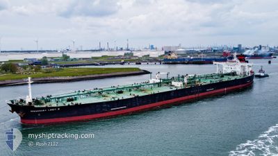
SUEZ ICE SUPREME
Crude Oil Tanker
Current Trip
| Time Travelled | 50 days |
|---|---|
| Remaining Time | --- |
| Distance Travelled | 11497.49 nm |
| Remaining Distance | --- |
| AVG Speed | 11.3 Knots |
| MAX Speed | 11.3 Knots |
| AVG Wind | 12.4 knots |
| MAX Wind | 36 knots |
| MIN Temp | 2.7°C / 36.86°F |
| MAX Temp | 34.3°C / 93.74°F |
| Draught | 12.8 m |
| Position Received | 12 h, 43 m ago |
Current Position
| Longitude | 19.18933° |
|---|---|
| Latitude | 34.67970° |
| Status | Under way using engine |
| Speed | 12.9 Knots |
| Course | 291° |
| Area | Mediterranean Sea - Eastern Basin |
| Station | T-AIS |
| Position Received | 12 h, 43 m ago |
Info
Information
The current position of SUEZ ICE SUPREME is in Mediterranean Sea - Eastern Basin with coordinates 34.67970° / 19.18933° as reported on 2024-05-18 13:02 by AIS to our vessel tracker app. The vessel's current speed is 12.9 Knots and is heading at the port of GDANSK. The estimated time of arrival as calculated by vessel tracking app is 2024-05-31 05:00 LT
The vessel SUEZ ICE SUPREME (IMO: 9296418, MMSI: 636022121) is a Crude Oil Tanker that was built in 2007 ( 17 years old ). It's sailing under the flag of [LR] Liberia.
In this page you can find informations about the vessels current position, last detected port calls, and current voyage information. If the vessels is not in coverage by AIS you will find the latest position.
The current position of SUEZ ICE SUPREME is detected by our AIS receivers and we are not responsible for the reliability of the data. The last position was recorded while the vessel was in Coverage by the Ais receivers of our vessel tracking app.
The current draught of SUEZ ICE SUPREME as reported by AIS is 12.8 meters
Weather
| Temperature | 20.4°C / 68.72°F |
|---|---|
| Wind Speed | 9 knots |
| Direction | 26° NNE |
| Pressure | 1010.5 hPa |
| Humidity | 84.6 % |
| Cloud Coverage | 7 % |
Featured Company
Last Port Calls
| Port | Arrival | Departure | Time In Port |
|---|---|---|---|
| 2024-05-09 05:57 | 2024-05-09 15:09 | 9 h | |
| 2024-04-16 05:10 | 2024-04-16 14:09 | 8 h | |
| 2024-03-27 14:16 | 2024-03-29 11:15 | 1 d | |
| 2024-03-02 02:55 |
Last Trips
| Origin | Departure | Destination | Arrival | Distance | |
|---|---|---|---|---|---|
| 2024-03-29 14:15 | 2024-05-09 07:57 | 10143.82 nm | |||
| 2024-03-29 14:15 | 2024-04-16 07:10 | 4810.99 nm | |||
| 2024-03-02 03:55 | 2024-03-27 17:16 | 661.63 nm |
Events
| Time | Event | Details | Position / Dest | Info |
|---|---|---|---|---|
| 2024-05-18 13:05 | Status Changed | Default Under way using engine |
34.68277 / 19.17988
PL GDN
|
Speed: 12.9 kn Course: 291° |
| 2024-05-18 13:02 | OUT of Coverage |
34.67970 / 19.18933
Mediterranean Sea - Eastern Basin
PL GDN
|
Speed: 12.9 kn Course: 291° |
|
| 2024-05-18 12:54 | Status Changed | Under way using engine Default |
34.66857 / 19.22300
PL GDN
|
Speed: 12.6 kn Course: 291° |
| 2024-05-18 12:54 | IN Coverage |
34.66857 / 19.22300
Mediterranean Sea - Eastern Basin
PL GDN
|
Speed: 12.9 kn Course: 291° |
|
| 2024-05-18 11:32 | Status Changed | Default Under way using engine |
34.55877 / 19.55240
PL GDN
|
Speed: 12.9 kn Course: 291° |
| 2024-05-18 11:25 | OUT of Coverage |
34.54962 / 19.57995
Mediterranean Sea - Eastern Basin
PL GDN
|
Speed: 12.9 kn Course: 291° |
|
| 2024-05-18 11:08 | ETA Changed | 2024/05/31 05:00 2024/05/31 00:00 |
34.52613 / 19.65277
PL GDN
|
Speed: 12.8 kn Course: 290° |
| 2024-05-18 10:53 | Status Changed | Under way using engine Default |
34.50812 / 19.70937
PL GDN
|
Speed: 12.7 kn Course: 291° |
| 2024-05-18 10:53 | IN Coverage |
34.50983 / 19.70392
Mediterranean Sea - Eastern Basin
PL GDN
|
Speed: 12.8 kn Course: 291° |
|
| 2024-05-17 19:54 | OUT of Coverage |
33.30388 / 23.32217
Mediterranean Sea - Eastern Basin
PL GDN
|
Speed: 13.6 kn Course: 291° |