
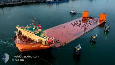
SUN SHINE
Heavy Lift Vessel
Current Trip
| Time Travelled | 13 days |
|---|---|
| Remaining Time | 7 days |
| Distance Travelled | 2777.58 nm |
| Remaining Distance | 1673.97 nm |
| AVG Speed | 8.9 Knots |
| MAX Speed | 12.5 Knots |
| AVG Wind | 12.4 knots |
| MAX Wind | 26 knots |
| MIN Temp | 8.2°C / 46.76°F |
| MAX Temp | 19.7°C / 67.46°F |
| Draught | 5.5 m |
| Position Received | 7 d ago |
Current Position
| Longitude | -5.17586° |
|---|---|
| Latitude | 49.40035° |
| Status | Under way using engine |
| Speed | 5.3 Knots |
| Course | 243.7° |
| Area | English Channel |
| Station | T-AIS |
| Position Received | 7 d ago |
Info
Information
The current position of SUN SHINE is in English Channel with coordinates 49.40035° / -5.17586° as reported on 2024-05-14 20:41 by AIS to our vessel tracker app. The vessel's current speed is 5.3 Knots and is heading at the port of NORFOLK. The estimated time of arrival as calculated by vessel tracking app is 2024-05-30 06:50 LT
The vessel SUN SHINE (IMO: 9471616, MMSI: 440040000) is a Heavy Lift Vessel that was built in 2008 ( 16 years old ). It's sailing under the flag of [KR] Korea.
In this page you can find informations about the vessels current position, last detected port calls, and current voyage information. If the vessels is not in coverage by AIS you will find the latest position.
The current position of SUN SHINE is detected by our AIS receivers and we are not responsible for the reliability of the data. The last position was recorded while the vessel was in Coverage by the Ais receivers of our vessel tracking app.
The current draught of SUN SHINE as reported by AIS is 5.5 meters
Weather
| Temperature | 19.8°C / 67.64°F |
|---|---|
| Wind Speed | 16 knots |
| Direction | 193° SSW |
| Pressure | 1009.1 hPa |
| Humidity | 92.2 % |
| Cloud Coverage | 72 % |
Featured Company
Most Visited Ports (Last year)
| Port | Arrivals | |
|---|---|---|
| 5 | ||
| 4 | ||
| 1 | ||
| 1 | ||
| 1 |
Events
| Time | Event | Details | Position / Dest | Info |
|---|---|---|---|---|
| 2024-05-14 20:47 | Status Changed | Default Under way using engine |
49.39696 / -5.18683
USPTM
|
Speed: 5.3 kn Course: 243.7° |
| 2024-05-14 20:41 | Status Changed | Under way using engine Default |
49.40035 / -5.17586
USPTM
|
Speed: 5.1 kn Course: 246° |
| 2024-05-14 20:41 | OUT of Coverage |
49.40035 / -5.17586
English Channel
USPTM
|
Speed: 5.3 kn Course: 243.7° |
|
| 2024-05-14 20:31 | IN Coverage |
49.40035 / -5.17586
English Channel
USPTM
|
Speed: 5.3 kn Course: 243.7° |
|
| 2024-05-14 18:14 | Status Changed | Default Under way using engine |
49.48179 / -4.87675
USPTM
|
Speed: 4.7 kn Course: 244° |
| 2024-05-14 18:09 | OUT of Coverage |
49.48436 / -4.86634
English Channel
USPTM
|
Speed: 4.7 kn Course: 250.5° |
|
| 2024-05-14 18:09 | Status Changed | Under way using engine Default |
49.48445 / -4.86597
USPTM
|
Speed: 5.2 kn Course: 256° |
| 2024-05-14 17:55 | IN Coverage |
49.48436 / -4.86634
English Channel
USPTM
|
Speed: 4.7 kn Course: 250.5° |
|
| 2024-05-14 16:46 | Status Changed | Default Under way using engine |
49.52737 / -4.71216
USPTM
|
Speed: 5 kn Course: 249° |
| 2024-05-14 16:41 | OUT of Coverage |
49.53072 / -4.70309
English Channel
USPTM
|
Speed: 5 kn Course: 249° |