
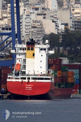
SUNAID X
Container Ship
Current Trip
| Time Travelled | 2 days |
|---|---|
| Remaining Time | 55 mins |
| Distance Travelled | 535.55 nm |
| Remaining Distance | 10.90 nm |
| AVG Speed | 10.2 Knots |
| MAX Speed | 12.4 Knots |
| AVG Wind | 13 knots |
| MAX Wind | 22.8 knots |
| MIN Temp | 15.4°C / 59.72°F |
| MAX Temp | 21°C / 69.8°F |
| Draught | 6.9 m |
| Position Received | 1 m ago |
Current Position
| Longitude | -8.90424° |
|---|---|
| Latitude | 42.15723° |
| Status | Under way using engine |
| Speed | 10.3 Knots |
| Course | 70.2° |
| Area | North Atlantic Ocean |
| Station | T-AIS |
| Position Received | 1 m ago |
Info
Information
The current position of SUNAID X is in North Atlantic Ocean with coordinates 42.15723° / -8.90424° as reported on 2024-06-16 03:09 by AIS to our vessel tracker app. The vessel's current speed is 10.3 Knots and is heading at the port of VIGO. The estimated time of arrival as calculated by vessel tracking app is 2024-06-16 04:05 LT
The vessel SUNAID X (IMO: 9358539, MMSI: 255806259) is a Container Ship that was built in 2006 ( 18 years old ). It's sailing under the flag of [PT] Portugal.
In this page you can find informations about the vessels current position, last detected port calls, and current voyage information. If the vessels is not in coverage by AIS you will find the latest position.
The current position of SUNAID X is detected by our AIS receivers and we are not responsible for the reliability of the data. The last position was recorded while the vessel was in Coverage by the Ais receivers of our vessel tracking app.
The current draught of SUNAID X as reported by AIS is 6.9 meters
Weather
| Temperature | 15.4°C / 59.72°F |
|---|---|
| Wind Speed | 13 knots |
| Direction | 172° S |
| Pressure | 1015.9 hPa |
| Humidity | 90.7 % |
| Cloud Coverage | 100 % |
Featured Company
Last Port Calls
| Port | Arrival | Departure | Time In Port |
|---|---|---|---|
| 2024-06-13 10:37 | 2024-06-14 00:08 | 13 h | |
| 2024-06-10 06:45 | 2024-06-11 19:34 | 1 d | |
| 2024-06-08 22:56 | 2024-06-09 08:14 | 9 h | |
| 2024-06-06 16:26 | 2024-06-07 03:47 | 11 h | |
| 2024-06-01 23:33 | 2024-06-02 19:32 | 19 h | |
| 2024-05-31 12:39 | 2024-05-31 19:28 | 6 h | |
| 2024-05-28 16:38 | 2024-05-29 05:37 | 12 h | |
| 2024-05-26 13:17 | 2024-05-26 14:14 | 56 m | |
| 2024-04-06 15:18 | 2024-04-07 01:16 | 9 h | |
| 2024-04-05 18:27 | 2024-04-06 09:42 | 15 h |
Last Trips
| Origin | Departure | Destination | Arrival | Distance | |
|---|---|---|---|---|---|
| 2024-06-11 20:34 | 2024-06-13 12:37 | 386.13 nm | |||
| 2024-06-09 10:14 | 2024-06-10 07:45 | 252.74 nm | |||
| 2024-06-07 05:47 | 2024-06-09 00:56 | 546.46 nm | |||
| 2024-06-02 20:32 | 2024-06-06 18:26 | 455.38 nm | |||
| 2024-05-31 20:28 | 2024-06-02 00:33 | 338.02 nm | |||
| 2024-05-29 07:37 | 2024-05-31 13:39 | 206.04 nm | |||
| 2024-05-26 16:14 | 2024-05-28 18:38 | 89.90 nm | |||
| 2024-04-07 04:16 | 2024-05-26 15:17 | 1940.16 nm | |||
| 2024-04-06 12:42 | 2024-04-06 18:18 | 62.72 nm | |||
| 2024-03-24 09:25 | 2024-04-05 21:27 | 696.95 nm |
Events
| Time | Event | Details | Position / Dest | Info |
|---|---|---|---|---|
| 2024-06-16 02:19 | Status Changed | Under way using engine Default |
42.05505 / -9.02084
ESVGO
|
Speed: 10.5 kn Course: 28° |
| 2024-06-16 02:12 | Status Changed | Default Under way using engine |
42.03767 / -9.03341
ESVGO
|
Speed: 10.5 kn Course: 33° |
| 2024-06-16 01:54 | Detected in Sea | Spanish part of the North Atlantic Ocean |
41.99345 / -9.07190
North Atlantic Ocean
ESVGO
|
Speed: 10.4 kn Course: 35.4° |
| 2024-06-16 01:53 | Status Changed | Under way using engine Default |
41.99089 / -9.07437
ESVGO
|
Speed: 10.3 kn Course: 34° |
| 2024-06-16 01:53 | IN Coverage |
41.99345 / -9.07190
North Atlantic Ocean
ESVGO
|
Speed: 10.4 kn Course: 35.4° |
|
| 2024-06-15 23:08 | Status Changed | Default Under way using engine |
41.55452 / -9.24605
ESVGO
|
Speed: 9.7 kn Course: 10.2° |
| 2024-06-15 22:57 | OUT of Coverage |
41.52420 / -9.25289
North Atlantic Ocean
ESVGO
|
Speed: 9.7 kn Course: 10.2° |
|
| 2024-06-15 21:03 | Status Changed | Under way using engine Default |
41.21260 / -9.34015
ESVGO
|
Speed: 10.8 kn Course: 12° |
| 2024-06-15 20:54 | Status Changed | Default Under way using engine |
41.18497 / -9.34842
ESVGO
|
Speed: 10.7 kn Course: 9.7° |
| 2024-06-15 20:48 | Status Changed | Under way using engine Default |
41.16765 / -9.35280
ESVGO
|
Speed: 10.6 kn Course: 9° |