
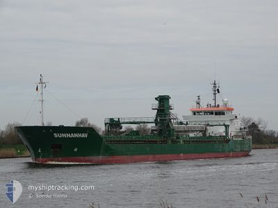
SUNNANHAV
General Cargo
Current Trip
| Time Travelled | 3 days |
|---|---|
| Remaining Time | 20 h, 25 mins |
| Distance Travelled | 915.38 nm |
| Remaining Distance | 266.57 nm |
| AVG Speed | 12 Knots |
| MAX Speed | 14.2 Knots |
| AVG Wind | 9.3 knots |
| MAX Wind | 22.2 knots |
| MIN Temp | 11°C / 51.8°F |
| MAX Temp | 17°C / 62.6°F |
| Draught | 5.3 m |
| Position Received | 2 m ago |
Current Position
| Longitude | 4.18283° |
|---|---|
| Latitude | 61.65096° |
| Status | Under way using engine |
| Speed | 12.7 Knots |
| Course | 356.3° |
| Area | Norwegian Sea |
| Station | T-AIS |
| Position Received | 2 m ago |
Info
Information
The current position of SUNNANHAV is in Norwegian Sea with coordinates 61.65096° / 4.18283° as reported on 2024-06-01 02:05 by AIS to our vessel tracker app. The vessel's current speed is 12.7 Knots and is heading at the port of VERDAL. The estimated time of arrival as calculated by vessel tracking app is 2024-06-01 22:33 LT
The vessel SUNNANHAV (IMO: 9341160, MMSI: 231790000) is a General Cargo that was built in 2006 ( 18 years old ). It's sailing under the flag of [FO] Faroe Is.
In this page you can find informations about the vessels current position, last detected port calls, and current voyage information. If the vessels is not in coverage by AIS you will find the latest position.
The current position of SUNNANHAV is detected by our AIS receivers and we are not responsible for the reliability of the data. The last position was recorded while the vessel was in Coverage by the Ais receivers of our vessel tracking app.
The current draught of SUNNANHAV as reported by AIS is 5.3 meters
Weather
| Temperature | 11.3°C / 52.34°F |
|---|---|
| Wind Speed | 11 knots |
| Direction | 336° NNW |
| Pressure | 1021.8 hPa |
| Humidity | 82.8 % |
| Cloud Coverage | 4 % |
Featured Company
Last Port Calls
| Port | Arrival | Departure | Time In Port |
|---|---|---|---|
| 2024-05-28 22:25 | 2024-05-28 23:13 | 48 m | |
| 2024-05-26 17:33 | 2024-05-28 16:29 | 1 d | |
| 2024-05-26 10:34 | 2024-05-26 11:13 | 38 m | |
| 2024-05-12 09:04 | 2024-05-22 16:23 | 10 d | |
| 2024-05-09 06:45 |
Last Trips
| Origin | Departure | Destination | Arrival | Distance | |
|---|---|---|---|---|---|
| 2024-05-28 18:29 | 2024-05-29 00:25 | 65.94 nm | |||
| 2024-05-26 13:13 | 2024-05-26 19:33 | 65.36 nm | |||
| 2024-05-22 18:23 | 2024-05-26 12:34 | 878.15 nm | |||
| 2024-05-09 08:45 | 2024-05-12 11:04 | 630.62 nm |
Events
| Time | Event | Details | Position / Dest | Info |
|---|---|---|---|---|
| 2024-05-31 23:04 | Detected in Sea | Norwegian part of the Norwegian Sea |
61.00055 / 4.16813
Norwegian Sea
SE KOG => NO VER
|
Speed: 13.1 kn Course: 1.4° |
| 2024-05-31 03:37 | Change Sea Area | Norwegian part of the North Sea Norwegian part of the Skaggerak |
57.75172 / 7.43410
North Sea
SE KOG => NO VER
|
Speed: 13.2 kn Course: 271° |
| 2024-05-30 23:38 | Change Sea Area | Norwegian part of the Skaggerak Danish part of the Skaggerak |
57.80831 / 9.06508
Skaggerak
SE KOG => NO VER
|
Speed: 12.5 kn Course: 266.6° |
| 2024-05-30 18:38 | Change Sea Area | Danish part of the Skaggerak Danish part of the Kattegat |
57.80510 / 10.93130
Skaggerak
SE KOG => NO VER
|
Speed: 12.7 kn Course: 304.1° |
| 2024-05-30 17:41 | Change Sea Area | Danish part of the Kattegat Swedish part of the Kattegat |
57.65417 / 11.20315
Kattegat
SE KOG => NO VER
|
Speed: 13.7 kn Course: 318.8° |
| 2024-05-30 14:20 | ETA Changed | 2024/06/02 00:31 2024/06/02 06:00 |
57.06961 / 12.01223
SE KOG => NO VER
|
Speed: 12.7 kn Course: 341.1° |
| 2024-05-30 09:23 | Change Sea Area | Swedish part of the Kattegat Danish part of the Kattegat |
56.12111 / 12.54137
Kattegat
SE KOG => NO VER
|
Speed: 14.1 kn Course: 318.5° |
| 2024-05-30 09:17 | Change Sea Area | Danish part of the Kattegat Swedish part of the Kattegat |
56.10369 / 12.56960
Kattegat
SE KOG => NO VER
|
Speed: 14.2 kn Course: 316.7° |
| 2024-05-30 07:47 | Detected in Sea | Swedish part of the Kattegat |
55.82016 / 12.72075
Kattegat
SE KOG => NO VER
|
Speed: 11.1 kn Course: 10.6° |
| 2024-05-30 05:56 | Change Sea Area | Danish part of the Kattegat Swedish part of the Kattegat |
55.48987 / 12.70711
Kattegat
SE KOG => NO VER
|
Speed: 9.7 kn Course: 9.4° |