
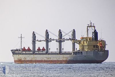
SUNRISE
Bulk Carrier
Current Trip
| Time Travelled | 1 day |
|---|---|
| Remaining Time | --- |
| Distance Travelled | 527.98 nm |
| Remaining Distance | --- |
| AVG Speed | 13.2 Knots |
| MAX Speed | 14.3 Knots |
| AVG Wind | 17.1 knots |
| MAX Wind | 23 knots |
| MIN Temp | 11.4°C / 52.52°F |
| MAX Temp | 17.2°C / 62.96°F |
| Draught | 6.3 m |
| Position Received | 3 h, 50 m ago |
Current Position
| Longitude | 28.35625° |
|---|---|
| Latitude | 60.46725° |
| Status | Under way using engine |
| Speed | 10.7 Knots |
| Course | 44° |
| Area | Gulf of Finland |
| Station | T-AIS |
| Position Received | 3 h, 50 m ago |
Info
Information
The current position of SUNRISE is in Gulf of Finland with coordinates 60.46725° / 28.35625° as reported on 2024-06-21 16:25 by AIS to our vessel tracker app. The vessel's current speed is 10.7 Knots
The vessel SUNRISE (IMO: 9393620, MMSI: 311013800) is a Bulk Carrier that was built in 2009 ( 15 years old ). It's sailing under the flag of [BS] Bahamas.
In this page you can find informations about the vessels current position, last detected port calls, and current voyage information. If the vessels is not in coverage by AIS you will find the latest position.
The current position of SUNRISE is detected by our AIS receivers and we are not responsible for the reliability of the data. The last position was recorded while the vessel was in Coverage by the Ais receivers of our vessel tracking app.
The current draught of SUNRISE as reported by AIS is 6.3 meters
Weather
| Temperature | 15°C / 59°F |
|---|---|
| Wind Speed | 10 knots |
| Direction | 296° WNW |
| Pressure | 1008.6 hPa |
| Humidity | 62.4 % |
| Cloud Coverage | 6 % |
Featured Company
Events
| Time | Event | Details | Position / Dest | Info |
|---|---|---|---|---|
| 2024-06-21 16:33 | Status Changed | Default Under way using engine |
60.48477 / 28.36468
RUVYS
|
Speed: 10.7 kn Course: 44° |
| 2024-06-21 16:25 | OUT of Coverage |
60.46725 / 28.35625
Gulf of Finland
RUVYS
|
Speed: 10.7 kn Course: 44° |
|
| 2024-06-21 11:13 | Change Sea Area | Russian part of the Gulf of Finland Estonian part of the Gulf of Finland |
59.95708 / 26.42683
Gulf of Finland
RUVYS
|
Speed: 14.4 kn Course: 77° |
| 2024-06-21 10:22 | Change Sea Area | Estonian part of the Gulf of Finland Finnish part of the Gulf of Finland |
59.90925 / 26.04268
Gulf of Finland
RUVYS
|
Speed: 14.1 kn Course: 74° |
| 2024-06-21 09:43 | Detected in Sea | Finnish part of the Gulf of Finland |
59.87060 / 25.74658
Gulf of Finland
RUVYS
|
Speed: 14.4 kn Course: 74° |
| 2024-06-21 06:25 | Detected in Sea | Estonian part of the Gulf of Finland |
59.69947 / 24.25083
Gulf of Finland
RUVYS
|
Speed: 13.8 kn Course: 73° |
| 2024-06-21 03:58 | Detected in Sea | Finnish part of the Gulf of Finland |
59.52917 / 23.20968
Gulf of Finland
RUVYS
|
Speed: 13.5 kn Course: 71° |
| 2024-06-21 03:55 | Detected in Sea | Estonian part of the Gulf of Finland |
59.52570 / 23.18983
Gulf of Finland
RUVYS
|
Speed: 13.5 kn Course: 71° |
| 2024-06-21 03:43 | Detected in Sea | Estonian part of the Baltic Sea |
59.51092 / 23.10472
Baltic Sea
RUVYS
|
Speed: 13.4 kn Course: 70° |
| 2024-06-21 02:25 | Detected in Sea | Finnish part of the Baltic Sea |
59.40813 / 22.56590
Baltic Sea
RUVYS
|
Speed: 13.8 kn Course: 50° |