
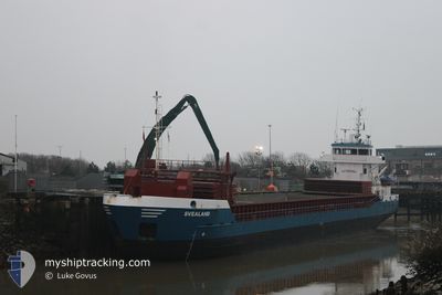
SVEALAND
General Cargo
Current Trip
| Time Travelled | 1 day |
|---|---|
| Remaining Time | 1 day |
| Distance Travelled | 439.21 nm |
| Remaining Distance | 271.21 nm |
| AVG Speed | 9.2 Knots |
| MAX Speed | 10.2 Knots |
| AVG Wind | 13.9 knots |
| MAX Wind | 24.3 knots |
| MIN Temp | 10°C / 50°F |
| MAX Temp | 15.5°C / 59.9°F |
| Draught | 5.8 m |
| Position Received | 7 h, 11 m ago |
Current Position
| Longitude | 19.17068° |
|---|---|
| Latitude | 58.64250° |
| Status | Under way using engine |
| Speed | 8.3 Knots |
| Course | 28.4° |
| Area | Baltic Sea |
| Station | T-AIS |
| Position Received | 7 h, 11 m ago |
Info
Information
The current position of SVEALAND is in Baltic Sea with coordinates 58.64250° / 19.17068° as reported on 2024-06-09 07:08 by AIS to our vessel tracker app. The vessel's current speed is 8.3 Knots and is heading at the port of HOLMSUND. The estimated time of arrival as calculated by vessel tracking app is 2024-06-10 21:24 LT
The vessel SVEALAND (IMO: 9195743, MMSI: 211815120) is a General Cargo that was built in 2001 ( 23 years old ). It's sailing under the flag of [DE] Germany.
In this page you can find informations about the vessels current position, last detected port calls, and current voyage information. If the vessels is not in coverage by AIS you will find the latest position.
The current position of SVEALAND is detected by our AIS receivers and we are not responsible for the reliability of the data. The last position was recorded while the vessel was in Coverage by the Ais receivers of our vessel tracking app.
The current draught of SVEALAND as reported by AIS is 5.8 meters
Weather
| Temperature | 11.3°C / 52.34°F |
|---|---|
| Wind Speed | 23 knots |
| Direction | 205° SSW |
| Pressure | 997.4 hPa |
| Humidity | 74.8 % |
| Cloud Coverage | 5 % |
Featured Company
Last Port Calls
| Port | Arrival | Departure | Time In Port |
|---|---|---|---|
| 2024-06-06 14:09 | 2024-06-07 14:45 | 1 d | |
| 2024-06-06 03:03 | 2024-06-06 03:06 | 3 m | |
| 2024-06-03 18:12 | 2024-06-05 03:32 | 1 d | |
| 2024-05-30 04:30 | 2024-05-31 23:10 | 1 d | |
| 2024-05-27 05:02 | 2024-05-28 10:07 | 1 d | |
| 2024-05-24 06:10 | 2024-05-25 08:07 | 1 d | |
| 2024-05-19 15:14 | 2024-05-20 22:50 | 1 d | |
| 2024-05-08 03:56 | 2024-05-13 18:58 | 5 d | |
| 2024-05-03 04:02 | 2024-05-07 14:44 | 4 d | |
| 2024-04-29 20:25 | 2024-04-30 16:35 | 20 h |
Last Trips
| Origin | Departure | Destination | Arrival | Distance | |
|---|---|---|---|---|---|
| 2024-06-06 05:06 | 2024-06-06 16:09 | 79.96 nm | |||
| 2024-06-05 05:32 | 2024-06-06 05:03 | 163.68 nm | |||
| 2024-06-01 02:10 | 2024-06-03 20:12 | 573.80 nm | |||
| 2024-05-28 12:07 | 2024-05-30 07:30 | 391.68 nm | |||
| 2024-05-25 10:07 | 2024-05-27 07:02 | 374.25 nm | |||
| 2024-05-20 23:50 | 2024-05-24 08:10 | 648.70 nm | |||
| 2024-05-13 20:58 | 2024-05-19 16:14 | 1219.19 nm | |||
| 2024-05-07 16:44 | 2024-05-08 05:56 | 115.83 nm | |||
| 2024-04-30 18:35 | 2024-05-03 06:02 | 502.06 nm | |||
| 2024-04-26 13:44 | 2024-04-29 22:25 | 145.92 nm |
Events
| Time | Event | Details | Position / Dest | Info |
|---|---|---|---|---|
| 2024-06-09 07:13 | Status Changed | Default Under way using engine |
58.65351 / 19.18274
SEUME
|
Speed: 8.3 kn Course: 28.4° |
| 2024-06-09 07:08 | Status Changed | Under way using engine Default |
58.64250 / 19.17068
SEUME
|
Speed: 8.4 kn Course: 31° |
| 2024-06-09 07:08 | OUT of Coverage |
58.64250 / 19.17068
Baltic Sea
SEUME
|
Speed: 8.3 kn Course: 28.4° |
|
| 2024-06-09 06:33 | Status Changed | Default Under way using engine |
58.57264 / 19.09402
SEUME
|
Speed: 8.1 kn Course: 32.3° |
| 2024-06-09 06:01 | Status Changed | Under way using engine Default |
58.51085 / 19.02172
SEUME
|
Speed: 8.1 kn Course: 31° |
| 2024-06-09 05:57 | Status Changed | Default Under way using engine |
58.50403 / 19.01365
SEUME
|
Speed: 8.1 kn Course: 30° |
| 2024-06-09 05:51 | Status Changed | Under way using engine Default |
58.49185 / 18.99925
SEUME
|
Speed: 7.9 kn Course: 32° |
| 2024-06-09 05:38 | IN Coverage |
58.49312 / 19.00077
Baltic Sea
SEUME
|
Speed: 8.1 kn Course: 35.3° |
|
| 2024-06-08 19:21 | Status Changed | Default Under way using engine |
57.08724 / 17.56529
SEUME
|
Speed: 9.5 kn Course: 20.2° |
| 2024-06-08 19:15 | OUT of Coverage |
57.07243 / 17.55556
Baltic Sea
SEUME
|
Speed: 9.5 kn Course: 20.2° |