
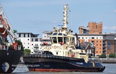
SVITZER ADIRA
Tug
Current Trip
RIVER THAMES
| Time Travelled | 34 mins |
|---|---|
| Remaining Time | --- |
| Distance Travelled | 3.12 nm |
| Remaining Distance | --- |
| AVG Speed | 6.9 Knots |
| MAX Speed | 7.3 Knots |
| AVG Wind | 7.4 knots |
| MAX Wind | 7.6 knots |
| MIN Temp | 8.8°C / 47.84°F |
| MAX Temp | 8.9°C / 48.02°F |
| Draught | 5.4 m |
| Position Received | 1 m ago |
Current Position
| Longitude | 0.38220° |
|---|---|
| Latitude | 51.44708° |
| Status | Under way using engine |
| Speed | 6.6 Knots |
| Course | 92.1° |
| Area | North Sea |
| Station | T-AIS |
| Position Received | 1 m ago |
Info
Information
The current position of SVITZER ADIRA is in North Sea with coordinates 51.44708° / 0.38220° as reported on 2024-06-01 03:08 by AIS to our vessel tracker app. The vessel's current speed is 6.6 Knots
The vessel SVITZER ADIRA (IMO: 9788112, MMSI: 232008120) is a Tug It's sailing under the flag of [GB] United Kingdom.
In this page you can find informations about the vessels current position, last detected port calls, and current voyage information. If the vessels is not in coverage by AIS you will find the latest position.
The current position of SVITZER ADIRA is detected by our AIS receivers and we are not responsible for the reliability of the data. The last position was recorded while the vessel was in Coverage by the Ais receivers of our vessel tracking app.
The current draught of SVITZER ADIRA as reported by AIS is 5.4 meters
Weather
| Temperature | 8.9°C / 48.02°F |
|---|---|
| Wind Speed | 10 knots |
| Direction | 342° NNW |
| Pressure | 1022.1 hPa |
| Humidity | 92.6 % |
| Cloud Coverage | 90 % |
Featured Company
Last Port Calls
| Port | Arrival | Departure | Time In Port |
|---|---|---|---|
| 2024-06-01 02:01 | 2024-06-01 02:35 | 33 m | |
| 2024-05-31 18:28 | 2024-05-31 19:25 | 56 m | |
| 2024-05-31 18:13 | 2024-05-31 18:18 | 5 m | |
| 2024-05-31 17:37 | 2024-05-31 17:48 | 11 m | |
| 2024-05-30 16:47 | 2024-05-31 16:20 | 23 h | |
| 2024-05-30 15:21 | 2024-05-30 15:46 | 25 m | |
| 2024-05-29 18:05 | 2024-05-30 14:25 | 20 h | |
| 2024-05-29 16:51 | 2024-05-29 17:13 | 22 m | |
| 2024-05-29 15:30 | 2024-05-29 16:35 | 1 h | |
| 2024-05-29 12:10 | 2024-05-29 13:53 | 1 h |
Most Visited Ports (Last year)
| Port | Arrivals | |
|---|---|---|
| 404 | ||
| 279 | ||
| 237 | ||
| 125 | ||
| 66 | ||
| 49 |
Last Trips
| Origin | Departure | Destination | Arrival | Distance | |
|---|---|---|---|---|---|
| 2024-05-31 20:25 | 2024-06-01 03:01 | 10.50 nm | |||
| 2024-05-31 19:18 | 2024-05-31 19:28 | 0.29 nm | |||
| 2024-05-31 18:48 | 2024-05-31 19:13 | 1.87 nm | |||
| 2024-05-31 17:20 | 2024-05-31 18:37 | 7.40 nm | |||
| 2024-05-30 16:46 | 2024-05-30 17:47 | 5.88 nm | |||
| 2024-05-30 15:25 | 2024-05-30 16:21 | 5.54 nm | |||
| 2024-05-29 18:13 | 2024-05-29 19:05 | 6.01 nm | |||
| 2024-05-29 17:35 | 2024-05-29 17:51 | 1.72 nm | |||
| 2024-05-29 14:53 | 2024-05-29 16:30 | 9.03 nm | |||
| 2024-05-29 13:06 | 2024-05-29 13:10 | 0.29 nm |
Events
| Time | Event | Details | Position / Dest | Info |
|---|---|---|---|---|
| 2024-06-01 02:46 | Status Changed | Under way using engine Moored |
51.45827 / .32593
RIVER THAMES
|
Speed: 7.2 kn Course: 155.3° |
| 2024-06-01 02:35 | START Moving | 0.28 nm, East of SOUTH STIFFORD |
51.46994 / .30858
RIVER THAMES
|
Speed: 3.2 kn Course: 89° |
| 2024-06-01 02:35 | PORT DEPARTURE |
|
51.47000 / .30781
RIVER THAMES
|
Speed: 2.3 kn Course: 102° |
| 2024-06-01 02:01 | PORT ARRIVAL |
|
51.47117 / .30640
[GB] SOUTH STIFFORD
|
Speed: 0.4 kn Course: 39° |
| 2024-06-01 02:00 | STOP Moving | 0.2 nm, East of SOUTH STIFFORD |
51.47116 / .30642
RIVER THAMES
|
Speed: 0.3 kn Course: 46° |
| 2024-06-01 01:51 | START Moving | 0.39 nm, South of SOUTH STIFFORD |
51.46429 / .30045
RIVER THAMES
|
Speed: 4.1 kn Course: 21° |
| 2024-05-31 21:06 | Status Changed | Moored Under way using engine |
51.46223 / .29948
RIVER THAMES
|
Speed: 0.3 kn Course: 20° |
| 2024-05-31 21:01 | STOP Moving | 0.49 nm, South of SOUTH STIFFORD |
51.46258 / .29940
RIVER THAMES
|
Speed: 0.3 kn Course: 39° |
| 2024-05-31 19:25 | PORT DEPARTURE |
|
51.49921 / .48221
RIVER THAMES
|
Speed: 6.5 kn Course: 241° |
| 2024-05-31 19:21 | START Moving |
51.50181 / .49251
[GB] THAMES
|
Speed: 5.5 kn Course: 248.4° |