
SWANSEA
Cargo
Current Trip
| Trip Time | 6 days |
|---|---|
| Trip Distance | 435.17 nm |
| AVG Speed | 4.9 Knots |
| MAX Speed | 4.9 Knots |
| Draught | 13.6 m |
| AVG Wind | 10.5 knots |
| MAX Wind | 17.4 knots |
| MIN Temp | 24.7°C / 76.46°F |
| MAX Temp | 30.1°C / 86.18°F |
| Position Received | 26 d ago |
Current Position
| Longitude | 17.48899° |
|---|---|
| Latitude | -33.37626° |
| Status | Under way using engine |
| Speed | 11.2 Knots |
| Course | 336.4° |
| Area | South Atlantic Ocean |
| Station | T-AIS |
| Position Received | 26 d ago |
Info
Information
The current position of SWANSEA is in South Atlantic Ocean with coordinates -33.37626° / 17.48899° as reported on 2024-05-09 17:45 by AIS to our vessel tracker app. The vessel's current speed is 11.2 Knots and is currently inside the port of KPEME.
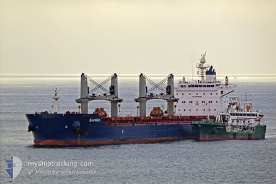
The vessel SWANSEA (IMO: 9735115, MMSI: 538006084) is a Cargo It's sailing under the flag of [MH] Marshall Is.
In this page you can find informations about the vessels current position, last detected port calls, and current voyage information. If the vessels is not in coverage by AIS you will find the latest position.
The current position of SWANSEA is detected by our AIS receivers and we are not responsible for the reliability of the data. The last position was recorded while the vessel was in Coverage by the Ais receivers of our vessel tracking app.
The current draught of SWANSEA as reported by AIS is 13.6 meters
Weather
| Temperature | 29.6°C / 85.28°F |
|---|---|
| Wind Speed | 14 knots |
| Direction | 190° S |
| Pressure | 1011.4 hPa |
| Humidity | 70.2 % |
| Cloud Coverage | 100 % |
Featured Company
Last Trips
Events
| Time | Event | Details | Position / Dest | Info |
|---|---|---|---|---|
| 2024-06-04 08:40 | STOP Moving |
6.19853 / 1.51773
[TG] KPEME
|
Speed: 0.3 kn Course: 194° |
|
| 2024-06-04 08:39 | PORT ARRIVAL |
|
6.19853 / 1.51773
[TG] KPEME
|
Speed: 0.6 kn Course: 213° |
| 2024-06-04 07:52 | START Moving | 1 nm, South of KPEME |
6.18399 / 1.52131
GHTKD
|
Speed: 3.7 kn Course: 85° |
| 2024-06-02 19:26 | STOP Moving | 1.18 nm, South East of KPEME |
6.18472 / 1.52910
GHTKD
|
Speed: 0.3 kn Course: 89° |
| 2024-06-02 19:02 | START Moving | 1.31 nm, South East of KPEME |
6.18174 / 1.52878
GHTKD
|
Speed: 3.6 kn Course: 57° |
| 2024-06-02 18:35 | STOP Moving | 1.4 nm, South of KPEME |
6.17806 / 1.52489
GHTKD
|
Speed: 0.2 kn Course: 97° |
| 2024-05-28 23:06 | PORT DEPARTURE |
|
5.62953 / .02498
GHTKD
|
Speed: 4.3 kn Course: 78° |
| 2024-05-28 23:02 | START Moving |
5.62853 / .01928
[GH] TEMA
|
Speed: 4.3 kn Course: 78° |