
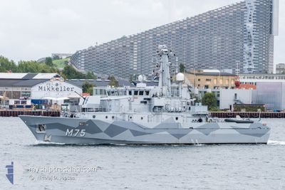
SWEDISH WARSHIP M75
Military ops
Current Trip
Unknown
| Time Travelled | 23 days |
|---|---|
| Remaining Time | --- |
| Distance Travelled | 1033.43 nm |
| Remaining Distance | --- |
| AVG Speed | 7.5 Knoten |
| MAX Speed | 13.5 Knoten |
| AVG Wind | 10.5 knots |
| MAX Wind | 21.8 knots |
| MIN Temp | 6.1°C / 42.98°F |
| MAX Temp | 17.6°C / 63.68°F |
| Tiefgang | 0 m |
| Position erhalten | 1 m alt |
Current Position
| Länge | 9.86544° |
|---|---|
| Breite | 55.17956° |
| Zustand | Under way using engine |
| Geschwindigkeit | 11.6 Knoten |
| Kurs | 324.2° |
| Gebiet | Kattegat |
| Station | T-AIS |
| Position erhalten | 1 m alt |
Info
Information
Die aktuelle Position von SWEDISH WARSHIP M75 befindet sich in Kattegat mit den Koordinaten 55.17956° / 9.86544°, wie von AIS am 2024-07-03 20:31 an unsere Schiffsverfolgungs-App. Die aktuelle Geschwindigkeit des Schiffes betragt 11.6 Knoten
Das Schiff SWEDISH WARSHIP M75 (MMSI: 266279000) ist Military ops Es segelt unter der Flagge [SE] Sweden.
Auf dieser Seite finden Sie Informationen zur aktuellen Position des Schiffes, zu den zuletzt erkannten Hafenanlaufen und zu aktuellen Reiseinformationen. Wenn die Schiffe nicht von AIS abgedeckt werden, finden Sie die neueste Position.
Die aktuelle Position von SWEDISH WARSHIP M75 wird von unseren AIS-Empfangern erkannt und wir sind nicht fur die Zuverlassigkeit der Daten verantwortlich. Die letzte Position wurde von den Ais-Empfangern unserer Schiffsverfolgungs-App aufgezeichnet, wahrend sich das Schiff in Deckung befand.
Weather
| Temperature | 13°C / 55.4°F |
|---|---|
| Wind Speed | 13 knots |
| Direction | 282° WNW |
| Pressure | 1003.6 hPa |
| Humidity | 87.5 % |
| Cloud Coverage | 100 % |
Featured Company
Most Visited Ports (Last year)
| Port | Arrivals | |
|---|---|---|
| 1 |
Last Trips
| Origin | Departure | Destination | Arrival | Distance |
|---|
Events
| Zeit | Ereignis | Details | Position / Ziel | Information |
|---|---|---|---|---|
| 2024-07-03 17:58 | Ändere Seegebiet | Danish part of the Kattegat Danish part of the Baltic Sea |
54.80879 / 10.24314
Kattegat
|
Geschwindigkeit: 9.9 kn Kurs: 329.2° |
| 2024-07-03 16:44 | Ändere Seegebiet | Danish part of the Baltic Sea German part of the Baltic Sea |
54.62198 / 10.37348
Baltic Sea
|
Geschwindigkeit: 6.4 kn Kurs: 339.9° |
| 2024-07-03 14:58 | START Bewegung | 2.17 nm, East of OLPENITZ |
54.66869 / 10.09576
|
Geschwindigkeit: 5.1 kn Kurs: 109° |
| 2024-07-03 11:46 | STOP Bewegung | 2.06 nm, East of OLPENITZ |
54.66942 / 10.09217
|
Geschwindigkeit: 0.1 kn Kurs: 511° |
| 2024-07-03 03:48 | START Bewegung | 6.07 nm, East of OLPENITZ |
54.69525 / 10.19838
|
Geschwindigkeit: 4.6 kn Kurs: 270° |
| 2024-07-03 03:36 | STOP Bewegung | 6.18 nm, East of OLPENITZ |
54.69541 / 10.20167
|
Geschwindigkeit: 0.3 kn Kurs: 511° |
| 2024-07-03 01:49 | Ändere Seegebiet | German part of the Baltic Sea German part of the Kattegat |
54.78493 / 10.01131
Baltic Sea
|
Geschwindigkeit: 5.8 kn Kurs: 131.4° |
| 2024-07-03 01:10 | Ändere Seegebiet | German part of the Kattegat Danish part of the Kattegat |
54.82502 / 9.92791
Kattegat
|
Geschwindigkeit: 5.7 kn Kurs: 129.6° |
| 2024-07-03 00:37 | Ändere Seegebiet | Danish part of the Kattegat German part of the Kattegat |
54.83268 / 9.84615
Kattegat
|
Geschwindigkeit: 5.5 kn Kurs: 78.9° |
| 2024-07-03 00:10 | Ändere Seegebiet | German part of the Kattegat Danish part of the Kattegat |
54.82437 / 9.77258
Kattegat
|
Geschwindigkeit: 6 kn Kurs: 79.8° |