
SYNERGY ANTWERP
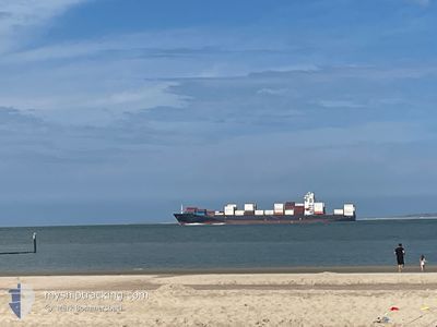
Container Ship
Current Trip
| Time Travelled | 1 day |
|---|---|
| Remaining Time | 5 days |
| Distance Travelled | 528.71 nm |
| Remaining Distance | 2643.28 nm |
| AVG Speed | 15.1 Knots |
| MAX Speed | 19.3 Knots |
| AVG Wind | 20.3 knots |
| MAX Wind | 28 knots |
| MIN Temp | 12.4°C / 54.32°F |
| MAX Temp | 16.4°C / 61.52°F |
| Draught | 10.6 m |
| Position Received | 13 h, 13 m ago |
Current Position
| Longitude | -9.96031° |
|---|---|
| Latitude | 51.26640° |
| Status | Under way using engine |
| Speed | 16.5 Knots |
| Course | 259.2° |
| Area | Celtic Sea |
| Station | T-AIS |
| Position Received | 13 h, 13 m ago |
Info
Information
The current position of SYNERGY ANTWERP is in Celtic Sea with coordinates 51.26640° / -9.96031° as reported on 2024-06-28 08:59 by AIS to our vessel tracker app. The vessel's current speed is 16.5 Knots and is heading at the port of MONTREAL. The estimated time of arrival as calculated by vessel tracking app is 2024-07-04 21:35 LT
The vessel SYNERGY ANTWERP (IMO: 9443580, MMSI: 538008756) is a Container Ship that was built in 2008 ( 16 years old ). It's sailing under the flag of [MH] Marshall Is.
In this page you can find informations about the vessels current position, last detected port calls, and current voyage information. If the vessels is not in coverage by AIS you will find the latest position.
The current position of SYNERGY ANTWERP is detected by our AIS receivers and we are not responsible for the reliability of the data. The last position was recorded while the vessel was in Coverage by the Ais receivers of our vessel tracking app.
The current draught of SYNERGY ANTWERP as reported by AIS is 10.6 meters
Weather
| Temperature | 14.6°C / 58.28°F |
|---|---|
| Wind Speed | 10 knots |
| Direction | 314° NW |
| Pressure | 1011.1 hPa |
| Humidity | 97.6 % |
| Cloud Coverage | 100 % |
Featured Company
Last Port Calls
| Port | Arrival | Departure | Time In Port |
|---|---|---|---|
| 2024-06-26 14:43 | 2024-06-27 14:23 | 23 h | |
| 2024-06-23 10:33 | 2024-06-24 12:31 | 1 d | |
| 2024-06-20 17:22 | 2024-06-21 20:18 | 1 d | |
| 2024-06-17 01:53 | 2024-06-18 04:20 | 1 d | |
| 2024-06-07 17:18 | 2024-06-08 05:23 | 12 h | |
| 2024-05-28 03:07 | 2024-05-29 01:32 | 22 h | |
| 2024-05-23 00:18 | 2024-05-23 11:18 | 11 h | |
| 2024-05-06 09:40 | 2024-05-09 21:19 | 3 d | |
| 2024-04-23 10:45 | 2024-04-24 12:10 | 1 d | |
| 2024-04-09 09:37 | 2024-04-09 23:53 | 14 h |
Last Trips
| Origin | Departure | Destination | Arrival | Distance | |
|---|---|---|---|---|---|
| 2024-06-24 14:31 | 2024-06-26 15:43 | 539.06 nm | |||
| 2024-06-21 22:18 | 2024-06-23 12:33 | 485.51 nm | |||
| 2024-06-18 06:20 | 2024-06-20 19:22 | 343.50 nm | |||
| 2024-06-08 07:23 | 2024-06-17 03:53 | 1030.36 nm | |||
| 2024-05-29 01:32 | 2024-06-07 19:18 | 2215.08 nm | |||
| 2024-05-23 11:18 | 2024-05-28 03:07 | 1246.88 nm | |||
| 2024-05-09 23:19 | 2024-05-23 00:18 | 3537.45 nm | |||
| 2024-04-24 20:10 | 2024-05-06 11:40 | 4903.73 nm | |||
| 2024-04-10 07:53 | 2024-04-23 18:45 | 1519.16 nm | |||
| 2024-04-05 10:00 | 2024-04-09 17:37 | 1201.41 nm |
Events
| Time | Event | Details | Position / Dest | Info |
|---|---|---|---|---|
| 2024-06-28 09:16 | Status Changed | Default Under way using engine |
51.23837 / -10.08329
CAMTR
|
Speed: 16.5 kn Course: 259.2° |
| 2024-06-28 08:59 | OUT of Coverage |
51.26640 / -9.96031
Celtic Sea
CAMTR
|
Speed: 16.5 kn Course: 259.2° |
|
| 2024-06-28 06:19 | Status Changed | Under way using engine Moored |
51.46405 / -8.75306
CAMTR
|
Speed: 18.1 kn Course: 254° |
| 2024-06-28 06:18 | Status Changed | Moored Under way using engine |
51.46461 / -8.74997
CAMTR
|
Speed: 18 kn Course: 254.1° |
| 2024-06-28 00:19 | Change Sea Area | Irish part of the Celtic Sea Irish part of the Irish Sea and St. George's Channel |
52.13115 / -6.19177
Celtic Sea
CAMTR
|
Speed: 15.7 kn Course: 222.4° |
| 2024-06-27 23:00 | Status Changed | Under way using engine Default |
52.42146 / -5.89581
CAMTR
|
Speed: 16.1 kn Course: 210° |
| 2024-06-27 22:28 | Status Changed | Default Under way using engine |
52.54644 / -5.77561
CAMTR
|
Speed: 16.5 kn Course: 210° |
| 2024-06-27 22:20 | Status Changed | Under way using engine Default |
52.57562 / -5.74772
CAMTR
|
Speed: 16.5 kn Course: 211° |
| 2024-06-27 22:16 | IN Coverage |
52.57404 / -5.74922
Irish Sea and St. George's Channel
CAMTR
|
Speed: 16.5 kn Course: 210° |
|
| 2024-06-27 21:18 | OUT of Coverage |
52.82686 / -5.50448
Irish Sea and St. George's Channel
CAMTR
|
Speed: 17.6 kn Course: 212.1° |