
SZCZECIN
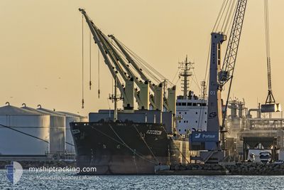
Bulk Carrier
Current Trip
| Time Travelled | --- |
|---|---|
| Remaining Time | --- |
| Distance Travelled | --- |
| Remaining Distance | --- |
| AVG Speed | --- |
| MAX Speed | --- |
| AVG Wind | --- |
| MAX Wind | --- |
| MIN Temp | --- |
| MAX Temp | --- |
| Draught | 10.5 m |
| Position Received | 2 h, 48 m ago |
Current Position
| Longitude | 4.96122° |
|---|---|
| Latitude | 37.29760° |
| Status | Under way using engine |
| Speed | 11.4 Knots |
| Course | 264.9° |
| Area | Mediterranean Sea - Western Basin |
| Station | T-AIS |
| Position Received | 2 h, 48 m ago |
Info
Information
The current position of SZCZECIN is in Mediterranean Sea - Western Basin with coordinates 37.29760° / 4.96122° as reported on 2024-06-27 02:35 by AIS to our vessel tracker app. The vessel's current speed is 11.4 Knots and is heading at the port of HOUSTON. The estimated time of arrival as calculated by vessel tracking app is 2024-07-16 12:00 LT
The vessel SZCZECIN (IMO: 9594224, MMSI: 311055400) is a Bulk Carrier that was built in 2012 ( 12 years old ). It's sailing under the flag of [BS] Bahamas.
In this page you can find informations about the vessels current position, last detected port calls, and current voyage information. If the vessels is not in coverage by AIS you will find the latest position.
The current position of SZCZECIN is detected by our AIS receivers and we are not responsible for the reliability of the data. The last position was recorded while the vessel was in Coverage by the Ais receivers of our vessel tracking app.
The current draught of SZCZECIN as reported by AIS is 10.5 meters
Weather
| Temperature | 23.6°C / 74.48°F |
|---|---|
| Wind Speed | 14 knots |
| Direction | 89° E |
| Pressure | 1006.9 hPa |
| Humidity | 82.9 % |
| Cloud Coverage | 12 % |
Featured Company
Last Port Calls
| Port | Arrival | Departure | Time In Port |
|---|---|---|---|
| 2024-06-20 12:54 | |||
| 2024-06-19 08:31 | |||
| 2024-06-18 03:29 | |||
| 2024-06-17 13:05 | |||
| 2024-06-11 10:04 | |||
| 2024-06-10 16:03 | |||
| 2024-05-25 12:49 | 2024-06-03 10:20 | 8 d | |
| 2024-04-06 23:30 | 2024-04-09 05:02 | 2 d |
Most Visited Ports (Last year)
| Port | Arrivals | |
|---|---|---|
| 7 | ||
| 3 | ||
| 2 | ||
| 2 | ||
| 1 | ||
| 1 |
Last Trips
| Origin | Departure | Destination | Arrival | Distance | |
|---|---|---|---|---|---|
| 2024-06-03 11:20 | 2024-06-10 19:03 | 1942.00 nm | |||
| 2024-04-09 02:02 | 2024-05-25 13:49 | 6220.26 nm |
Events
| Time | Event | Details | Position / Dest | Info |
|---|---|---|---|---|
| 2024-06-27 02:42 | Status Changed | Default Under way using engine |
37.29497 / 4.93374
US HOU
|
Speed: 11.4 kn Course: 264.9° |
| 2024-06-27 02:35 | Status Changed | Under way using engine Default |
37.29760 / 4.96122
US HOU
|
Speed: 11.5 kn Course: 264° |
| 2024-06-27 02:35 | OUT of Coverage |
37.29760 / 4.96122
Mediterranean Sea - Western Basin
US HOU
|
Speed: 11.4 kn Course: 264.9° |
|
| 2024-06-27 02:10 | Status Changed | Default Under way using engine |
37.30681 / 5.06177
US HOU
|
Speed: 11.4 kn Course: 263.2° |
| 2024-06-27 02:03 | Status Changed | Under way using engine Default |
37.30906 / 5.08832
US HOU
|
Speed: 11.5 kn Course: 265° |
| 2024-06-27 01:37 | Status Changed | Default Under way using engine |
37.31610 / 5.19381
US HOU
|
Speed: 11.6 kn Course: 266° |
| 2024-06-27 00:47 | Status Changed | Under way using engine Default |
37.33297 / 5.39417
US HOU
|
Speed: 11.5 kn Course: 260° |
| 2024-06-27 00:47 | IN Coverage |
37.33279 / 5.39285
Mediterranean Sea - Western Basin
US HOU
|
Speed: 11.5 kn Course: 260.3° |
|
| 2024-06-26 23:38 | Status Changed | Default Under way using engine |
37.36467 / 5.66544
US HOU
|
Speed: 11.2 kn Course: 264.2° |
| 2024-06-26 23:33 | OUT of Coverage |
37.36638 / 5.68354
Mediterranean Sea - Western Basin
US HOU
|
Speed: 11.2 kn Course: 264.2° |