
T PRIME
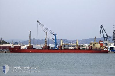
Bulk Carrier
Current Trip
BE ANR
| Time Travelled | 3 days |
|---|---|
| Remaining Time | --- |
| Distance Travelled | 870.05 nm |
| Remaining Distance | --- |
| AVG Speed | 10.9 Knots |
| MAX Speed | 13 Knots |
| AVG Wind | 7.3 knots |
| MAX Wind | 20 knots |
| MIN Temp | 18.8°C / 65.84°F |
| MAX Temp | 25.5°C / 77.9°F |
| Draught | 8.6 m |
| Position Received | 22 h, 27 m ago |
Current Position
| Longitude | 10.71471° |
|---|---|
| Latitude | 37.55940° |
| Status | Under way using engine |
| Speed | 10.4 Knots |
| Course | 285.6° |
| Area | Mediterranean Sea - Western Basin |
| Station | T-AIS |
| Position Received | 22 h, 27 m ago |
Info
Information
The current position of T PRIME is in Mediterranean Sea - Western Basin with coordinates 37.55940° / 10.71471° as reported on 2024-05-22 20:19 by AIS to our vessel tracker app. The vessel's current speed is 10.4 Knots
The vessel T PRIME (IMO: 9611503, MMSI: 538007082) is a Bulk Carrier that was built in 2011 ( 13 years old ). It's sailing under the flag of [MH] Marshall Is.
In this page you can find informations about the vessels current position, last detected port calls, and current voyage information. If the vessels is not in coverage by AIS you will find the latest position.
The current position of T PRIME is detected by our AIS receivers and we are not responsible for the reliability of the data. The last position was recorded while the vessel was in Coverage by the Ais receivers of our vessel tracking app.
The current draught of T PRIME as reported by AIS is 8.6 meters
Weather
| Temperature | 20.3°C / 68.54°F |
|---|---|
| Wind Speed | 14 knots |
| Direction | 62° ENE |
| Pressure | 1015.8 hPa |
| Humidity | 78.5 % |
| Cloud Coverage | 86 % |
Featured Company
Last Port Calls
| Port | Arrival | Departure | Time In Port |
|---|---|---|---|
| 2024-05-20 10:55 | |||
| 2024-03-16 22:13 | 2024-03-25 19:45 | 8 d | |
| 2024-03-11 15:06 | 2024-03-15 03:04 | 3 d | |
| 2024-03-08 05:48 |
Most Visited Ports (Last year)
| Port | Arrivals | |
|---|---|---|
| 2 | ||
| 2 | ||
| 1 | ||
| 1 | ||
| 1 | ||
| 1 |
Last Trips
| Origin | Departure | Destination | Arrival | Distance | |
|---|---|---|---|---|---|
| 2024-03-15 07:04 | 2024-03-17 01:13 | 478.88 nm | |||
| 2024-03-08 11:18 | 2024-03-11 19:06 | 984.53 nm |
Events
| Time | Event | Details | Position / Dest | Info |
|---|---|---|---|---|
| 2024-05-22 20:29 | Status Changed | Default Under way using engine |
37.56667 / 10.67833
BE ANR
|
Speed: 10.4 kn Course: 285.6° |
| 2024-05-22 20:19 | OUT of Coverage |
37.55940 / 10.71471
Mediterranean Sea - Western Basin
BE ANR
|
Speed: 10.4 kn Course: 285.6° |
|
| 2024-05-22 20:09 | Status Changed | Under way using engine Default |
37.55078 / 10.75227
BE ANR
|
Speed: 10.5 kn Course: 278° |
| 2024-05-22 19:26 | Status Changed | Default Under way using engine |
37.52500 / 10.90833
BE ANR
|
Speed: 10.8 kn Course: 283° |
| 2024-05-22 19:18 | Status Changed | Under way using engine Default |
37.52150 / 10.93756
BE ANR
|
Speed: 11 kn Course: 283° |
| 2024-05-22 18:52 | Status Changed | Default Under way using engine |
37.50294 / 11.03482
BE ANR
|
Speed: 10.9 kn Course: 285.1° |
| 2024-05-22 18:42 | Status Changed | Under way using engine Default |
37.49560 / 11.06858
BE ANR
|
Speed: 11 kn Course: 288° |
| 2024-05-22 18:29 | IN Coverage |
37.49560 / 11.06858
Mediterranean Sea - Western Basin
BE ANR
|
Speed: 10.9 kn Course: 286.2° |
|
| 2024-05-22 16:59 | Status Changed | Default Under way using engine |
37.35829 / 11.43374
BE ANR
|
Speed: 11.1 kn Course: 289.1° |
| 2024-05-22 16:57 | OUT of Coverage |
37.35675 / 11.43930
Mediterranean Sea - Western Basin
BE ANR
|
Speed: 11.1 kn Course: 289.1° |