
TABEA
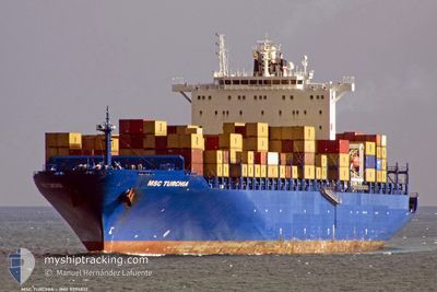
Container Ship
Current Trip
| Time Travelled | 4 days |
|---|---|
| Remaining Time | 3 days |
| Distance Travelled | 1725.31 nm |
| Remaining Distance | 1246.91 nm |
| AVG Speed | 16.4 Knots |
| MAX Speed | 18.7 Knots |
| AVG Wind | 10.4 knots |
| MAX Wind | 27.9 knots |
| MIN Temp | 24.5°C / 76.1°F |
| MAX Temp | 30.7°C / 87.26°F |
| Draught | 11.9 m |
| Position Received | 20 h, 15 m ago |
Current Position
| Longitude | 103.31781° |
|---|---|
| Latitude | 1.31482° |
| Status | Under way using engine |
| Speed | 16.5 Knots |
| Course | 302.5° |
| Area | Malacca Strait |
| Station | T-AIS |
| Position Received | 20 h, 15 m ago |
Info
Information
The current position of TABEA is in Malacca Strait with coordinates 1.31482° / 103.31781° as reported on 2024-06-03 12:49 by AIS to our vessel tracker app. The vessel's current speed is 16.5 Knots and is heading at the port of COLOMBO. The estimated time of arrival as calculated by vessel tracking app is 2024-06-07 11:13 LT
The vessel TABEA (IMO: 9294812, MMSI: 255805778) is a Container Ship that was built in 2006 ( 18 years old ). It's sailing under the flag of [PT] Portugal.
In this page you can find informations about the vessels current position, last detected port calls, and current voyage information. If the vessels is not in coverage by AIS you will find the latest position.
The current position of TABEA is detected by our AIS receivers and we are not responsible for the reliability of the data. The last position was recorded while the vessel was in Coverage by the Ais receivers of our vessel tracking app.
The current draught of TABEA as reported by AIS is 11.9 meters
Weather
| Temperature | 29.5°C / 85.1°F |
|---|---|
| Wind Speed | 5 knots |
| Direction | 4° N |
| Pressure | 1008.3 hPa |
| Humidity | 75.3 % |
| Cloud Coverage | 64 % |
Featured Company
Last Port Calls
| Port | Arrival | Departure | Time In Port |
|---|---|---|---|
| 2024-05-30 04:00 | 2024-05-30 19:41 | 15 h | |
| 2024-05-27 11:33 | 2024-05-28 07:17 | 19 h | |
| 2024-05-22 11:08 | 2024-05-24 02:20 | 1 d | |
| 2024-05-14 17:52 | 2024-05-16 05:24 | 1 d | |
| 2024-05-10 13:42 | 2024-05-11 12:50 | 23 h | |
| 2024-05-06 07:20 | 2024-05-09 02:28 | 2 d | |
| 2024-05-02 04:56 | 2024-05-02 20:56 | 15 h | |
| 2024-05-01 04:02 | 2024-05-01 16:01 | 11 h | |
| 2024-04-17 13:40 | |||
| 2024-04-09 13:33 | 2024-04-10 13:06 | 23 h |
Most Visited Ports (Last year)
| Port | Arrivals | |
|---|---|---|
| 8 | ||
| 6 | ||
| 5 | ||
| 5 | ||
| 3 | ||
| 3 |
Last Trips
| Origin | Departure | Destination | Arrival | Distance | |
|---|---|---|---|---|---|
| 2024-05-28 15:17 | 2024-05-30 12:00 | 784.55 nm | |||
| 2024-05-24 10:20 | 2024-05-27 19:33 | 508.63 nm | |||
| 2024-05-16 13:24 | 2024-05-22 19:08 | 2709.87 nm | |||
| 2024-05-11 18:20 | 2024-05-15 01:52 | 1401.84 nm | |||
| 2024-05-09 07:58 | 2024-05-10 19:12 | 333.89 nm | |||
| 2024-05-03 04:56 | 2024-05-06 12:50 | 1409.26 nm | |||
| 2024-05-02 00:01 | 2024-05-02 12:56 | 192.22 nm | |||
| 2024-04-10 18:36 | 2024-04-17 21:40 | 2314.26 nm | |||
| 2024-04-06 19:55 | 2024-04-09 19:03 | 1013.16 nm | |||
| 2024-04-03 22:52 | 2024-04-06 07:20 | 548.70 nm |
Events
| Time | Event | Details | Position / Dest | Info |
|---|---|---|---|---|
| 2024-06-03 12:51 | Status Changed | Default Under way using engine |
1.32099 / 103.30821
LKCMB
|
Speed: 16.5 kn Course: 302.5° |
| 2024-06-03 12:49 | OUT of Coverage |
1.31482 / 103.31781
Malacca Strait
LKCMB
|
Speed: 16.5 kn Course: 302.5° |
|
| 2024-06-03 12:47 | Status Changed | Under way using engine Default |
1.31182 / 103.32242
LKCMB
|
Speed: 16.5 kn Course: 295° |
| 2024-06-03 12:43 | Status Changed | Default Under way using engine |
1.30112 / 103.33955
LKCMB
|
Speed: 16.4 kn Course: 301.4° |
| 2024-06-03 12:37 | Status Changed | Under way using engine Default |
1.28760 / 103.36531
LKCMB
|
Speed: 16.4 kn Course: 303° |
| 2024-06-03 12:27 | Status Changed | Default Under way using engine |
1.26362 / 103.40351
LKCMB
|
Speed: 16.7 kn Course: 301.5° |
| 2024-06-03 12:14 | Change Sea Area | Malaysian part of the Malacca Strait Malaysian part of the Singapore Strait |
1.23489 / 103.45254
Malacca Strait
LKCMB
|
Speed: 16.6 kn Course: 289.3° |
| 2024-06-03 12:14 | Status Changed | Under way using engine Default |
1.23489 / 103.45254
LKCMB
|
Speed: 16.7 kn Course: 286° |
| 2024-06-03 12:11 | Status Changed | Default Under way using engine |
1.22995 / 103.46704
LKCMB
|
Speed: 16.7 kn Course: 283.4° |
| 2024-06-03 11:41 | Change Sea Area | Malaysian part of the Singapore Strait Indonesian part of the Singapore Strait |
1.20747 / 103.59797
Singapore Strait
LKCMB
|
Speed: 13.3 kn Course: 285.2° |