
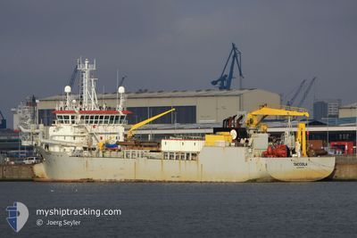
TACCOLA
Trailing Suction Hopper Dredger
Current Trip
CANAL DE MITRE
| Time Travelled | 8 days |
|---|---|
| Remaining Time | --- |
| Distance Travelled | 606.61 nm |
| Remaining Distance | --- |
| AVG Speed | 8.1 Knots |
| MAX Speed | 13 Knots |
| AVG Wind | 6.9 knots |
| MAX Wind | 19.9 knots |
| MIN Temp | 6.7°C / 44.06°F |
| MAX Temp | 24.3°C / 75.74°F |
| Draught | 4 m |
| Position Received | 4 h, 11 m ago |
Current Position
| Longitude | -59.23743° |
|---|---|
| Latitude | -33.90408° |
| Status | Restricted manoeuverability |
| Speed | 7.1 Knots |
| Course | 161.3° |
| Area | Rio de La Plata |
| Station | T-AIS |
| Position Received | 4 h, 11 m ago |
Info
Information
The current position of TACCOLA is in Rio de La Plata with coordinates -33.90408° / -59.23743° as reported on 2024-06-20 13:50 by AIS to our vessel tracker app. The vessel's current speed is 7.1 Knots
The vessel TACCOLA (IMO: 9280213, MMSI: 253454000) is a Trailing Suction Hopper Dredger that was built in 2003 ( 21 years old ). It's sailing under the flag of [LU] Luxembourg.
In this page you can find informations about the vessels current position, last detected port calls, and current voyage information. If the vessels is not in coverage by AIS you will find the latest position.
The current position of TACCOLA is detected by our AIS receivers and we are not responsible for the reliability of the data. The last position was recorded while the vessel was in Coverage by the Ais receivers of our vessel tracking app.
The current draught of TACCOLA as reported by AIS is 4 meters
Weather
| Temperature | 17.9°C / 64.22°F |
|---|---|
| Wind Speed | 10 knots |
| Direction | 77° ENE |
| Pressure | 1016.6 hPa |
| Humidity | 37.7 % |
| Cloud Coverage | --- |
Featured Company
Last Port Calls
| Port | Arrival | Departure | Time In Port |
|---|---|---|---|
| 2024-06-10 10:07 | 2024-06-12 00:39 | 1 d | |
| 2024-05-18 11:05 | 2024-05-21 15:20 | 3 d | |
| 2024-05-15 17:36 | 2024-05-18 05:05 | 2 d | |
| 2024-04-30 18:30 | 2024-04-30 18:56 | 26 m | |
| 2024-04-22 16:05 | 2024-04-28 22:32 | 6 d | |
| 2024-04-09 10:10 | 2024-04-12 21:09 | 3 d |
Most Visited Ports (Last year)
| Port | Arrivals | |
|---|---|---|
| 94 | ||
| 56 | ||
| 14 | ||
| 2 | ||
| 2 | ||
| 2 |
Last Trips
| Origin | Departure | Destination | Arrival | Distance | |
|---|---|---|---|---|---|
| 2024-05-21 12:20 | 2024-06-10 07:07 | 1685.56 nm | |||
| 2024-05-18 02:05 | 2024-05-18 08:05 | 56.76 nm | |||
| 2024-04-30 15:56 | 2024-05-15 14:36 | 892.50 nm | |||
| 2024-04-28 19:32 | 2024-04-30 15:30 | 100.32 nm | |||
| 2024-04-12 18:09 | 2024-04-22 13:05 | 250.40 nm | |||
| 2024-03-19 19:38 | 2024-04-09 07:10 | 1168.19 nm |
Events
| Time | Event | Details | Position / Dest | Info |
|---|---|---|---|---|
| 2024-06-20 17:22 | START Moving | 9.35 nm, North West of TERMINAL LAS PALMAS |
-33.89700 / -59.24025
CANAL DE MITRE
|
Speed: 10.6 kn Course: 330° |
| 2024-06-20 17:10 | STOP Moving | 8.66 nm, North West of TERMINAL LAS PALMAS |
-33.90807 / -59.23468
CANAL DE MITRE
|
Speed: Course: 331° |
| 2024-06-20 14:26 | START Moving | 9.34 nm, North West of TERMINAL LAS PALMAS |
-33.89710 / -59.24002
CANAL DE MITRE
|
Speed: 10.6 kn Course: 323° |
| 2024-06-20 14:10 | STOP Moving | 8.69 nm, North West of TERMINAL LAS PALMAS |
-33.90752 / -59.23485
CANAL DE MITRE
|
Speed: 0.1 kn Course: 354° |
| 2024-06-20 13:50 | Status Changed | Default Restricted manoeuverability |
-33.90500 / -59.23701
CANAL DE MITRE
|
Speed: 7.1 kn Course: 161.3° |
| 2024-06-20 13:50 | OUT of Coverage |
-33.90408 / -59.23743
Rio de La Plata
|
Speed: 7.1 kn Course: 161.3° |
|
| 2024-06-20 13:40 | START Moving | 10.4 nm, North West of TERMINAL LAS PALMAS |
-33.88703 / -59.25892
CANAL DE MITRE
|
Speed: 10.3 kn Course: 143.5° |
| 2024-06-20 12:05 | Status Changed | Restricted manoeuverability Default |
-33.88158 / -59.26292
CANAL DE MITRE
|
Speed: 1.3 kn Course: 140° |
| 2024-06-20 11:58 | STOP Moving | 10.91 nm, North West of TERMINAL LAS PALMAS |
-33.87947 / -59.26388
CANAL DE MITRE
|
Speed: 0.3 kn Course: 160° |
| 2024-06-20 11:34 | Status Changed | Default Restricted manoeuverability |
-33.88312 / -59.26248
CANAL DE MITRE
|
Speed: 11.3 kn Course: 287.8° |