
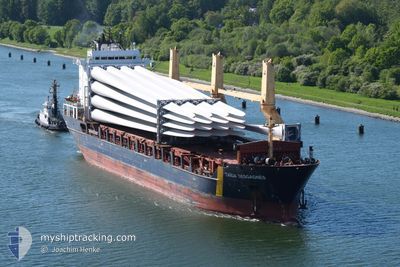
TAIGA DESGAGNES
General Cargo
Current Trip
| Time Travelled | 4 days |
|---|---|
| Remaining Time | 13 h, 32 mins |
| Distance Travelled | 1506.10 nm |
| Remaining Distance | 225.23 nm |
| AVG Speed | 14.1 Knots |
| MAX Speed | 17 Knots |
| AVG Wind | 10.8 knots |
| MAX Wind | 20 knots |
| MIN Temp | 1.8°C / 35.24°F |
| MAX Temp | 17.7°C / 63.86°F |
| Draught | 6 m |
| Position Received | 6 h, 29 m ago |
Current Position
| Longitude | -3.96204° |
|---|---|
| Latitude | 58.71298° |
| Status | Under way using engine |
| Speed | 14.7 Knots |
| Course | 265.5° |
| Area | North Atlantic Ocean |
| Station | T-AIS |
| Position Received | 6 h, 29 m ago |
Info
Information
The current position of TAIGA DESGAGNES is in North Atlantic Ocean with coordinates 58.71298° / -3.96204° as reported on 2024-05-25 00:46 by AIS to our vessel tracker app. The vessel's current speed is 14.7 Knots and is heading at the port of BELFAST. The estimated time of arrival as calculated by vessel tracking app is 2024-05-25 20:48 LT
The vessel TAIGA DESGAGNES (IMO: 9303302, MMSI: 314450000) is a General Cargo that was built in 2007 ( 17 years old ). It's sailing under the flag of [BB] Barbados.
In this page you can find informations about the vessels current position, last detected port calls, and current voyage information. If the vessels is not in coverage by AIS you will find the latest position.
The current position of TAIGA DESGAGNES is detected by our AIS receivers and we are not responsible for the reliability of the data. The last position was recorded while the vessel was in Coverage by the Ais receivers of our vessel tracking app.
The current draught of TAIGA DESGAGNES as reported by AIS is 6 meters
Weather
| Temperature | 11.7°C / 53.06°F |
|---|---|
| Wind Speed | 3 knots |
| Direction | 148° SSE |
| Pressure | 1016.7 hPa |
| Humidity | 87.3 % |
| Cloud Coverage | 30 % |
Featured Company
Last Port Calls
| Port | Arrival | Departure | Time In Port |
|---|---|---|---|
| 2024-05-20 06:52 | 2024-05-20 23:16 | 16 h | |
| 2024-05-17 07:19 | 2024-05-19 11:41 | 2 d | |
| 2024-05-15 10:50 | 2024-05-16 13:11 | 1 d | |
| 2024-05-14 16:08 | 2024-05-15 00:20 | 8 h | |
| 2024-05-12 15:51 | 2024-05-12 15:55 | 4 m | |
| 2024-04-26 22:00 | 2024-05-01 05:40 | 4 d | |
| 2024-04-20 03:55 | 2024-04-24 08:27 | 4 d | |
| 2024-03-28 19:05 | 2024-03-28 20:24 | 1 h | |
| 2024-03-25 22:14 | 2024-03-26 01:43 | 3 h | |
| 2024-03-20 19:25 | 2024-03-24 21:53 | 4 d |
Most Visited Ports (Last year)
| Port | Arrivals | |
|---|---|---|
| 4 | ||
| 3 | ||
| 2 | ||
| 2 | ||
| 1 | ||
| 1 |
Last Trips
| Origin | Departure | Destination | Arrival | Distance | |
|---|---|---|---|---|---|
| 2024-05-19 14:41 | 2024-05-20 09:52 | 169.26 nm | |||
| 2024-05-16 15:11 | 2024-05-17 10:19 | 223.75 nm | |||
| 2024-05-15 03:20 | 2024-05-15 12:50 | 137.95 nm | |||
| 2024-05-12 17:55 | 2024-05-14 19:08 | 676.11 nm | |||
| 2024-05-01 08:40 | 2024-05-12 17:51 | 3402.48 nm | |||
| 2024-04-24 11:27 | 2024-04-27 01:00 | 619.61 nm | |||
| 2024-03-28 15:24 | 2024-04-20 06:55 | 6093.48 nm | |||
| 2024-03-25 20:43 | 2024-03-28 14:05 | 75.96 nm | |||
| 2024-03-24 16:53 | 2024-03-25 17:14 | 324.91 nm | |||
| 2024-03-08 03:45 | 2024-03-20 14:25 | 3476.48 nm |
Events
| Time | Event | Details | Position / Dest | Info |
|---|---|---|---|---|
| 2024-05-25 01:06 | Status Changed | Default Under way using engine |
58.70667 / -4.11500
FI RAA>GB BEL
|
Speed: 14.7 kn Course: 265.5° |
| 2024-05-25 00:46 | OUT of Coverage |
58.71298 / -3.96204
North Atlantic Ocean
FI RAA>GB BEL
|
Speed: 14.7 kn Course: 265.5° |
|
| 2024-05-24 23:55 | Change Sea Area | United Kingdom part of the North Atlantic Ocean United Kingdom part of the North Sea |
58.72809 / -3.57328
North Atlantic Ocean
FI RAA>GB BEL
|
Speed: 13.7 kn Course: 266.1° |
| 2024-05-24 23:54 | Status Changed | Under way using engine Default |
58.72833 / -3.56609
FI RAA>GB BEL
|
Speed: 12.9 kn Course: 266° |
| 2024-05-24 23:02 | Status Changed | Default Under way using engine |
58.73148 / -3.21532
FI RAA>GB BEL
|
Speed: 11.8 kn Course: 287.3° |
| 2024-05-24 21:34 | Change Sea Area | United Kingdom part of the North Sea Norwegian part of the North Sea |
58.70673 / -2.68215
North Sea
FI RAA>GB BEL
|
Speed: 14.2 kn Course: 268.9° |
| 2024-05-24 21:33 | Status Changed | Under way using engine Default |
58.70681 / -2.67167
FI RAA>GB BEL
|
Speed: 14.1 kn Course: 269° |
| 2024-05-24 21:31 | IN Coverage |
58.70673 / -2.68215
North Sea
FI RAA>GB BEL
|
Speed: 14.2 kn Course: 268.9° |
|
| 2024-05-24 05:41 | Status Changed | Default Under way using engine |
58.18333 / 4.48167
FI RAA>GB BEL
|
Speed: 14.5 kn Course: 287.4° |
| 2024-05-24 05:34 | OUT of Coverage |
58.17428 / 4.53591
North Sea
FI RAA>GB BEL
|
Speed: 14.5 kn Course: 287.4° |