
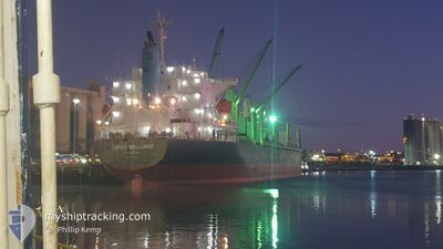
TAIKOO BRILLIANCE
Cargo
Current Trip
| Trip Time | 21 h, 36 mins |
|---|---|
| Trip Distance | 171.57 nm |
| AVG Speed | 12 Knots |
| MAX Speed | 14.2 Knots |
| Draught | 7.2 m |
| AVG Wind | 5.5 knots |
| MAX Wind | 9.8 knots |
| MIN Temp | 11.4°C / 52.52°F |
| MAX Temp | 13.7°C / 56.66°F |
| Position Received | 2 d ago |
Current Position
| Longitude | 135.91730° |
|---|---|
| Latitude | -34.66416° |
| Status | Under way using engine |
| Speed | 9.6 Knots |
| Course | 242.7° |
| Area | Great Australian Bight |
| Station | T-AIS |
| Position Received | 2 d ago |
Info
Information
The current position of TAIKOO BRILLIANCE is in Great Australian Bight with coordinates -34.66416° / 135.91730° as reported on 2024-05-22 21:46 by AIS to our vessel tracker app. The vessel's current speed is 9.6 Knots and is currently inside the port of PORT LINCOLN.
The vessel TAIKOO BRILLIANCE (IMO: 9738727, MMSI: 357772000) is a Cargo It's sailing under the flag of [PA] Panama.
In this page you can find informations about the vessels current position, last detected port calls, and current voyage information. If the vessels is not in coverage by AIS you will find the latest position.
The current position of TAIKOO BRILLIANCE is detected by our AIS receivers and we are not responsible for the reliability of the data. The last position was recorded while the vessel was in Coverage by the Ais receivers of our vessel tracking app.
The current draught of TAIKOO BRILLIANCE as reported by AIS is 7.2 meters
Weather
| Temperature | 19°C / 66.2°F |
|---|---|
| Wind Speed | 4 knots |
| Direction | 96° E |
| Pressure | 1021.9 hPa |
| Humidity | 39.8 % |
| Cloud Coverage | --- |
Featured Company
Last Port Calls
| Port | Arrival | Departure | Time In Port |
|---|---|---|---|
| 2024-05-22 22:19 | |||
| 2024-05-18 15:22 | 2024-05-22 00:43 | 3 d | |
| 2024-05-14 07:10 | 2024-05-16 16:19 | 2 d | |
| 2024-04-01 06:12 | 2024-04-06 18:45 | 5 d | |
| 2024-03-28 17:55 | 2024-03-30 09:55 | 1 d | |
| 2024-03-24 16:28 | |||
| 2024-03-19 08:45 |
Most Visited Ports (Last year)
| Port | Arrivals | |
|---|---|---|
| 2 | ||
| 2 | ||
| 2 | ||
| 2 | ||
| 1 | ||
| 1 |
Last Trips
| Origin | Departure | Destination | Arrival | Distance | |
|---|---|---|---|---|---|
| 2024-05-22 10:13 | 2024-05-23 07:49 | 171.57 nm | |||
| 2024-05-17 02:19 | 2024-05-19 00:52 | 535.78 nm | |||
| 2024-04-06 21:45 | 2024-05-14 17:10 | 7185.52 nm | |||
| 2024-03-30 13:55 | 2024-04-01 09:12 | 315.82 nm | |||
| 2024-03-24 21:58 | 2024-03-28 21:55 | 907.78 nm |
Events
| Time | Event | Details | Position / Dest | Info |
|---|---|---|---|---|
| 2024-05-22 22:32 | STOP Moving |
-34.71764 / 135.86998
[AU] PORT LINCOLN
|
Speed: 0.2 kn Course: 6° |
|
| 2024-05-22 22:19 | PORT ARRIVAL |
|
-34.71806 / 135.87561
[AU] PORT LINCOLN
|
Speed: 3.9 kn Course: 254° |
| 2024-05-22 21:52 | Status Changed | Default Under way using engine |
-34.67321 / 135.90356
PORT LINCOLN
|
Speed: 9.6 kn Course: 242.7° |
| 2024-05-22 21:46 | OUT of Coverage |
-34.66416 / 135.91730
Great Australian Bight
[AU] PORT LINCOLN
|
Speed: 9.6 kn Course: 242.7° |
|
| 2024-05-22 21:46 | Status Changed | Under way using engine Default |
-34.66376 / 135.91827
PORT LINCOLN
|
Speed: 10.2 kn Course: 260° |
| 2024-05-22 21:32 | IN Coverage |
-34.66416 / 135.91730
Great Australian Bight
|
Speed: 9.6 kn Course: 242.7° |
|
| 2024-05-22 21:19 | START Moving | 7.07 nm, North East of PORT LINCOLN |
-34.65667 / 136.00252
PORT LINCOLN
|
Speed: 5.2 kn Course: 268° |
| 2024-05-22 13:56 | STOP Moving | 7.14 nm, North East of PORT LINCOLN |
-34.65905 / 136.00600
PORT LINCOLN
|
Speed: 0.1 kn Course: 229° |
| 2024-05-22 10:15 | Status Changed | Default Under way using engine |
-35.06498 / 136.54587
PORT LINCOLN
|
Speed: 13.2 kn Course: 339.4° |
| 2024-05-22 10:07 | OUT of Coverage |
-35.09346 / 136.55991
Great Australian Bight
PORT LINCOLN
|
Speed: 13.2 kn Course: 339.4° |