
TAMESIS
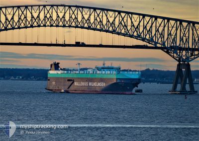
Vehicles Carrier
Current Trip
| Time Travelled | 1 day |
|---|---|
| Remaining Time | --- |
| Distance Travelled | 265.16 nm |
| Remaining Distance | --- |
| AVG Speed | 12.7 Knots |
| MAX Speed | 13.6 Knots |
| AVG Wind | 4.3 knots |
| MAX Wind | 8.9 knots |
| MIN Temp | 26.9°C / 80.42°F |
| MAX Temp | 28.7°C / 83.66°F |
| Draught | 7.7 m |
| Position Received | 1 d ago |
Current Position
| Longitude | -80.67981° |
|---|---|
| Latitude | 30.80156° |
| Status | Under way using engine |
| Speed | 13.5 Knots |
| Course | 126.7° |
| Area | North Atlantic Ocean |
| Station | T-AIS |
| Position Received | 1 d ago |
Info
Information
The current position of TAMESIS is in North Atlantic Ocean with coordinates 30.80156° / -80.67981° as reported on 2024-06-29 08:30 by AIS to our vessel tracker app. The vessel's current speed is 13.5 Knots and is heading at the port of CRISTOBAL. The estimated time of arrival as calculated by vessel tracking app is 2024-07-04 07:00 LT
The vessel TAMESIS (IMO: 9191307, MMSI: 257565000) is a Vehicles Carrier that was built in 2000 ( 24 years old ). It's sailing under the flag of [NO] Norway.
In this page you can find informations about the vessels current position, last detected port calls, and current voyage information. If the vessels is not in coverage by AIS you will find the latest position.
The current position of TAMESIS is detected by our AIS receivers and we are not responsible for the reliability of the data. The last position was recorded while the vessel was in Coverage by the Ais receivers of our vessel tracking app.
The current draught of TAMESIS as reported by AIS is 7.7 meters
Weather
| Temperature | 28.1°C / 82.58°F |
|---|---|
| Wind Speed | 7 knots |
| Direction | 122° ESE |
| Pressure | 1019 hPa |
| Humidity | 76.1 % |
| Cloud Coverage | 100 % |
Featured Company
Last Port Calls
| Port | Arrival | Departure | Time In Port |
|---|---|---|---|
| 2024-06-28 06:10 | 2024-06-29 04:42 | 22 h | |
| 2024-06-25 05:36 | 2024-06-26 05:32 | 23 h | |
| 2024-06-23 09:28 | 2024-06-24 20:10 | 1 d | |
| 2024-06-17 20:38 | 2024-06-18 16:31 | 19 h | |
| 2024-05-27 22:57 | 2024-05-28 20:32 | 21 h | |
| 2024-05-24 00:20 | 2024-05-24 23:47 | 23 h | |
| 2024-05-22 22:32 | 2024-05-23 09:41 | 11 h | |
| 2024-05-20 21:40 | 2024-05-21 09:26 | 11 h | |
| 2024-05-18 21:08 | 2024-05-19 10:42 | 13 h | |
| 2024-04-03 04:40 | 2024-04-03 17:40 | 13 h |
Most Visited Ports (Last year)
| Port | Arrivals | |
|---|---|---|
| 5 | ||
| 5 | ||
| 4 | ||
| 3 | ||
| 3 | ||
| 3 |
Last Trips
| Origin | Departure | Destination | Arrival | Distance | |
|---|---|---|---|---|---|
| 2024-06-26 01:32 | 2024-06-28 02:10 | 554.36 nm | |||
| 2024-06-24 16:10 | 2024-06-25 01:36 | 163.66 nm | |||
| 2024-06-18 11:31 | 2024-06-23 05:28 | 1907.30 nm | |||
| 2024-05-29 05:32 | 2024-06-17 15:38 | 7808.62 nm | |||
| 2024-05-25 08:47 | 2024-05-28 07:57 | 368.34 nm | |||
| 2024-05-23 18:41 | 2024-05-24 09:20 | 205.77 nm | |||
| 2024-05-21 18:26 | 2024-05-23 07:32 | 367.06 nm | |||
| 2024-05-19 19:42 | 2024-05-21 06:40 | 492.46 nm | |||
| 2024-04-03 13:40 | 2024-05-19 06:08 | 15865.89 nm | |||
| 2024-03-31 13:02 | 2024-04-03 00:40 | 507.99 nm |
Events
| Time | Event | Details | Position / Dest | Info |
|---|---|---|---|---|
| 2024-06-29 08:39 | Status Changed | Default Under way using engine |
30.78225 / -80.65011
PACTB
|
Speed: 13.5 kn Course: 126.7° |
| 2024-06-29 08:30 | OUT of Coverage |
30.80156 / -80.67981
North Atlantic Ocean
PACTB
|
Speed: 13.5 kn Course: 126.7° |
|
| 2024-06-29 08:24 | Status Changed | Under way using engine Default |
30.81594 / -80.70197
PACTB
|
Speed: 13.5 kn Course: 127° |
| 2024-06-29 08:18 | Status Changed | Default Under way using engine |
30.82910 / -80.72235
PACTB
|
Speed: 13.5 kn Course: 126.5° |
| 2024-06-29 08:06 | Draught Changed | 7.7 8.8 |
30.85539 / -80.76307
PACTB
|
Speed: 13.5 kn Course: 127° |
| 2024-06-29 08:06 | Destination Changed | PACTB US SSI |
30.85539 / -80.76307
PACTB
|
Speed: 13.5 kn Course: 127° |
| 2024-06-29 08:06 | ETA Changed | 2024/07/04 07:00 2024/06/28 05:00 |
30.85539 / -80.76307
PACTB
|
Speed: 13.5 kn Course: 127° |
| 2024-06-29 07:18 | Status Changed | Under way using engine Default |
30.92994 / -80.94873
US SSI
|
Speed: 13.1 kn Course: 108° |
| 2024-06-29 07:18 | IN Coverage |
30.92994 / -80.94873
North Atlantic Ocean
|
Speed: 13.3 kn Course: 103.8° |
|
| 2024-06-29 05:31 | OUT of Coverage |
31.10035 / -81.33392
North Atlantic Ocean
|
Speed: 13.1 kn Course: 122.2° |