
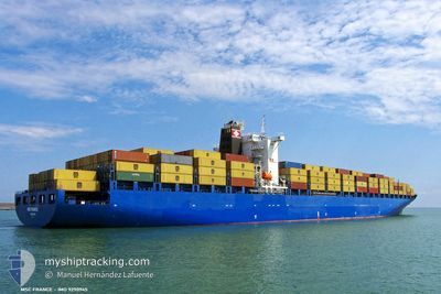
TAMINA
Container Ship
Current Trip
| Time Travelled | 5 days |
|---|---|
| Remaining Time | --- |
| Distance Travelled | 618.89 nm |
| Remaining Distance | 102.51 nm |
| AVG Speed | 15.3 Knots |
| MAX Speed | 20.2 Knots |
| AVG Wind | 7.9 knots |
| MAX Wind | 14.5 knots |
| MIN Temp | 17.6°C / 63.68°F |
| MAX Temp | 21.7°C / 71.06°F |
| Draught | 12.6 m |
| Position Received | 4 d ago |
Current Position
| Longitude | 122.86515° |
|---|---|
| Latitude | 33.25227° |
| Status | Under way using engine |
| Speed | 17.4 Knots |
| Course | 178.1° |
| Area | Eastern China Sea |
| Station | T-AIS |
| Position Received | 4 d ago |
Info
Information
The current position of TAMINA is in Eastern China Sea with coordinates 33.25227° / 122.86515° as reported on 2024-06-02 02:55 by AIS to our vessel tracker app. The vessel's current speed is 17.4 Knots and is heading at the port of NINGBO. The estimated time of arrival as calculated by vessel tracking app is 2024-06-02 18:00 LT
The vessel TAMINA (IMO: 9290945, MMSI: 255915647) is a Container Ship that was built in 2004 ( 20 years old ). It's sailing under the flag of [PT] Portugal.
In this page you can find informations about the vessels current position, last detected port calls, and current voyage information. If the vessels is not in coverage by AIS you will find the latest position.
The current position of TAMINA is detected by our AIS receivers and we are not responsible for the reliability of the data. The last position was recorded while the vessel was in Coverage by the Ais receivers of our vessel tracking app.
The current draught of TAMINA as reported by AIS is 12.6 meters
Weather
| Temperature | 19.3°C / 66.74°F |
|---|---|
| Wind Speed | 9 knots |
| Direction | 80° E |
| Pressure | 1014 hPa |
| Humidity | 83.6 % |
| Cloud Coverage | 98 % |
Featured Company
Last Port Calls
| Port | Arrival | Departure | Time In Port |
|---|---|---|---|
| 2024-05-31 16:58 | 2024-06-01 15:14 | 22 h | |
| 2024-05-15 09:43 | 2024-05-17 00:36 | 1 d | |
| 2024-05-10 14:23 | 2024-05-12 21:45 | 2 d | |
| 2024-05-07 11:44 | 2024-05-09 06:47 | 1 d | |
| 2024-04-24 03:32 | 2024-04-24 17:12 | 13 h | |
| 2024-04-23 01:51 | 2024-04-23 20:39 | 18 h | |
| 2024-04-12 07:22 | 2024-04-13 20:54 | 1 d |
Last Trips
| Origin | Departure | Destination | Arrival | Distance | |
|---|---|---|---|---|---|
| 2024-05-17 10:36 | 2024-06-01 00:58 | 4394.92 nm | |||
| 2024-05-13 07:45 | 2024-05-15 19:43 | 1111.66 nm | |||
| 2024-05-09 16:47 | 2024-05-11 00:23 | 580.17 nm | |||
| 2024-04-25 01:12 | 2024-05-07 21:44 | 4567.10 nm | |||
| 2024-04-24 04:39 | 2024-04-24 11:32 | 59.27 nm | |||
| 2024-04-14 04:54 | 2024-04-23 09:51 | 1388.66 nm | |||
| 2024-03-29 09:15 | 2024-04-12 15:22 | 4396.47 nm |
Events
| Time | Event | Details | Position / Dest | Info |
|---|---|---|---|---|
| 2024-06-06 07:54 | START Moving |
30.27556 / 123.15346
CNQDG>CNNGB
|
Speed: 8.5 kn Course: 280° |
|
| 2024-06-06 07:09 | STOP Moving |
30.27213 / 123.16920
CNQDG>CNNGB
|
Speed: Course: 300° |
|
| 2024-06-04 23:15 | STOP Moving |
30.27668 / 123.16554
CNQDG>CNNGB
|
Speed: 0.1 kn Course: 150° |
|
| 2024-06-04 14:40 | START Moving | 9.36 nm, South West of ZHOUSHAN |
29.89577 / 122.04009
CNQDG>CNNGB
|
Speed: 5.8 kn Course: 83° |
| 2024-06-02 20:18 | STOP Moving | 9.75 nm, South West of ZHOUSHAN |
29.89406 / 122.03277
CNQDG>CNNGB
|
Speed: 0.2 kn Course: 110° |
| 2024-06-02 03:02 | Status Changed | Default Under way using engine |
33.21959 / 122.86792
CNQDG>CNNGB
|
Speed: 17.4 kn Course: 178.1° |
| 2024-06-02 02:55 | Change Sea Area | Chinese part of the Eastern China Sea Chinese part of the Yellow Sea |
33.25227 / 122.86515
Eastern China Sea
CNQDG>CNNGB
|
Speed: 17.4 kn Course: 178.1° |
| 2024-06-02 02:55 | Status Changed | Under way using engine Default |
33.25227 / 122.86515
CNQDG>CNNGB
|
Speed: 17.4 kn Course: 178° |
| 2024-06-02 02:55 | OUT of Coverage |
33.25227 / 122.86515
Eastern China Sea
CNQDG>CNNGB
|
Speed: 17.4 kn Course: 178.1° |
|
| 2024-06-02 02:38 | IN Coverage |
33.25227 / 122.86515
Eastern China Sea
CNQDG>CNNGB
|
Speed: 17.4 kn Course: 178.1° |