
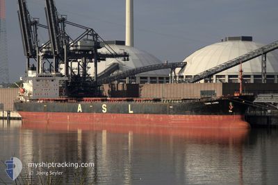
TANG LAND
Bulk Carrier
Current Trip
STPTB RU
| Time Travelled | 27 days |
|---|---|
| Remaining Time | --- |
| Distance Travelled | 6128.17 nm |
| Remaining Distance | --- |
| AVG Speed | 12.7 Knots |
| MAX Speed | 12.7 Knots |
| AVG Wind | 13.6 knots |
| MAX Wind | 30.6 knots |
| MIN Temp | 5°C / 41°F |
| MAX Temp | 29°C / 84.2°F |
| Draught | 7.9 m |
| Position Received | 2 m ago |
Current Position
| Longitude | 14.26877° |
|---|---|
| Latitude | 36.70536° |
| Status | Under way using engine |
| Speed | 13 Knots |
| Course | 281.4° |
| Area | Mediterranean Sea - Eastern Basin |
| Station | T-AIS |
| Position Received | 2 m ago |
Info
Information
The current position of TANG LAND is in Mediterranean Sea - Eastern Basin with coordinates 36.70536° / 14.26877° as reported on 2024-06-27 03:39 by AIS to our vessel tracker app. The vessel's current speed is 13 Knots
The vessel TANG LAND (IMO: 9233595, MMSI: 352001788) is a Bulk Carrier that was built in 2001 ( 23 years old ). It's sailing under the flag of [PA] Panama.
In this page you can find informations about the vessels current position, last detected port calls, and current voyage information. If the vessels is not in coverage by AIS you will find the latest position.
The current position of TANG LAND is detected by our AIS receivers and we are not responsible for the reliability of the data. The last position was recorded while the vessel was in Coverage by the Ais receivers of our vessel tracking app.
The current draught of TANG LAND as reported by AIS is 7.9 meters
Weather
| Temperature | 23.4°C / 74.12°F |
|---|---|
| Wind Speed | 5 knots |
| Direction | 81° E |
| Pressure | 1011.5 hPa |
| Humidity | 75.2 % |
| Cloud Coverage | --- |
Featured Company
Last Port Calls
| Port | Arrival | Departure | Time In Port |
|---|---|---|---|
| 2024-05-27 19:59 | 2024-05-30 22:17 | 3 d | |
| 2024-05-09 02:56 | 2024-05-09 12:21 | 9 h | |
| 2024-04-14 02:22 | 2024-04-16 07:59 | 2 d |
Events
| Time | Event | Details | Position / Dest | Info |
|---|---|---|---|---|
| 2024-06-27 02:58 | Status Changed | Under way using engine Default |
36.67005 / 14.44314
STPTB RU
|
Speed: 12.6 kn Course: 280° |
| 2024-06-27 02:45 | IN Coverage |
36.67046 / 14.44019
Mediterranean Sea - Eastern Basin
STPTB RU
|
Speed: 12.7 kn Course: 280° |
|
| 2024-06-27 00:46 | Status Changed | Default Under way using engine |
36.58503 / 15.01891
STPTB RU
|
Speed: 12.9 kn Course: 279.8° |
| 2024-06-27 00:42 | OUT of Coverage |
36.58248 / 15.03632
Mediterranean Sea - Eastern Basin
STPTB RU
|
Speed: 12.9 kn Course: 279.8° |
|
| 2024-06-26 23:40 | Status Changed | Under way using engine Default |
36.55489 / 15.30722
STPTB RU
|
Speed: 12.6 kn Course: 278° |
| 2024-06-26 23:37 | Status Changed | Default Under way using engine |
36.55345 / 15.32091
STPTB RU
|
Speed: 12.7 kn Course: 276.7° |
| 2024-06-26 23:34 | Status Changed | Under way using engine Default |
36.55188 / 15.33532
STPTB RU
|
Speed: 12.7 kn Course: 275° |
| 2024-06-26 23:26 | IN Coverage |
36.55196 / 15.33460
Mediterranean Sea - Eastern Basin
STPTB RU
|
Speed: 12.7 kn Course: 276.7° |
|
| 2024-06-26 19:06 | Status Changed | Default Under way using engine |
36.47005 / 16.47832
STPTB RU
|
Speed: 12 kn Course: 275.1° |
| 2024-06-26 18:59 | OUT of Coverage |
36.46794 / 16.50707
Mediterranean Sea - Eastern Basin
STPTB RU
|
Speed: 12 kn Course: 275.1° |