
TARIFA
Vehicles Carrier
Current Trip
| Trip Time | 2 days |
|---|---|
| Trip Distance | 760.16 nm |
| AVG Speed | 13.9 Knots |
| MAX Speed | 17.1 Knots |
| Draught | 8.3 m |
| AVG Wind | 9.9 knots |
| MAX Wind | 17 knots |
| MIN Temp | 18.9°C / 66.02°F |
| MAX Temp | 37°C / 98.6°F |
| Position Received | 30 m ago |
Current Position
| Longitude | -81.53846° |
|---|---|
| Latitude | 31.13425° |
| Status | Moored |
| Speed | |
| Course | 133° |
| Area | North Atlantic Ocean |
| Station | T-AIS |
| Position Received | 30 m ago |
Info
Information
The current position of TARIFA is in North Atlantic Ocean with coordinates 31.13425° / -81.53846° as reported on 2024-06-07 06:39 by AIS to our vessel tracker app. The vessel's current speed is 0 Knots and is currently inside the port of BRUNSWICK.
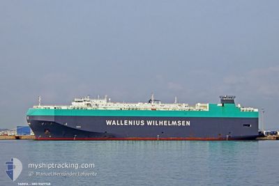
The vessel TARIFA (IMO: 9327748, MMSI: 309847000) is a Vehicles Carrier that was built in 2007 ( 17 years old ). It's sailing under the flag of [BS] Bahamas.
In this page you can find informations about the vessels current position, last detected port calls, and current voyage information. If the vessels is not in coverage by AIS you will find the latest position.
The current position of TARIFA is detected by our AIS receivers and we are not responsible for the reliability of the data. The last position was recorded while the vessel was in Coverage by the Ais receivers of our vessel tracking app.
The current draught of TARIFA as reported by AIS is 8.3 meters
Weather
| Temperature | 23.2°C / 73.76°F |
|---|---|
| Wind Speed | 4 knots |
| Direction | 220° SW |
| Pressure | 1009.8 hPa |
| Humidity | 84.2 % |
| Cloud Coverage | 83 % |
Featured Company
Last Port Calls
| Port | Arrival | Departure | Time In Port |
|---|---|---|---|
| 2024-06-06 20:29 | |||
| 2024-06-03 14:11 | 2024-06-04 18:12 | 1 d | |
| 2024-06-01 09:01 | 2024-06-01 16:58 | 7 h | |
| 2024-05-23 01:59 | 2024-05-24 13:29 | 1 d | |
| 2024-05-20 21:41 | 2024-05-21 21:29 | 23 h | |
| 2024-05-17 02:23 | 2024-05-17 21:28 | 19 h | |
| 2024-05-04 04:31 | 2024-05-04 21:24 | 16 h | |
| 2024-05-03 04:05 | 2024-05-03 10:49 | 6 h | |
| 2024-04-28 23:15 | 2024-04-30 05:38 | 1 d | |
| 2024-04-24 04:44 | 2024-04-24 20:12 | 15 h |
Most Visited Ports (Last year)
| Port | Arrivals | |
|---|---|---|
| 4 | ||
| 4 | ||
| 3 | ||
| 3 | ||
| 3 | ||
| 3 |
Last Trips
| Origin | Departure | Destination | Arrival | Distance | |
|---|---|---|---|---|---|
| 2024-06-04 14:12 | 2024-06-06 16:29 | 760.16 nm | |||
| 2024-06-01 13:58 | 2024-06-03 10:11 | 606.73 nm | |||
| 2024-05-24 14:29 | 2024-06-01 06:01 | 2680.00 nm | |||
| 2024-05-21 23:29 | 2024-05-23 02:59 | 240.01 nm | |||
| 2024-05-17 23:28 | 2024-05-20 23:41 | 589.32 nm | |||
| 2024-05-05 00:24 | 2024-05-17 04:23 | 3563.85 nm | |||
| 2024-05-03 13:49 | 2024-05-04 07:31 | 223.53 nm | |||
| 2024-04-30 07:38 | 2024-05-03 07:05 | 900.36 nm | |||
| 2024-04-24 22:12 | 2024-04-29 01:15 | 1430.73 nm | |||
| 2024-04-24 06:35 | 2024-04-24 06:44 | 0.65 nm |
Events
| Time | Event | Details | Position / Dest | Info |
|---|---|---|---|---|
| 2024-06-07 06:45 | Status Changed | Default Moored |
31.13426 / -81.53845
[US] BRUNSWICK
|
Speed: Course: 133° |
| 2024-06-07 05:57 | Status Changed | Moored Default |
31.13428 / -81.53849
[US] BRUNSWICK
|
Speed: Course: -1° |
| 2024-06-07 05:43 | IN Coverage |
31.13428 / -81.53849
North Atlantic Ocean
[US] BRUNSWICK
|
Speed: Course: 207.4° |
|
| 2024-06-07 02:36 | Status Changed | Default Moored |
31.13425 / -81.53846
[US] BRUNSWICK
|
Speed: Course: 133° |
| 2024-06-07 02:33 | OUT of Coverage |
31.13424 / -81.53846
North Atlantic Ocean
[US] BRUNSWICK
|
Speed: Course: 207.4° |
|
| 2024-06-06 23:51 | IN Coverage |
31.13425 / -81.53847
North Atlantic Ocean
[US] BRUNSWICK
|
Speed: Course: 207.4° |
|
| 2024-06-06 20:29 | PORT ARRIVAL |
|
31.13425 / -81.53847
[US] BRUNSWICK
|
Speed: 11 kn Course: 255° |
| 2024-06-06 20:00 | OUT of Coverage |
31.10628 / -81.44148
North Atlantic Ocean
USSSI
|
Speed: 11 kn Course: 255° |
|
| 2024-06-06 16:26 | IN Coverage |
31.10082 / -80.77605
North Atlantic Ocean
USSSI
|
Speed: 8.8 kn Course: 241° |
|
| 2024-06-06 14:58 | OUT of Coverage |
31.26466 / -80.44094
North Atlantic Ocean
USSSI
|
Speed: 14.3 kn Course: 240.3° |