
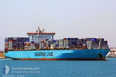
TASMAN
Container Ship
Current Trip
BS FPO
| Time Travelled | 5 days |
|---|---|
| Remaining Time | --- |
| Distance Travelled | 1298.24 nm |
| Remaining Distance | --- |
| AVG Speed | 14.8 Knots |
| MAX Speed | 17.7 Knots |
| AVG Wind | 8.6 knots |
| MAX Wind | 20.6 knots |
| MIN Temp | 25.9°C / 78.62°F |
| MAX Temp | 31.8°C / 89.24°F |
| Draught | 13 m |
| Position Received | 14 h, 22 m ago |
Current Position
| Longitude | -79.45615° |
|---|---|
| Latitude | 8.85571° |
| Status | At anchor |
| Speed | 0.1 Knots |
| Course | 60° |
| Area | North Pacific Ocean |
| Station | T-AIS |
| Position Received | 14 h, 22 m ago |
Info
Information
The current position of TASMAN is in North Pacific Ocean with coordinates 8.85571° / -79.45615° as reported on 2024-06-12 15:52 by AIS to our vessel tracker app. The vessel's current speed is 0.1 Knots
The vessel TASMAN (IMO: 9189342, MMSI: 538006111) is a Container Ship that was built in 2000 ( 24 years old ). It's sailing under the flag of [MH] Marshall Is.
In this page you can find informations about the vessels current position, last detected port calls, and current voyage information. If the vessels is not in coverage by AIS you will find the latest position.
The current position of TASMAN is detected by our AIS receivers and we are not responsible for the reliability of the data. The last position was recorded while the vessel was in Coverage by the Ais receivers of our vessel tracking app.
The current draught of TASMAN as reported by AIS is 13 meters
Weather
| Temperature | 28°C / 82.4°F |
|---|---|
| Wind Speed | 3 knots |
| Direction | 84° E |
| Pressure | 1009.9 hPa |
| Humidity | 79.7 % |
| Cloud Coverage | 97 % |
Featured Company
Last Port Calls
| Port | Arrival | Departure | Time In Port |
|---|---|---|---|
| 2024-06-06 05:35 | 2024-06-07 12:07 | 1 d | |
| 2024-06-03 14:43 | 2024-06-04 04:02 | 13 h | |
| 2024-05-30 18:43 | 2024-05-31 14:35 | 19 h | |
| 2024-05-27 15:13 | 2024-05-29 11:55 | 1 d | |
| 2024-05-21 09:38 | 2024-05-22 04:10 | 18 h | |
| 2024-04-06 06:13 | 2024-04-07 14:01 | 1 d |
Most Visited Ports (Last year)
| Port | Arrivals | |
|---|---|---|
| 4 | ||
| 4 | ||
| 3 | ||
| 2 | ||
| 2 | ||
| 2 |
Last Trips
| Origin | Departure | Destination | Arrival | Distance | |
|---|---|---|---|---|---|
| 2024-06-04 00:02 | 2024-06-06 01:35 | 151.09 nm | |||
| 2024-05-31 09:35 | 2024-06-03 10:43 | 843.80 nm | |||
| 2024-05-29 06:55 | 2024-05-30 13:43 | 440.99 nm | |||
| 2024-05-21 23:10 | 2024-05-27 10:13 | 560.46 nm | |||
| 2024-04-07 23:01 | 2024-05-21 04:38 | 10814.93 nm | |||
| 2024-03-16 08:47 | 2024-04-06 15:13 | 8998.29 nm |
Events
| Time | Event | Details | Position / Dest | Info |
|---|---|---|---|---|
| 2024-06-12 16:01 | Status Changed | Default At anchor |
8.85578 / -79.45624
BS FPO
|
Speed: 0.1 kn Course: 60° |
| 2024-06-12 15:52 | Status Changed | At anchor Default |
8.85571 / -79.45615
BS FPO
|
Speed: Course: 60° |
| 2024-06-12 15:52 | OUT of Coverage |
8.85571 / -79.45615
North Pacific Ocean
|
Speed: 0.1 kn Course: 75.5° |
|
| 2024-06-12 15:37 | Status Changed | Default At anchor |
8.85576 / -79.45617
BS FPO
|
Speed: Course: 59° |
| 2024-06-12 15:16 | Status Changed | At anchor Default |
8.85567 / -79.45620
BS FPO
|
Speed: Course: 59° |
| 2024-06-12 14:47 | Status Changed | Default At anchor |
8.85577 / -79.45623
BS FPO
|
Speed: 0.1 kn Course: 63° |
| 2024-06-12 14:40 | Status Changed | At anchor Default |
8.85576 / -79.45628
BS FPO
|
Speed: Course: 64° |
| 2024-06-12 14:38 | Status Changed | Default At anchor |
8.85581 / -79.45627
BS FPO
|
Speed: Course: 65° |
| 2024-06-12 14:35 | Status Changed | At anchor Default |
8.85583 / -79.45628
BS FPO
|
Speed: Course: 65° |
| 2024-06-12 13:37 | Status Changed | Default At anchor |
8.85619 / -79.45648
BS FPO
|
Speed: 0.1 kn Course: 79° |