
TAYCAN
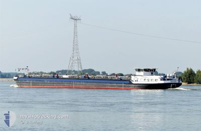
Tanker
Current Trip
| Time Travelled | 2 days |
|---|---|
| Remaining Time | --- |
| Distance Travelled | --- |
| Remaining Distance | --- |
| AVG Speed | --- |
| MAX Speed | --- |
| AVG Wind | --- |
| MAX Wind | --- |
| MIN Temp | --- |
| MAX Temp | --- |
| Draught | 2.6 m |
| Position Received | 3 d ago |
Current Position
| Longitude | 7.39211° |
|---|---|
| Latitude | 50.44518° |
| Status | Under way using engine |
| Speed | 5.2 Knots |
| Course | 124.7° |
| Area | North Sea |
| Station | T-AIS |
| Position Received | 3 d ago |
Info
Information
The current position of TAYCAN is in North Sea with coordinates 50.44518° / 7.39211° as reported on 2024-05-17 02:23 by AIS to our vessel tracker app. The vessel's current speed is 5.2 Knots and is heading at the port of MERTERT. The estimated time of arrival as calculated by vessel tracking app is 2024-05-19 08:59 LT
The vessel TAYCAN (MMSI: 205253790) is a Tanker It's sailing under the flag of [BE] Belgium.
In this page you can find informations about the vessels current position, last detected port calls, and current voyage information. If the vessels is not in coverage by AIS you will find the latest position.
The current position of TAYCAN is detected by our AIS receivers and we are not responsible for the reliability of the data. The last position was recorded while the vessel was in Coverage by the Ais receivers of our vessel tracking app.
The current draught of TAYCAN as reported by AIS is 2.6 meters
Weather
| Temperature | 8.6°C / 47.48°F |
|---|---|
| Wind Speed | 3 knots |
| Direction | 212° SSW |
| Pressure | 1011.5 hPa |
| Humidity | 96.1 % |
| Cloud Coverage | 62 % |
Featured Company
Last Port Calls
| Port | Arrival | Departure | Time In Port |
|---|---|---|---|
| 2024-05-17 15:44 | 2024-05-17 19:26 | 3 h | |
| 2024-05-15 22:03 | 2024-05-15 23:06 | 1 h | |
| 2024-05-14 17:00 | 2024-05-15 11:10 | 18 h | |
| 2024-05-08 06:46 | 2024-05-14 10:31 | 6 d | |
| 2024-05-06 14:56 | 2024-05-07 15:34 | 1 d | |
| 2024-05-05 10:25 | 2024-05-06 10:06 | 23 h | |
| 2024-05-04 09:49 | 2024-05-04 11:00 | 1 h | |
| 2024-05-04 03:55 | 2024-05-04 04:15 | 20 m | |
| 2024-05-03 03:04 | 2024-05-04 00:00 | 20 h | |
| 2024-05-02 21:33 | 2024-05-02 21:55 | 21 m |
Last Trips
| Origin | Departure | Destination | Arrival | Distance | |
|---|---|---|---|---|---|
| 2024-05-16 01:06 | 2024-05-17 17:44 | 180.22 nm | |||
| 2024-05-15 13:10 | 2024-05-16 00:03 | 73.15 nm | |||
| 2024-05-14 12:31 | 2024-05-14 19:00 | 53.91 nm | |||
| 2024-05-07 17:34 | 2024-05-08 08:46 | 137.54 nm | |||
| 2024-05-06 12:06 | 2024-05-06 16:56 | 58.08 nm | |||
| 2024-05-04 13:00 | 2024-05-05 12:25 | 105.13 nm | |||
| 2024-05-04 06:15 | 2024-05-04 11:49 | 31.13 nm | |||
| 2024-05-04 02:00 | 2024-05-04 05:55 | 31.15 nm | |||
| 2024-05-02 23:55 | 2024-05-03 05:04 | 37.63 nm | |||
| 2024-05-02 10:43 | 2024-05-02 23:33 | 136.40 nm |
Events
| Time | Event | Details | Position / Dest | Info |
|---|---|---|---|---|
| 2024-05-17 19:26 | PORT DEPARTURE |
|
49.96667 / 7.13167
MERTERT
|
Speed: Course: -1° |
| 2024-05-17 15:44 | STOP Moving |
50.09167 / 7.13500
[DE] SANKT ALDEGUND
|
Speed: Course: -1° |
|
| 2024-05-17 15:44 | PORT ARRIVAL |
|
50.09167 / 7.13500
[DE] SANKT ALDEGUND
|
Speed: 4 kn Course: -1° |
| 2024-05-17 10:41 | STOP Moving | 1.52 nm, East of TREIS KARDEN |
50.18167 / 7.33167
MERTERT
|
Speed: Course: -1° |
| 2024-05-17 02:47 | Status Changed | Default Under way using engine |
50.43667 / 7.44333
MERTERT
|
Speed: 5.2 kn Course: 124.7° |
| 2024-05-17 02:23 | OUT of Coverage |
50.44518 / 7.39211
North Sea
MERTERT
|
Speed: 5.2 kn Course: 124.7° |
|
| 2024-05-17 02:17 | Status Changed | Under way using engine Default |
50.44972 / 7.38186
MERTERT
|
Speed: 4 kn Course: -1° |
| 2024-05-17 02:12 | Status Changed | Default Under way using engine |
50.45334 / 7.37333
MERTERT
|
Speed: 4.7 kn Course: 130.3° |
| 2024-05-16 15:52 | ETA Changed | 2024/05/19 08:59 2024/05/18 09:26 |
51.06812 / 6.89165
MERTERT
|
Speed: 5.1 kn Course: 117.6° |
| 2024-05-16 05:19 | Status Changed | Under way using engine Default |
51.57014 / 6.63339
MERTERT
|
Speed: 5 kn Course: 67° |