
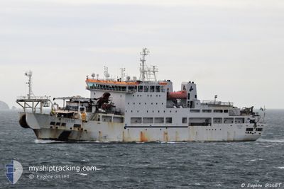
TELIRI
Cable Layer
Current Trip
| Time Travelled | 15 days |
|---|---|
| Remaining Time | --- |
| Distance Travelled | 830.98 nm |
| Remaining Distance | --- |
| AVG Speed | 11.7 Knots |
| MAX Speed | 14 Knots |
| AVG Wind | 8.4 knots |
| MAX Wind | 23.9 knots |
| MIN Temp | 17.3°C / 63.14°F |
| MAX Temp | 23.9°C / 75.02°F |
| Draught | 6.7 m |
| Position Received | 8 d ago |
Current Position
| Longitude | 15.34868° |
|---|---|
| Latitude | 37.56159° |
| Status | Under way using engine |
| Speed | 12.9 Knots |
| Course | 241.1° |
| Area | Ionian Sea |
| Station | T-AIS |
| Position Received | 8 d ago |
Info
Information
The current position of TELIRI is in Ionian Sea with coordinates 37.56159° / 15.34868° as reported on 2024-05-25 15:09 by AIS to our vessel tracker app. The vessel's current speed is 12.9 Knots
The vessel TELIRI (IMO: 9105889, MMSI: 247057000) is a Cable Layer that was built in 1996 ( 28 years old ). It's sailing under the flag of [IT] Italy.
In this page you can find informations about the vessels current position, last detected port calls, and current voyage information. If the vessels is not in coverage by AIS you will find the latest position.
The current position of TELIRI is detected by our AIS receivers and we are not responsible for the reliability of the data. The last position was recorded while the vessel was in Coverage by the Ais receivers of our vessel tracking app.
The current draught of TELIRI as reported by AIS is 6.7 meters
Weather
| Temperature | 18.9°C / 66.02°F |
|---|---|
| Wind Speed | 9 knots |
| Direction | 284° WNW |
| Pressure | 1015.5 hPa |
| Humidity | 80.7 % |
| Cloud Coverage | 56 % |
Featured Company
Events
| Time | Event | Details | Position / Dest | Info |
|---|---|---|---|---|
| 2024-05-25 15:09 | OUT of Coverage |
37.56159 / 15.34868
Ionian Sea
ITCTA
|
Speed: 12.9 kn Course: 241.1° |
|
| 2024-05-25 13:16 | ETA Changed | 2024/05/25 16:00 2024/05/25 22:00 |
37.75268 / 15.78515
ITCTA
|
Speed: 12.6 kn Course: 241.4° |
| 2024-05-25 12:27 | IN Coverage |
37.83577 / 15.96991
Ionian Sea
ITCTA
|
Speed: 12.9 kn Course: 238° |
|
| 2024-05-25 10:10 | OUT of Coverage |
38.17372 / 16.43416
Ionian Sea
ITCTA
|
Speed: 12.7 kn Course: 224.4° |
|
| 2024-05-25 07:01 | IN Coverage |
38.67287 / 17.04012
Ionian Sea
ITCTA
|
Speed: 13.1 kn Course: 223.2° |
|
| 2024-05-25 04:20 | OUT of Coverage |
39.10169 / 17.56211
Ionian Sea
ITCTA
|
Speed: 13 kn Course: 223.3° |
|
| 2024-05-24 23:53 | Change Sea Area | Italian part of the Ionian Sea Italian part of the Adriatic Sea |
39.79093 / 18.40995
Ionian Sea
ITCTA
|
Speed: 13.4 kn Course: 223.4° |
| 2024-05-24 16:14 | IN Coverage |
41.11668 / 17.47537
Adriatic Sea
ITCTA
|
Speed: 13 kn Course: 130.8° |
|
| 2024-05-24 14:58 | OUT of Coverage |
41.29336 / 17.20198
Adriatic Sea
ITCTA
|
Speed: 12.8 kn Course: 129.9° |
|
| 2024-05-24 14:55 | IN Coverage |
41.30054 / 17.19057
Adriatic Sea
ITCTA
|
Speed: 12.8 kn Course: 130.1° |