
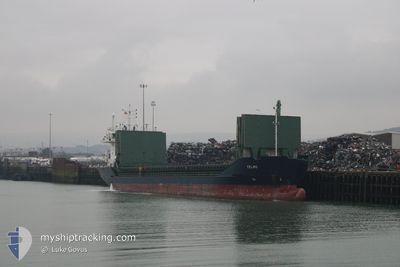
TELMO
Cargo
Current Trip
| Time Travelled | 5 h, 37 mins |
|---|---|
| Remaining Time | --- |
| Distance Travelled | 51.85 nm |
| Remaining Distance | --- |
| AVG Speed | 9.4 Knots |
| MAX Speed | 10.3 Knots |
| AVG Wind | 16.1 knots |
| MAX Wind | 22 knots |
| MIN Temp | 14.3°C / 57.74°F |
| MAX Temp | 19.2°C / 66.56°F |
| Draught | 6.5 m |
| Position Received | 11 m ago |
Current Position
| Longitude | -7.73053° |
|---|---|
| Latitude | 43.85339° |
| Status | Under way using engine |
| Speed | 9.8 Knots |
| Course | 92.1° |
| Area | North Atlantic Ocean |
| Station | T-AIS |
| Position Received | 11 m ago |
Info
Information
The current position of TELMO is in North Atlantic Ocean with coordinates 43.85339° / -7.73053° as reported on 2024-06-16 12:11 by AIS to our vessel tracker app. The vessel's current speed is 9.8 Knots and is heading at the port of BAYONNE. The estimated time of arrival as calculated by vessel tracking app is 2024-06-17 16:00 LT
The vessel TELMO (IMO: 9786798, MMSI: 212657000) is a Cargo It's sailing under the flag of [CY] Cyprus.
In this page you can find informations about the vessels current position, last detected port calls, and current voyage information. If the vessels is not in coverage by AIS you will find the latest position.
The current position of TELMO is detected by our AIS receivers and we are not responsible for the reliability of the data. The last position was recorded while the vessel was in Coverage by the Ais receivers of our vessel tracking app.
The current draught of TELMO as reported by AIS is 6.5 meters
Weather
| Temperature | 19.2°C / 66.56°F |
|---|---|
| Wind Speed | 19 knots |
| Direction | 239° WSW |
| Pressure | 1011.5 hPa |
| Humidity | 71.5 % |
| Cloud Coverage | 100 % |
Featured Company
Last Port Calls
| Port | Arrival | Departure | Time In Port |
|---|---|---|---|
| 2024-06-14 20:03 | 2024-06-16 06:46 | 1 d | |
| 2024-06-07 14:50 | 2024-06-09 21:36 | 2 d | |
| 2024-06-03 16:22 | 2024-06-04 22:20 | 1 d | |
| 2024-05-29 19:59 | 2024-06-01 06:23 | 2 d | |
| 2024-05-23 06:35 | 2024-05-24 17:43 | 1 d | |
| 2024-05-20 23:45 | 2024-05-22 13:03 | 1 d | |
| 2024-05-16 07:31 | 2024-05-18 12:39 | 2 d | |
| 2024-05-07 15:05 | 2024-05-08 18:35 | 1 d | |
| 2024-05-02 17:05 | 2024-05-06 16:24 | 3 d | |
| 2024-04-25 12:13 | 2024-04-29 20:19 | 4 d |
Most Visited Ports (Last year)
| Port | Arrivals | |
|---|---|---|
| 4 | ||
| 3 | ||
| 3 | ||
| 3 | ||
| 2 | ||
| 2 |
Last Trips
| Origin | Departure | Destination | Arrival | Distance | |
|---|---|---|---|---|---|
| 2024-06-09 22:36 | 2024-06-14 22:03 | 664.33 nm | |||
| 2024-06-04 23:20 | 2024-06-07 15:50 | 344.97 nm | |||
| 2024-06-01 08:23 | 2024-06-03 17:22 | 316.71 nm | |||
| 2024-05-24 18:43 | 2024-05-29 21:59 | 1200.85 nm | |||
| 2024-05-22 14:03 | 2024-05-23 07:35 | 187.42 nm | |||
| 2024-05-18 14:39 | 2024-05-21 00:45 | 572.06 nm | |||
| 2024-05-08 20:35 | 2024-05-16 09:31 | 941.57 nm | |||
| 2024-05-06 18:24 | 2024-05-07 17:05 | 31.05 nm | |||
| 2024-04-29 22:19 | 2024-05-02 19:05 | 669.28 nm | |||
| 2024-04-25 00:12 | 2024-04-25 14:13 | 152.96 nm |
Events
| Time | Event | Details | Position / Dest | Info |
|---|---|---|---|---|
| 2024-06-16 12:19 | Status Changed | Default Under way using engine |
43.85166 / -7.70167
FR BAY
|
Speed: 9.8 kn Course: 92.1° |
| 2024-06-16 12:03 | Change Sea Area | Spanish part of the Bay of Biscay Spanish part of the North Atlantic Ocean |
43.85420 / -7.76125
Bay of Biscay
FR BAY
|
Speed: 9.8 kn Course: 89.3° |
| 2024-06-16 11:45 | Status Changed | Under way using engine Default |
43.85309 / -7.82862
FR BAY
|
Speed: 10 kn Course: 84° |
| 2024-06-16 11:40 | Status Changed | Default Under way using engine |
43.85166 / -7.84833
FR BAY
|
Speed: 9.8 kn Course: 84.9° |
| 2024-06-16 11:34 | Status Changed | Under way using engine Default |
43.85122 / -7.87149
FR BAY
|
Speed: 10 kn Course: 78° |
| 2024-06-16 11:34 | IN Coverage |
43.85125 / -7.87091
North Atlantic Ocean
FR BAY
|
Speed: 10 kn Course: 87.1° |
|
| 2024-06-16 10:10 | Status Changed | Default Under way using engine |
43.74333 / -8.15500
FR BAY
|
Speed: 10 kn Course: 58.3° |
| 2024-06-16 10:03 | OUT of Coverage |
43.73388 / -8.17743
North Atlantic Ocean
FR BAY
|
Speed: 10 kn Course: 58.3° |
|
| 2024-06-16 06:59 | Status Changed | Under way using engine Moored |
43.36387 / -8.54114
FR BAY
|
Speed: 8.2 kn Course: 20° |
| 2024-06-16 06:46 | PORT DEPARTURE |
|
43.34085 / -8.53009
FR BAY
|
Speed: 9.7 kn Course: 249° |