
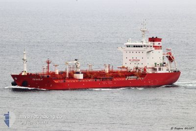
TEQUILA
Oil/Chemical Tanker
Current Trip
| Time Travelled | 3 days |
|---|---|
| Remaining Time | --- |
| Distance Travelled | 665.47 nm |
| Remaining Distance | 71.52 nm |
| AVG Speed | 10.2 Knots |
| MAX Speed | 13.4 Knots |
| AVG Wind | 18.5 knots |
| MAX Wind | 25.4 knots |
| MIN Temp | 10.1°C / 50.18°F |
| MAX Temp | 14.6°C / 58.28°F |
| Draught | 7.3 m |
| Position Received | 4 m ago |
Current Position
| Longitude | 2.63363° |
|---|---|
| Latitude | 51.41501° |
| Status | At anchor |
| Speed | 0.2 Knots |
| Course | 16° |
| Area | North Sea |
| Station | T-AIS |
| Position Received | 4 m ago |
Info
Information
The current position of TEQUILA is in North Sea with coordinates 51.41501° / 2.63363° as reported on 2024-06-02 06:26 by AIS to our vessel tracker app. The vessel's current speed is 0.2 Knots and is heading at the port of ANTWERP. The estimated time of arrival as calculated by vessel tracking app is 2024-06-01 16:00 LT
The vessel TEQUILA (IMO: 9345219, MMSI: 538002883) is a Oil/Chemical Tanker that was built in 2007 ( 17 years old ). It's sailing under the flag of [MH] Marshall Is.
In this page you can find informations about the vessels current position, last detected port calls, and current voyage information. If the vessels is not in coverage by AIS you will find the latest position.
The current position of TEQUILA is detected by our AIS receivers and we are not responsible for the reliability of the data. The last position was recorded while the vessel was in Coverage by the Ais receivers of our vessel tracking app.
The current draught of TEQUILA as reported by AIS is 7.3 meters
Weather
| Temperature | 12.9°C / 55.22°F |
|---|---|
| Wind Speed | 18 knots |
| Direction | 4° N |
| Pressure | 1024.8 hPa |
| Humidity | 83.7 % |
| Cloud Coverage | 84 % |
Featured Company
Last Port Calls
| Port | Arrival | Departure | Time In Port |
|---|---|---|---|
| 2024-05-30 02:17 | 2024-05-30 03:14 | 57 m | |
| 2024-05-28 03:08 | 2024-05-29 13:11 | 1 d | |
| 2024-05-28 02:01 | 2024-05-28 02:42 | 40 m | |
| 2024-05-27 11:20 | 2024-05-27 23:14 | 11 h | |
| 2024-05-19 08:18 | 2024-05-21 08:27 | 2 d | |
| 2024-05-14 01:19 | 2024-05-14 02:04 | 45 m | |
| 2024-05-08 13:31 | 2024-05-14 00:52 | 5 d | |
| 2024-05-08 12:24 | 2024-05-08 13:04 | 39 m | |
| 2024-05-04 02:07 | 2024-05-05 18:53 | 1 d | |
| 2024-05-03 23:30 | 2024-05-04 01:07 | 1 h |
Most Visited Ports (Last year)
| Port | Arrivals | |
|---|---|---|
| 44 | ||
| 30 | ||
| 13 | ||
| 7 | ||
| 7 | ||
| 6 |
Last Trips
| Origin | Departure | Destination | Arrival | Distance | |
|---|---|---|---|---|---|
| 2024-05-29 14:11 | 2024-05-30 03:17 | 2.08 nm | |||
| 2024-05-28 03:42 | 2024-05-28 04:08 | 2.07 nm | |||
| 2024-05-21 10:27 | 2024-05-28 03:01 | 746.48 nm | |||
| 2024-05-21 10:27 | 2024-05-27 12:20 | 718.13 nm | |||
| 2024-05-14 03:04 | 2024-05-19 10:18 | 740.00 nm | |||
| 2024-05-14 01:52 | 2024-05-14 02:19 | 1.92 nm | |||
| 2024-05-08 14:04 | 2024-05-08 14:31 | 2.06 nm | |||
| 2024-05-05 20:53 | 2024-05-08 13:24 | 711.49 nm | |||
| 2024-05-04 03:07 | 2024-05-04 04:07 | 8.33 nm | |||
| 2024-05-02 21:56 | 2024-05-04 01:30 | 96.75 nm |
Events
| Time | Event | Details | Position / Dest | Info |
|---|---|---|---|---|
| 2024-06-01 14:56 | STOP Moving | 16.28 nm, North West of OOSTENDE |
51.41530 / 2.63286
BE ANR
|
Speed: 0.2 kn Course: 17° |
| 2024-06-01 14:38 | Status Changed | At anchor Under way using engine |
51.41794 / 2.63429
BE ANR
|
Speed: 0.4 kn Course: 22° |
| 2024-06-01 12:59 | Change Sea Area | Belgian part of the North Sea French part of the North Sea |
51.33045 / 2.36274
North Sea
BE ANR
|
Speed: 8.2 kn Course: 65° |
| 2024-06-01 09:31 | ETA Changed | 2024/06/01 16:00 2024/06/01 15:00 |
51.05395 / 1.66566
BE ANR
|
Speed: 10.3 kn Course: 40.9° |
| 2024-06-01 09:11 | Change Sea Area | French part of the North Sea French part of the English Channel |
51.01075 / 1.60490
North Sea
BE ANR
|
Speed: 10.7 kn Course: 42° |
| 2024-06-01 07:15 | ETA Changed | 2024/06/01 15:00 2024/06/01 13:00 |
50.68550 / 1.33602
BE ANR
|
Speed: 11.7 kn Course: 41.8° |
| 2024-06-01 06:54 | Status Changed | Under way using engine Default |
50.64248 / 1.25702
BE ANR
|
Speed: 11.7 kn Course: 48° |
| 2024-06-01 06:46 | Status Changed | Default Under way using engine |
50.62410 / 1.22428
BE ANR
|
Speed: 11.9 kn Course: 50.3° |
| 2024-06-01 06:42 | Change Sea Area | French part of the English Channel United Kingdom part of the English Channel |
50.61484 / 1.20694
English Channel
BE ANR
|
Speed: 11.9 kn Course: 50.3° |
| 2024-06-01 06:42 | Status Changed | Under way using engine Default |
50.61484 / 1.20694
BE ANR
|
Speed: 11.9 kn Course: 50° |