
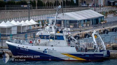
TETHYS 2
Other Type
Current Trip
| Time Travelled | 6 h, 29 mins |
|---|---|
| Remaining Time | --- |
| Distance Travelled | 60.93 nm |
| Remaining Distance | --- |
| AVG Speed | 9.5 Knots |
| MAX Speed | 10.3 Knots |
| AVG Wind | 12.3 knots |
| MAX Wind | 23.9 knots |
| MIN Temp | 21.9°C / 71.42°F |
| MAX Temp | 25.9°C / 78.62°F |
| Draught | 3.2 m |
| Position Received | 4 m ago |
Current Position
| Longitude | 8.35345° |
|---|---|
| Latitude | 43.04237° |
| Status | Under way using engine |
| Speed | 8.8 Knots |
| Course | 134.9° |
| Area | Mediterranean Sea - Western Basin |
| Station | T-AIS |
| Position Received | 4 m ago |
Info
Information
The current position of TETHYS 2 is in Mediterranean Sea - Western Basin with coordinates 43.04237° / 8.35345° as reported on 2024-06-29 14:07 by AIS to our vessel tracker app. The vessel's current speed is 8.8 Knots
The vessel TETHYS 2 (IMO: 9066007, MMSI: 227212000) is a Other Type It's sailing under the flag of [FR] France.
In this page you can find informations about the vessels current position, last detected port calls, and current voyage information. If the vessels is not in coverage by AIS you will find the latest position.
The current position of TETHYS 2 is detected by our AIS receivers and we are not responsible for the reliability of the data. The last position was recorded while the vessel was in Coverage by the Ais receivers of our vessel tracking app.
The current draught of TETHYS 2 as reported by AIS is 3.2 meters
Weather
| Temperature | 23°C / 73.4°F |
|---|---|
| Wind Speed | 11 knots |
| Direction | 254° WSW |
| Pressure | 1013.8 hPa |
| Humidity | 82.8 % |
| Cloud Coverage | 100 % |
Featured Company
Last Port Calls
| Port | Arrival | Departure | Time In Port |
|---|---|---|---|
| 2024-06-28 09:33 | 2024-06-29 07:42 | 22 h | |
| 2024-06-27 14:48 | 2024-06-28 06:14 | 15 h | |
| 2024-06-25 14:38 | 2024-06-26 05:21 | 14 h | |
| 2024-06-24 14:20 | 2024-06-25 06:19 | 15 h | |
| 2024-06-21 16:13 | 2024-06-22 06:01 | 13 h | |
| 2024-06-20 10:51 | 2024-06-21 05:20 | 18 h | |
| 2024-06-19 14:43 | 2024-06-20 05:22 | 14 h | |
| 2024-06-18 15:43 | 2024-06-19 06:22 | 14 h | |
| 2024-05-19 14:01 | 2024-06-17 16:11 | 29 d | |
| 2024-05-18 16:44 | 2024-05-19 06:08 | 13 h |
Most Visited Ports (Last year)
| Port | Arrivals | |
|---|---|---|
| 67 | ||
| 32 | ||
| 4 | ||
| 3 | ||
| 2 | ||
| 2 |
Last Trips
| Origin | Departure | Destination | Arrival | Distance | |
|---|---|---|---|---|---|
| 2024-06-28 08:14 | 2024-06-28 11:33 | 24.34 nm | |||
| 2024-06-26 07:21 | 2024-06-27 16:48 | 111.05 nm | |||
| 2024-06-25 08:19 | 2024-06-25 16:38 | 32.16 nm | |||
| 2024-06-22 08:01 | 2024-06-24 16:20 | 75.08 nm | |||
| 2024-06-21 07:20 | 2024-06-21 18:13 | 72.97 nm | |||
| 2024-06-20 07:22 | 2024-06-20 12:51 | 33.81 nm | |||
| 2024-06-19 08:22 | 2024-06-19 16:43 | 45.79 nm | |||
| 2024-06-17 18:11 | 2024-06-18 17:43 | 175.14 nm | |||
| 2024-05-19 08:08 | 2024-05-19 16:01 | 83.54 nm | |||
| 2024-05-18 07:44 | 2024-05-18 18:44 | 64.09 nm |
Events
| Time | Event | Details | Position / Dest | Info |
|---|---|---|---|---|
| 2024-06-29 13:01 | Detected in Sea | French part of the Mediterranean Sea - Western Basin |
43.15529 / 8.16841
Mediterranean Sea - Western Basin
FRILR
|
Speed: 9.8 kn Course: 129.3° |
| 2024-06-29 09:58 | Change Sea Area | Italian part of the Mediterranean Sea - Western Basin French part of the Mediterranean Sea - Western Basin |
43.46861 / 7.66517
Mediterranean Sea - Western Basin
FRILR
|
Speed: 9.1 kn Course: 129.7° |
| 2024-06-29 09:10 | Change Sea Area | French part of the Mediterranean Sea - Western Basin Mon�gasque part of the Mediterranean Sea - Western Basin |
43.54606 / 7.53370
Mediterranean Sea - Western Basin
FRILR
|
Speed: 9.1 kn Course: 117.8° |
| 2024-06-29 08:55 | Change Sea Area | Mon�gasque part of the Mediterranean Sea - Western Basin French part of the Mediterranean Sea - Western Basin |
43.56312 / 7.48766
Mediterranean Sea - Western Basin
FRILR
|
Speed: 9.1 kn Course: 116.7° |
| 2024-06-29 07:44 | Status Changed | Under way using engine Moored |
43.68490 / 7.28791
FRILR
|
Speed: 8 kn Course: 187.2° |
| 2024-06-29 07:42 | PORT DEPARTURE |
|
43.68804 / 7.28894
FRILR
|
Speed: 6.5 kn Course: 197° |
| 2024-06-29 07:41 | START Moving |
43.69024 / 7.28899
[FR] NICE
|
Speed: 4.4 kn Course: 168° |
|
| 2024-06-29 07:12 | Destination Changed | FRILR FRNCE |
43.69239 / 7.28827
[FR] NICE
|
Speed: Course: 19° |
| 2024-06-29 07:12 | ETA Changed | 2024/06/29 21:00 2024/06/28 12:00 |
43.69239 / 7.28827
[FR] NICE
|
Speed: Course: 19° |
| 2024-06-29 03:06 | Draught Changed | 3.2 3 |
43.69240 / 7.28827
[FR] NICE
|
Speed: Course: 19° |