
TEX
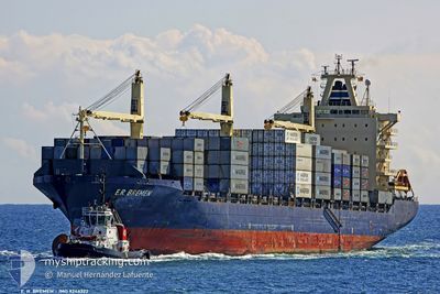
Container Ship
Current Trip
| Time Travelled | 4 days |
|---|---|
| Remaining Time | 5 days |
| Distance Travelled | 1494.27 nm |
| Remaining Distance | 1966.97 nm |
| AVG Speed | 14.8 Knots |
| MAX Speed | 14.8 Knots |
| AVG Wind | 14.5 knots |
| MAX Wind | 26.9 knots |
| MIN Temp | 18.8°C / 65.84°F |
| MAX Temp | 29.4°C / 84.92°F |
| Draught | 9.1 m |
| Position Received | 58 m ago |
Current Position
| Longitude | 39.14274° |
|---|---|
| Latitude | 18.50110° |
| Status | Under way using engine |
| Speed | 14.9 Knots |
| Course | 152.7° |
| Area | Red Sea |
| Station | T-AIS |
| Position Received | 58 m ago |
Info
Information
The current position of TEX is in Red Sea with coordinates 18.50110° / 39.14274° as reported on 2024-06-01 09:14 by AIS to our vessel tracker app. The vessel's current speed is 14.9 Knots and is heading at the port of SOHAR. The estimated time of arrival as calculated by vessel tracking app is 2024-06-06 21:17 LT
The vessel TEX (IMO: 9246322, MMSI: 636021547) is a Container Ship that was built in 2003 ( 21 years old ). It's sailing under the flag of [LR] Liberia.
In this page you can find informations about the vessels current position, last detected port calls, and current voyage information. If the vessels is not in coverage by AIS you will find the latest position.
The current position of TEX is detected by our AIS receivers and we are not responsible for the reliability of the data. The last position was recorded while the vessel was in Coverage by the Ais receivers of our vessel tracking app.
The current draught of TEX as reported by AIS is 9.1 meters
Weather
| Temperature | 28.9°C / 84.02°F |
|---|---|
| Wind Speed | 18 knots |
| Direction | 318° NW |
| Pressure | 1006.7 hPa |
| Humidity | 76.8 % |
| Cloud Coverage | 5 % |
Featured Company
Last Port Calls
| Port | Arrival | Departure | Time In Port |
|---|---|---|---|
| 2024-05-30 01:22 | 2024-05-30 10:05 | 8 h | |
| 2024-05-25 12:41 | 2024-05-27 14:10 | 2 d | |
| 2024-05-18 01:37 | 2024-05-19 13:21 | 1 d | |
| 2024-05-03 15:28 | 2024-05-05 22:08 | 2 d | |
| 2024-04-20 11:37 | 2024-04-21 09:56 | 22 h | |
| 2024-04-17 04:16 | 2024-04-17 13:53 | 9 h | |
| 2024-04-07 16:09 | 2024-04-08 13:29 | 21 h | |
| 2024-04-01 21:44 | 2024-04-02 19:56 | 22 h |
Most Visited Ports (Last year)
| Port | Arrivals | |
|---|---|---|
| 13 | ||
| 11 | ||
| 4 | ||
| 4 | ||
| 4 | ||
| 4 |
Last Trips
| Origin | Departure | Destination | Arrival | Distance | |
|---|---|---|---|---|---|
| 2024-05-27 17:10 | 2024-05-30 03:22 | 628.49 nm | |||
| 2024-05-19 16:21 | 2024-05-25 15:41 | 41.47 nm | |||
| 2024-05-06 01:08 | 2024-05-18 04:37 | 4522.59 nm | |||
| 2024-04-21 12:56 | 2024-05-03 18:28 | 4490.15 nm | |||
| 2024-04-08 17:29 | 2024-04-20 14:37 | 3492.96 nm | |||
| 2024-04-08 17:29 | 2024-04-17 06:16 | 2777.37 nm | |||
| 2024-04-03 01:26 | 2024-04-07 20:09 | 1051.79 nm | |||
| 2024-03-06 16:19 | 2024-04-02 03:14 | 7856.95 nm |
Events
| Time | Event | Details | Position / Dest | Info |
|---|---|---|---|---|
| 2024-06-01 09:17 | Status Changed | Default Under way using engine |
18.49184 / 39.14786
OMSOH
|
Speed: 14.9 kn Course: 152.7° |
| 2024-06-01 08:15 | Status Changed | Under way using engine Default |
18.71802 / 39.02360
OMSOH
|
Speed: 14.7 kn Course: 152° |
| 2024-06-01 07:23 | Status Changed | Default Under way using engine |
18.90737 / 38.92097
OMSOH
|
Speed: 14.8 kn Course: 154.6° |
| 2024-06-01 07:22 | Status Changed | Under way using engine Default |
18.91180 / 38.91874
OMSOH
|
Speed: 14.7 kn Course: 154° |
| 2024-06-01 07:09 | IN Coverage |
18.91180 / 38.91874
Red Sea
OMSOH
|
Speed: 14.8 kn Course: 154.6° |
|
| 2024-06-01 06:06 | Status Changed | Default Under way using engine |
19.19727 / 38.78218
OMSOH
|
Speed: 15 kn Course: 157.2° |
| 2024-06-01 06:06 | OUT of Coverage |
19.19803 / 38.78182
Red Sea
OMSOH
|
Speed: 15 kn Course: 157.2° |
|
| 2024-06-01 05:53 | Status Changed | Under way using engine Default |
19.24499 / 38.76037
OMSOH
|
Speed: 14.9 kn Course: 156° |
| 2024-06-01 05:48 | Status Changed | Default Under way using engine |
19.26475 / 38.75119
OMSOH
|
Speed: 14.9 kn Course: 156.5° |
| 2024-06-01 05:46 | Status Changed | Under way using engine Default |
19.27382 / 38.74697
OMSOH
|
Speed: 15 kn Course: 156° |