
TEX
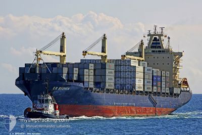
Container Ship
Current Trip
| Time Travelled | 11 days |
|---|---|
| Remaining Time | 9 h, 5 mins |
| Distance Travelled | 4371.14 nm |
| Remaining Distance | 150.25 nm |
| AVG Speed | 14.8 Knots |
| MAX Speed | 14.8 Knots |
| AVG Wind | 10.1 knots |
| MAX Wind | 32.6 knots |
| MIN Temp | 0.5°C / 32.9°F |
| MAX Temp | 21.2°C / 70.16°F |
| Draught | 10.9 m |
| Position Received | Now |
Current Position
| Longitude | 24.37398° |
|---|---|
| Latitude | 37.80966° |
| Status | Under way using engine |
| Speed | 15.7 Knots |
| Course | 58.5° |
| Area | Aegean Sea |
| Station | T-AIS |
| Position Received | Now |
Info
Information
The current position of TEX is in Aegean Sea with coordinates 37.80966° / 24.37398° as reported on 2024-05-17 08:47 by AIS to our vessel tracker app. The vessel's current speed is 15.7 Knots and is heading at the port of ALIAGA. The estimated time of arrival as calculated by vessel tracking app is 2024-05-17 17:53 LT
The vessel TEX (IMO: 9246322, MMSI: 636021547) is a Container Ship that was built in 2003 ( 21 years old ). It's sailing under the flag of [LR] Liberia.
In this page you can find informations about the vessels current position, last detected port calls, and current voyage information. If the vessels is not in coverage by AIS you will find the latest position.
The current position of TEX is detected by our AIS receivers and we are not responsible for the reliability of the data. The last position was recorded while the vessel was in Coverage by the Ais receivers of our vessel tracking app.
The current draught of TEX as reported by AIS is 10.9 meters
Weather
| Temperature | 18.3°C / 64.94°F |
|---|---|
| Wind Speed | 2 knots |
| Direction | 10° N |
| Pressure | 1015.9 hPa |
| Humidity | 77.7 % |
| Cloud Coverage | 100 % |
Featured Company
Last Port Calls
| Port | Arrival | Departure | Time In Port |
|---|---|---|---|
| 2024-05-03 15:28 | 2024-05-05 22:08 | 2 d | |
| 2024-04-20 11:37 | 2024-04-21 09:56 | 22 h | |
| 2024-04-17 04:16 | 2024-04-17 13:53 | 9 h | |
| 2024-04-07 16:09 | 2024-04-08 13:29 | 21 h | |
| 2024-04-01 21:44 | 2024-04-02 19:56 | 22 h | |
| 2024-03-20 02:47 | 2024-03-20 12:01 | 9 h | |
| 2024-03-03 14:35 | 2024-03-06 13:19 | 2 d | |
| 2024-03-02 13:03 |
Most Visited Ports (Last year)
| Port | Arrivals | |
|---|---|---|
| 13 | ||
| 11 | ||
| 4 | ||
| 4 | ||
| 3 | ||
| 3 |
Last Trips
| Origin | Departure | Destination | Arrival | Distance | |
|---|---|---|---|---|---|
| 2024-04-21 12:56 | 2024-05-03 18:28 | 4490.15 nm | |||
| 2024-04-08 17:29 | 2024-04-20 14:37 | 3492.96 nm | |||
| 2024-04-08 17:29 | 2024-04-17 06:16 | 2777.37 nm | |||
| 2024-04-03 01:26 | 2024-04-07 20:09 | 1051.79 nm | |||
| 2024-03-06 16:19 | 2024-04-02 03:14 | 7856.95 nm | |||
| 2024-03-06 16:19 | 2024-03-20 04:47 | 4745.57 nm | |||
| 2024-03-02 16:03 | 2024-03-03 17:35 | 36.12 nm |
Events
| Time | Event | Details | Position / Dest | Info |
|---|---|---|---|---|
| 2024-05-17 00:40 | Change Sea Area | Greek part of the Aegean Sea Greek part of the Mediterranean Sea - Eastern Basin |
36.06301 / 23.13582
Aegean Sea
TRALI
|
Speed: 15.2 kn Course: 65.6° |
| 2024-05-16 23:11 | Status Changed | Under way using engine Default |
35.99162 / 22.68427
TRALI
|
Speed: 16 kn Course: 88° |
| 2024-05-16 23:03 | Status Changed | Default Under way using engine |
35.98987 / 22.63975
TRALI
|
Speed: 16.1 kn Course: 94.3° |
| 2024-05-16 22:59 | Status Changed | Under way using engine Default |
35.99127 / 22.61606
TRALI
|
Speed: 16 kn Course: 94° |
| 2024-05-16 22:28 | Status Changed | Default Under way using engine |
36.00181 / 22.44716
TRALI
|
Speed: 16 kn Course: 96.6° |
| 2024-05-16 22:07 | Status Changed | Under way using engine Default |
36.01380 / 22.33278
TRALI
|
Speed: 16 kn Course: 97° |
| 2024-05-16 21:58 | IN Coverage |
36.01380 / 22.33278
Mediterranean Sea - Eastern Basin
TRALI
|
Speed: 16 kn Course: 96.7° |
|
| 2024-05-16 19:22 | Status Changed | Default Under way using engine |
36.07826 / 21.46803
TRALI
|
Speed: 14.1 kn Course: 95.5° |
| 2024-05-16 19:19 | OUT of Coverage |
36.07961 / 21.44983
Mediterranean Sea - Eastern Basin
TRALI
|
Speed: 14.1 kn Course: 95.5° |
|
| 2024-05-16 19:14 | Status Changed | Under way using engine Default |
36.08113 / 21.42949
TRALI
|
Speed: 14.1 kn Course: 95° |