
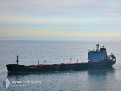
TG ARKTIKA
Bulk Carrier
Current Trip
| Time Travelled | 3 days |
|---|---|
| Remaining Time | --- |
| Distance Travelled | 577.53 nm |
| Remaining Distance | --- |
| AVG Speed | 10.6 Knots |
| MAX Speed | 10.6 Knots |
| AVG Wind | 9 knots |
| MAX Wind | 20.9 knots |
| MIN Temp | 11.3°C / 52.34°F |
| MAX Temp | 16.1°C / 60.98°F |
| Draught | 10.2 m |
| Position Received | 7 m ago |
Current Position
| Longitude | 27.05960° |
|---|---|
| Latitude | 40.55269° |
| Status | Under way using engine |
| Speed | 7.6 Knots |
| Course | 242.2° |
| Area | Sea of Marmara |
| Station | T-AIS |
| Position Received | 7 m ago |
Info
Information
The current position of TG ARKTIKA is in Sea of Marmara with coordinates 40.55269° / 27.05960° as reported on 2024-05-17 07:17 by AIS to our vessel tracker app. The vessel's current speed is 7.6 Knots and is heading at the port of ALEXANDRIA. The estimated time of arrival as calculated by vessel tracking app is 2024-05-19 18:00 LT
The vessel TG ARKTIKA (IMO: 9428499, MMSI: 273317180) is a Bulk Carrier that was built in 2007 ( 17 years old ). It's sailing under the flag of [RU] Russia.
In this page you can find informations about the vessels current position, last detected port calls, and current voyage information. If the vessels is not in coverage by AIS you will find the latest position.
The current position of TG ARKTIKA is detected by our AIS receivers and we are not responsible for the reliability of the data. The last position was recorded while the vessel was in Coverage by the Ais receivers of our vessel tracking app.
The current draught of TG ARKTIKA as reported by AIS is 10.2 meters
Weather
| Temperature | 15.5°C / 59.9°F |
|---|---|
| Wind Speed | 16 knots |
| Direction | 77° ENE |
| Pressure | 1018.4 hPa |
| Humidity | 73.5 % |
| Cloud Coverage | 100 % |
Featured Company
Most Visited Ports (Last year)
| Port | Arrivals | |
|---|---|---|
| 7 | ||
| 2 | ||
| 1 | ||
| 1 | ||
| 1 |
Last Trips
| Origin | Departure | Destination | Arrival | Distance | |
|---|---|---|---|---|---|
| 2024-04-24 06:24 | 2024-05-06 09:53 | 1447.80 nm | |||
| 2024-04-13 01:09 | 2024-04-22 01:12 | 1158.13 nm | |||
| 2024-04-12 17:06 | 2024-04-12 17:09 | 0.31 nm | |||
| 2024-03-21 10:03 | 2024-04-08 12:55 | 662.01 nm | |||
| 2024-01-26 21:54 | 2024-03-03 22:18 | 5871.14 nm |
Events
| Time | Event | Details | Position / Dest | Info |
|---|---|---|---|---|
| 2024-05-17 06:38 | Status Changed | Under way using engine Default |
40.58836 / 27.14904
EG ALY
|
Speed: 7.7 kn Course: 239° |
| 2024-05-17 06:26 | Status Changed | Default Under way using engine |
40.60032 / 27.17594
EG ALY
|
Speed: 8.2 kn Course: 239° |
| 2024-05-17 06:15 | Status Changed | Under way using engine Default |
40.61317 / 27.20409
EG ALY
|
Speed: 8.4 kn Course: 242° |
| 2024-05-17 06:01 | Status Changed | Default Under way using engine |
40.62994 / 27.24222
EG ALY
|
Speed: 8.4 kn Course: 242.4° |
| 2024-05-16 22:37 | START Moving | 2.15 nm, South of BAKIRKOY |
40.93784 / 28.87261
EG ALY
|
Speed: 3.8 kn Course: 139° |
| 2024-05-16 22:26 | Status Changed | Under way using engine At anchor |
40.93996 / 28.86790
EG ALY
|
Speed: 0.4 kn Course: 96° |
| 2024-05-16 22:26 | ETA Changed | 2024/05/19 18:00 2024/05/20 03:00 |
40.93990 / 28.86784
EG ALY
|
Speed: 0.4 kn Course: 96° |
| 2024-05-16 19:38 | STOP Moving | 2.07 nm, South of BAKIRKOY |
40.93933 / 28.87049
EG ALY
|
Speed: 0.3 kn Course: 291° |
| 2024-05-16 19:37 | Status Changed | At anchor Under way using engine |
40.93931 / 28.87055
EG ALY
|
Speed: 0.7 kn Course: 287° |
| 2024-05-16 16:55 | Change Sea Area | Turkish part of the Sea of Marmara Turkish part of the Black Sea |
41.23022 / 29.12805
Sea of Marmara
EG ALY
|
Speed: 9.8 kn Course: 190.7° |