
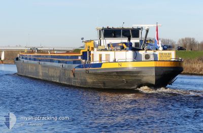
THE-AN 12
Cargo
Current Trip
| Trip Time | 3 days |
|---|---|
| Trip Distance | 103.83 nm |
| AVG Speed | 8.3 Knots |
| MAX Speed | 11.1 Knots |
| Draught | 0 m |
| AVG Wind | 7.9 knots |
| MAX Wind | 11.5 knots |
| MIN Temp | 10.8°C / 51.44°F |
| MAX Temp | 17.6°C / 63.68°F |
| Position Received | Now |
Current Position
| Longitude | 4.00744° |
|---|---|
| Latitude | 51.45967° |
| Status | Default |
| Speed | |
| Course | --- |
| Area | North Sea |
| Station | T-AIS |
| Position Received | Now |
Info
Information
The current position of THE-AN 12 is in North Sea with coordinates 51.45967° / 4.00744° as reported on 2024-05-27 19:05 by AIS to our vessel tracker app. The vessel's current speed is 0 Knots and is currently inside the port of HANSWEERT.
The vessel THE-AN 12 (MMSI: 244830615) is a Cargo It's sailing under the flag of [NL] Netherlands.
In this page you can find informations about the vessels current position, last detected port calls, and current voyage information. If the vessels is not in coverage by AIS you will find the latest position.
The current position of THE-AN 12 is detected by our AIS receivers and we are not responsible for the reliability of the data. The last position was recorded while the vessel was in Coverage by the Ais receivers of our vessel tracking app.
Weather
| Temperature | 12.9°C / 55.22°F |
|---|---|
| Wind Speed | 8 knots |
| Direction | 267° W |
| Pressure | 1016.2 hPa |
| Humidity | 77.3 % |
| Cloud Coverage | 100 % |
Featured Company
Last Port Calls
| Port | Arrival | Departure | Time In Port |
|---|---|---|---|
| 2024-05-27 18:30 | |||
| 2024-05-24 06:52 | 2024-05-24 13:59 | 7 h | |
| 2024-05-22 16:05 | 2024-05-23 16:21 | 1 d | |
| 2024-05-22 07:29 | 2024-05-22 09:12 | 1 h | |
| 2024-05-21 12:26 | 2024-05-22 02:49 | 14 h | |
| 2024-05-21 10:38 | 2024-05-21 11:09 | 31 m | |
| 2024-05-17 15:47 | 2024-05-21 08:57 | 3 d | |
| 2024-05-17 13:22 | 2024-05-17 13:53 | 30 m | |
| 2024-05-16 19:45 | 2024-05-16 20:09 | 24 m | |
| 2024-05-16 17:35 | 2024-05-16 18:40 | 1 h |
Last Trips
| Origin | Departure | Destination | Arrival | Distance | |
|---|---|---|---|---|---|
| 2024-05-24 15:59 | 2024-05-27 20:30 | 103.83 nm | |||
| 2024-05-23 18:21 | 2024-05-24 08:52 | 35.94 nm | |||
| 2024-05-22 11:12 | 2024-05-22 18:05 | 42.89 nm | |||
| 2024-05-22 04:49 | 2024-05-22 09:29 | 48.75 nm | |||
| 2024-05-21 13:09 | 2024-05-21 14:26 | 3.54 nm | |||
| 2024-05-21 10:57 | 2024-05-21 12:38 | 7.29 nm | |||
| 2024-05-17 15:53 | 2024-05-17 17:47 | 7.99 nm | |||
| 2024-05-16 22:09 | 2024-05-17 15:22 | 66.47 nm | |||
| 2024-05-16 20:40 | 2024-05-16 21:45 | 10.56 nm | |||
| 2024-05-16 18:10 | 2024-05-16 19:35 | 10.20 nm |
Events
| Time | Event | Details | Position / Dest | Info |
|---|---|---|---|---|
| 2024-05-27 18:31 | STOP Moving |
51.45970 / 4.00746
[NL] HANSWEERT
|
Speed: 0.1 kn Course: 511° |
|
| 2024-05-27 18:30 | PORT ARRIVAL |
|
51.45970 / 4.00746
[NL] HANSWEERT
|
Speed: 2.3 kn Course: 511° |
| 2024-05-27 16:32 | START Moving | 2.43 nm, East of BRUINISSE |
51.66105 / 4.15446
KERKDRIEL
|
Speed: 9.3 kn Course: 275.8° |
| 2024-05-27 16:10 | STOP Moving | 2.64 nm, East of BRUINISSE |
51.66120 / 4.16018
KERKDRIEL
|
Speed: Course: 511° |
| 2024-05-27 15:02 | START Moving | 1.03 nm, North of DINTELMOND |
51.66900 / 4.37392
KERKDRIEL
|
Speed: 9.5 kn Course: 247.7° |
| 2024-05-27 14:41 | STOP Moving | 1.22 nm, West of WILLEMSTAD |
51.69061 / 4.40764
KERKDRIEL
|
Speed: Course: -1° |
| 2024-05-27 11:23 | START Moving | 0.56 nm, North of W.z.v. Trident |
51.76864 / 5.13931
KERKDRIEL
|
Speed: 8.1 kn Course: 195.9° |
| 2024-05-27 06:50 | STOP Moving | 0.58 nm, South East of DE RIETSCHOOF |
51.77054 / 5.14036
KERKDRIEL
|
Speed: 0.3 kn Course: 511° |
| 2024-05-27 05:06 | IN Coverage |
51.77719 / 5.34250
North Sea
|
Speed: 3.1 kn Course: 147.2° |
|
| 2024-05-27 03:37 | OUT of Coverage |
51.77618 / 5.34239
North Sea
|
Speed: Course: 277.8° |