
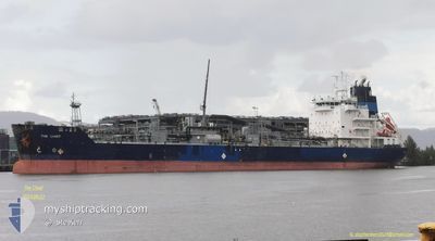
THE CHIEF
Asphalt/Bitumen Tanker
Current Trip
Current Position
| Longitude | -6.25633° |
|---|---|
| Latitude | 36.52098° |
| Status | Moored |
| Speed | |
| Course | 163° |
| Area | North Atlantic Ocean |
| Station | T-AIS |
| Position Received | 2 m ago |
Info
Information
The current position of THE CHIEF is in North Atlantic Ocean with coordinates 36.52098° / -6.25633° as reported on 2024-06-01 20:24 by AIS to our vessel tracker app. The vessel's current speed is 0 Knots and is currently inside the port of CADIZ.
The vessel THE CHIEF (IMO: 9492361, MMSI: 538005036) is a Asphalt/Bitumen Tanker that was built in 2013 ( 11 years old ). It's sailing under the flag of [MH] Marshall Is.
In this page you can find informations about the vessels current position, last detected port calls, and current voyage information. If the vessels is not in coverage by AIS you will find the latest position.
The current position of THE CHIEF is detected by our AIS receivers and we are not responsible for the reliability of the data. The last position was recorded while the vessel was in Coverage by the Ais receivers of our vessel tracking app.
The current draught of THE CHIEF as reported by AIS is 9.1 meters
Weather
| Temperature | 20°C / 68°F |
|---|---|
| Wind Speed | 21 knots |
| Direction | 119° ESE |
| Pressure | 1012 hPa |
| Humidity | 71.1 % |
| Cloud Coverage | 2 % |
Featured Company
Last Port Calls
| Port | Arrival | Departure | Time In Port |
|---|---|---|---|
| 2024-05-31 11:31 | |||
| 2024-05-24 03:04 | 2024-05-25 18:48 | 1 d | |
| 2024-05-08 22:23 | 2024-05-10 23:32 | 2 d | |
| 2024-04-19 11:26 | 2024-04-21 15:04 | 2 d | |
| 2024-04-14 12:14 | 2024-04-16 01:13 | 1 d | |
| 2024-04-02 19:19 | 2024-04-04 22:35 | 2 d |
Last Trips
| Origin | Departure | Destination | Arrival | Distance | |
|---|---|---|---|---|---|
| 2024-05-25 20:48 | 2024-05-31 13:31 | 1406.88 nm | |||
| 2024-05-11 00:32 | 2024-05-24 05:04 | 2878.43 nm | |||
| 2024-04-21 11:04 | 2024-05-08 23:23 | 3968.87 nm | |||
| 2024-04-15 21:13 | 2024-04-19 07:26 | 412.77 nm | |||
| 2024-04-04 18:35 | 2024-04-14 08:14 | 1889.17 nm | |||
| 2024-03-18 01:37 | 2024-04-02 15:19 | 2221.53 nm |
Events
| Time | Event | Details | Position / Dest | Info |
|---|---|---|---|---|
| 2024-06-01 00:05 | ETA Changed | 2025/05/31 10:00 2024/05/31 10:00 |
36.52099 / -6.25633
[ES] CADIZ
|
Speed: Course: 162° |
| 2024-05-31 13:33 | Status Changed | Moored Default |
36.52099 / -6.25633
[ES] CADIZ
|
Speed: Course: 162° |
| 2024-05-31 12:48 | Status Changed | Default Moored |
36.52099 / -6.25633
[ES] CADIZ
|
Speed: Course: 162° |
| 2024-05-31 11:52 | Status Changed | Moored Under way using engine |
36.52097 / -6.25640
[ES] CADIZ
|
Speed: 0.1 kn Course: 162° |
| 2024-05-31 11:50 | STOP Moving |
36.52106 / -6.25649
[ES] CADIZ
|
Speed: 0.3 kn Course: 164° |
|
| 2024-05-31 11:31 | PORT ARRIVAL |
|
36.53654 / -6.26580
[ES] CADIZ
|
Speed: 5.2 kn Course: 151.5° |
| 2024-05-31 07:22 | Status Changed | Under way using engine Default |
36.05430 / -6.46478
ESCAD
|
Speed: 10.2 kn Course: 295° |
| 2024-05-31 07:20 | Status Changed | Default Under way using engine |
36.05147 / -6.45743
ESCAD
|
Speed: 10.2 kn Course: 295.4° |
| 2024-05-31 06:30 | Status Changed | Under way using engine Default |
35.98849 / -6.28848
ESCAD
|
Speed: 11.6 kn Course: 296° |
| 2024-05-31 06:18 | Status Changed | Default Under way using engine |
35.97382 / -6.24434
ESCAD
|
Speed: 11.1 kn Course: 289.3° |