
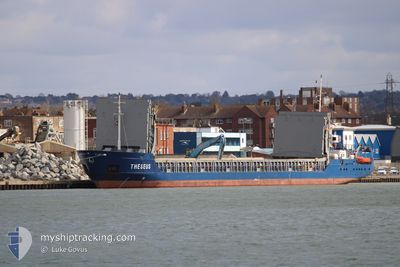
THESEUS
General Cargo
Current Trip
| Time Travelled | 3 days |
|---|---|
| Remaining Time | 29 mins |
| Distance Travelled | 626.12 nm |
| Remaining Distance | 7.12 nm |
| AVG Speed | 8.4 Knots |
| MAX Speed | 11.5 Knots |
| AVG Wind | 11.2 knots |
| MAX Wind | 23 knots |
| MIN Temp | 10.7°C / 51.26°F |
| MAX Temp | 20.3°C / 68.54°F |
| Draught | 4.6 m |
| Position Received | 1 m ago |
Current Position
| Longitude | -0.67922° |
|---|---|
| Latitude | 53.70175° |
| Status | Under way using engine |
| Speed | 7.8 Knots |
| Course | 251.5° |
| Area | North Sea |
| Station | T-AIS |
| Position Received | 1 m ago |
Info
Information
The current position of THESEUS is in North Sea with coordinates 53.70175° / -0.67922° as reported on 2024-06-02 14:11 by AIS to our vessel tracker app. The vessel's current speed is 7.8 Knots and is heading at the port of FLIXBOROUGH. The estimated time of arrival as calculated by vessel tracking app is 2024-06-02 14:41 LT
The vessel THESEUS (IMO: 9199256, MMSI: 304011027) is a General Cargo that was built in 2000 ( 24 years old ). It's sailing under the flag of [AG] Antigua Barbuda.
In this page you can find informations about the vessels current position, last detected port calls, and current voyage information. If the vessels is not in coverage by AIS you will find the latest position.
The current position of THESEUS is detected by our AIS receivers and we are not responsible for the reliability of the data. The last position was recorded while the vessel was in Coverage by the Ais receivers of our vessel tracking app.
The current draught of THESEUS as reported by AIS is 4.6 meters
Weather
| Temperature | 20°C / 68°F |
|---|---|
| Wind Speed | 7 knots |
| Direction | 287° WNW |
| Pressure | 1025 hPa |
| Humidity | 59 % |
| Cloud Coverage | 54 % |
Featured Company
Last Port Calls
| Port | Arrival | Departure | Time In Port |
|---|---|---|---|
| 2024-05-29 12:16 | 2024-05-30 07:19 | 19 h | |
| 2024-05-24 21:48 | 2024-05-25 06:41 | 8 h | |
| 2024-05-22 14:43 | 2024-05-23 10:55 | 20 h | |
| 2024-05-20 05:46 | 2024-05-21 17:39 | 1 d | |
| 2024-05-15 08:03 | 2024-05-15 19:04 | 11 h | |
| 2024-05-13 03:00 | 2024-05-14 11:09 | 1 d | |
| 2024-05-11 12:41 | 2024-05-11 17:54 | 5 h | |
| 2024-05-11 03:25 | 2024-05-11 08:40 | 5 h | |
| 2024-05-05 14:38 | 2024-05-07 11:26 | 1 d | |
| 2024-04-29 15:25 | 2024-05-01 13:06 | 1 d |
Last Trips
| Origin | Departure | Destination | Arrival | Distance | |
|---|---|---|---|---|---|
| 2024-05-25 08:41 | 2024-05-29 14:16 | 914.15 nm | |||
| 2024-05-23 12:55 | 2024-05-24 23:48 | 334.15 nm | |||
| 2024-05-21 19:39 | 2024-05-22 16:43 | 214.28 nm | |||
| 2024-05-15 21:04 | 2024-05-20 07:46 | 715.34 nm | |||
| 2024-05-14 13:09 | 2024-05-15 10:03 | 153.97 nm | |||
| 2024-05-11 19:54 | 2024-05-13 05:00 | 305.83 nm | |||
| 2024-05-11 10:40 | 2024-05-11 14:41 | 38.76 nm | |||
| 2024-05-07 13:26 | 2024-05-11 05:25 | 789.08 nm | |||
| 2024-05-01 15:06 | 2024-05-05 16:38 | 592.79 nm | |||
| 2024-04-25 17:46 | 2024-04-29 17:25 | 422.68 nm |
Events
| Time | Event | Details | Position / Dest | Info |
|---|---|---|---|---|
| 2024-06-02 10:24 | ETA Changed | 2024/06/02 16:10 2024/06/02 04:30 |
53.56858 / .10075
GBFLW
|
Speed: 9.2 kn Course: 307.7° |
| 2024-06-02 10:16 | Status Changed | Under way using engine Default |
53.55836 / .13030
GBFLW
|
Speed: 7.1 kn Course: 297° |
| 2024-06-02 10:10 | IN Coverage |
53.55852 / .12970
North Sea
|
Speed: 7.6 kn Course: 294.6° |
|
| 2024-06-02 04:54 | Status Changed | Default Under way using engine |
53.80178 / .82770
GBFLW
|
Speed: 6.1 kn Course: 241° |
| 2024-06-02 04:48 | OUT of Coverage |
53.80678 / .84391
North Sea
GBFLW
|
Speed: 6.1 kn Course: 241° |
|
| 2024-06-02 04:36 | Status Changed | Under way using engine Default |
53.82715 / .84580
GBFLW
|
Speed: 7 kn Course: 144° |
| 2024-06-02 04:34 | IN Coverage |
53.82657 / .84620
North Sea
GBFLW
|
Speed: 6.8 kn Course: 159.9° |
|
| 2024-06-01 23:38 | Status Changed | Default Under way using engine |
54.42191 / .91455
GBFLW
|
Speed: 8.1 kn Course: 201.3° |
| 2024-06-01 23:32 | OUT of Coverage |
54.43452 / .92414
North Sea
GBFLW
|
Speed: 8.1 kn Course: 201.3° |
|
| 2024-06-01 23:30 | Status Changed | Under way using engine Default |
54.43872 / .92707
GBFLW
|
Speed: 8 kn Course: 204° |