
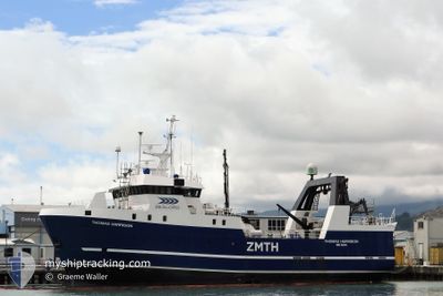
THOMAS HARRISON
Fishing
Current Trip
Unknown
| Time Travelled | 2 days |
|---|---|
| Remaining Time | --- |
| Distance Travelled | 355.52 nm |
| Remaining Distance | --- |
| AVG Speed | 5.7 Knots |
| MAX Speed | 13.3 Knots |
| AVG Wind | 16.6 knots |
| MAX Wind | 27.9 knots |
| MIN Temp | 10.2°C / 50.36°F |
| MAX Temp | 14.8°C / 58.64°F |
| Draught | 0 m |
| Position Received | Now |
Current Position
| Longitude | 174.55752° |
|---|---|
| Latitude | -41.51804° |
| Status | Under way sailing |
| Speed | 2 Knots |
| Course | 157° |
| Area | Tasman Sea |
| Station | T-AIS |
| Position Received | Now |
Info
Information
The current position of THOMAS HARRISON is in Tasman Sea with coordinates -41.51804° / 174.55752° as reported on 2024-06-03 18:54 by AIS to our vessel tracker app. The vessel's current speed is 2 Knots
The vessel THOMAS HARRISON (MMSI: 512000015) is a Fishing It's sailing under the flag of [NZ] New Zealand.
In this page you can find informations about the vessels current position, last detected port calls, and current voyage information. If the vessels is not in coverage by AIS you will find the latest position.
The current position of THOMAS HARRISON is detected by our AIS receivers and we are not responsible for the reliability of the data. The last position was recorded while the vessel was in Coverage by the Ais receivers of our vessel tracking app.
Weather
| Temperature | 11.1°C / 51.98°F |
|---|---|
| Wind Speed | 23 knots |
| Direction | 168° SSE |
| Pressure | 1027 hPa |
| Humidity | 71.8 % |
| Cloud Coverage | 61 % |
Featured Company
Last Port Calls
Last Trips
| Origin | Departure | Destination | Arrival | Distance | |
|---|---|---|---|---|---|
| 2024-05-25 22:04 | 2024-05-29 03:52 | 480.86 nm | |||
| 2024-05-25 11:59 | 2024-05-25 12:23 | 3.29 nm | |||
| 2024-05-21 16:29 | 2024-05-25 11:36 | 542.29 nm | |||
| 2024-05-21 11:37 | 2024-05-21 14:53 | 29.92 nm | |||
| 2024-05-14 14:53 | 2024-05-14 22:36 | 80.00 nm |
Events
| Time | Event | Details | Position / Dest | Info |
|---|---|---|---|---|
| 2024-06-03 10:44 | Change Sea Area | New Zealand part of the Tasman Sea New Zealand part of the South Pacific Ocean |
-41.68739 / 174.66908
Tasman Sea
|
Speed: 8.5 kn Course: 6.5° |
| 2024-06-03 03:59 | Change Sea Area | New Zealand part of the South Pacific Ocean New Zealand part of the Tasman Sea |
-41.69876 / 174.61429
South Pacific Ocean
|
Speed: 10 kn Course: 179.6° |
| 2024-06-02 13:55 | Change Sea Area | New Zealand part of the Tasman Sea New Zealand part of the South Pacific Ocean |
-41.67026 / 174.77715
Tasman Sea
|
Speed: 9.1 kn Course: 347.9° |
| 2024-06-02 08:10 | Change Sea Area | New Zealand part of the South Pacific Ocean New Zealand part of the Tasman Sea |
-41.68922 / 174.71660
South Pacific Ocean
|
Speed: 8.8 kn Course: 155.1° |
| 2024-06-02 02:06 | START Moving | 19.01 nm, South West of WELLINGTON |
-41.56082 / 174.60867
|
Speed: 3.4 kn Course: 344° |
| 2024-06-02 01:59 | STOP Moving | 19.13 nm, South West of WELLINGTON |
-41.56373 / 174.61036
|
Speed: 0.3 kn Course: 331° |
| 2024-06-01 23:13 | START Moving | 19.39 nm, South West of WELLINGTON |
-41.56293 / 174.59613
|
Speed: 3.3 kn Course: 306° |
| 2024-06-01 23:00 | STOP Moving | 19.44 nm, South West of WELLINGTON |
-41.56543 / 174.59993
|
Speed: 0.3 kn Course: 305° |
| 2024-06-01 10:42 | IN Coverage |
-41.20009 / 173.29668
Tasman Sea
|
Speed: 10.6 kn Course: 39° |
|
| 2024-06-01 10:24 | PORT DEPARTURE |
|
-41.20436 / 173.29207
|
Speed: Course: 290° |