
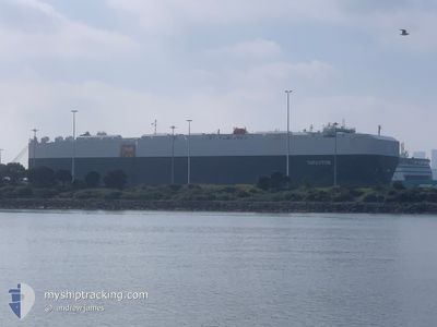
THRUXTON
Cargo
Current Trip
| Time Travelled | 29 days |
|---|---|
| Remaining Time | --- |
| Distance Travelled | 11542.75 nm |
| Remaining Distance | --- |
| AVG Speed | 16.7 Knots |
| MAX Speed | 20.2 Knots |
| AVG Wind | 12 knots |
| MAX Wind | 28.3 knots |
| MIN Temp | 13.6°C / 56.48°F |
| MAX Temp | 30.3°C / 86.54°F |
| Draught | 9.6 m |
| Position Received | 6 d ago |
Current Position
| Longitude | 16.75122° |
|---|---|
| Latitude | -33.02627° |
| Status | Under way using engine |
| Speed | 18.7 Knots |
| Course | 322° |
| Area | South Atlantic Ocean |
| Station | T-AIS |
| Position Received | 6 d ago |
Info
Information
The current position of THRUXTON is in South Atlantic Ocean with coordinates -33.02627° / 16.75122° as reported on 2024-06-16 02:27 by AIS to our vessel tracker app. The vessel's current speed is 18.7 Knots and is heading at the port of SOUTHAMPTON. The estimated time of arrival as calculated by vessel tracking app is 2024-06-30 05:00 LT
The vessel THRUXTON (IMO: 9782089, MMSI: 636018347) is a Cargo It's sailing under the flag of [LR] Liberia.
In this page you can find informations about the vessels current position, last detected port calls, and current voyage information. If the vessels is not in coverage by AIS you will find the latest position.
The current position of THRUXTON is detected by our AIS receivers and we are not responsible for the reliability of the data. The last position was recorded while the vessel was in Coverage by the Ais receivers of our vessel tracking app.
The current draught of THRUXTON as reported by AIS is 9.6 meters
Weather
| Temperature | 27.1°C / 80.78°F |
|---|---|
| Wind Speed | 13 knots |
| Direction | 172° S |
| Pressure | 1014.1 hPa |
| Humidity | 79 % |
| Cloud Coverage | 100 % |
Featured Company
Most Visited Ports (Last year)
| Port | Arrivals | |
|---|---|---|
| 3 | ||
| 2 | ||
| 2 | ||
| 2 | ||
| 2 | ||
| 2 |
Last Trips
| Origin | Departure | Destination | Arrival | Distance | |
|---|---|---|---|---|---|
| 2024-05-10 17:10 | 2024-05-23 11:16 | 5636.51 nm | |||
| 2024-05-05 18:46 | 2024-05-10 04:06 | 1717.44 nm | |||
| 2024-04-20 05:05 | 2024-05-03 00:40 | 4896.36 nm | |||
| 2024-04-03 20:16 | 2024-04-19 21:45 | 6621.86 nm | |||
| 2024-03-28 03:53 | 2024-04-02 17:46 | 1690.10 nm |
Events
| Time | Event | Details | Position / Dest | Info |
|---|---|---|---|---|
| 2024-06-16 02:29 | Status Changed | Default Under way using engine |
-33.01808 / 16.74359
GB SOU
|
Speed: 18.7 kn Course: 322° |
| 2024-06-16 02:27 | OUT of Coverage |
-33.02627 / 16.75122
South Atlantic Ocean
GB SOU
|
Speed: 18.7 kn Course: 322° |
|
| 2024-06-16 00:37 | Status Changed | Under way using engine Default |
-33.47525 / 17.19219
GB SOU
|
Speed: 19.2 kn Course: 320° |
| 2024-06-16 00:37 | Status Changed | Default Under way using engine |
-33.47906 / 17.19590
GB SOU
|
Speed: 19.2 kn Course: 321° |
| 2024-06-16 00:36 | Status Changed | Under way using engine Default |
-33.47993 / 17.19676
GB SOU
|
Speed: 19.1 kn Course: 320° |
| 2024-06-16 00:32 | Status Changed | Default Under way using engine |
-33.49595 / 17.21239
GB SOU
|
Speed: 19 kn Course: 320.4° |
| 2024-06-16 00:27 | Status Changed | Under way using engine Default |
-33.51666 / 17.23287
GB SOU
|
Speed: 19.3 kn Course: 320° |
| 2024-06-16 00:24 | Status Changed | Default Under way using engine |
-33.52874 / 17.24479
GB SOU
|
Speed: 19.3 kn Course: 321° |
| 2024-06-15 19:47 | Change Sea Area | South African part of the South Atlantic Ocean Indonesian part of the Malacca Strait |
-34.56802 / 18.47570
South Atlantic Ocean
GB SOU
|
Speed: 18.4 kn Course: 291.5° |
| 2024-06-15 19:46 | Draught Changed | 9.6 9.7 |
-34.56905 / 18.47877
GB SOU
|
Speed: 18.4 kn Course: 291.5° |